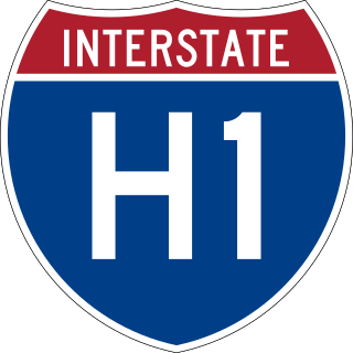
Interstate H-1 (H-1) is the longest and busiest Interstate Highway in the US state of Hawaii. The highway is located on the island of Oʻahu. Despite the number, this is an east–west highway; the 'H'-series numbering reflects the order in which routes were funded and built. H-1 goes from Route 93 in Kapolei to Route 72 in Kāhala. East of Middle Street in Honolulu (exit 19A), H-1 is also known as the Lunalilo Freeway, after the former Hawaiian king, and is sometimes signed as such at older signs in central Honolulu. West of Middle Street, H-1 is also known as the Queen Liliʻuokalani Freeway, after the former Hawaiian queen; this name is shown on some roadmaps. It is both the southernmost and westernmost signed Interstate Highway located in the US.

Makakilo or Makakilo City is a census-designated place and residential area located in the ʻEwa District on the island of Oʻahu in the City & County of Honolulu, United States. In Hawaiian, maka kilo means "observing eyes". As of the 2020 census, the CDP had a population of 19,877.
Project Nike was a U.S. Army project, proposed in May 1945 by Bell Laboratories, to develop a line-of-sight anti-aircraft missile system. The project delivered the United States' first operational anti-aircraft missile system, the Nike Ajax, in 1953. A great number of the technologies and rocket systems used for developing the Nike Ajax were re-used for a number of functions, many of which were given the "Nike" name . The missile's first-stage solid rocket booster became the basis for many types of rocket including the Nike Hercules missile and NASA's Nike Smoke rocket, used for upper-atmosphere research.

Kapolei is a planned community in Honolulu County, Hawaiʻi, United States, on the island of Oʻahu. It is colloquially known as the "second city" of Oʻahu, in relation to Honolulu. For statistical purposes, the United States Census Bureau has defined Kapolei as a census-designated place (CDP) within the consolidated city-county of Honolulu.

Diamond Head is a volcanic tuff cone on the Hawaiian island of Oʻahu and known to Hawaiians as Lēʻahi. The Hawaiian name is most likely derived from lae plus ʻahi (tuna) because the shape of the ridgeline resembles the shape of a tuna's dorsal fin. Its English name was given by British sailors in the 19th century, who named it for the calcite crystals on the adjacent beach.

SF-88 is a former Nike Missile launch site at Fort Barry, in the Marin Headlands to the north of San Francisco, California, United States. Opened in 1954, the site was intended to protect the population and military installations of the San Francisco Bay Area during the Cold War, specifically from attack by Soviet bomber aircraft.

The Oahu Railway and Land Company, or OR&L, was a 3 ft narrow gauge common carrier railway that served much of the Hawaiian island of Oahu, and was the largest narrow gauge class one common carrier in the U.S, until its dissolution in 1947.
KKOL-FM is a commercial FM radio station serving the Honolulu, Hawaii media market. The Salem Media Group outlet broadcasts at 107.9 MHz with an ERP of 100 kW and is licensed to Aiea, Hawaii. Its transmitter is on Palehua Road in Kapolei and its studios and offices are in Honolulu.

The Nike Missile Site HM-69 is a former Nike-Hercules missile base, now listed as a historic site west of Homestead, Florida, United States. It is located on Long Pine Key Road in the Everglades National Park. The site with 22 buildings opened in 1964 and closed in 1979 when it was turned over to the National Park Service.

Fort DeRussy is a United States military reservation in the Waikiki area of Honolulu, Hawaii, under the jurisdiction of the United States Army. Unfenced and largely open to public traffic, the installation consists mainly of landscaped greenspace. The former Battery Randolph now houses the U.S. Army Museum of Hawaiʻi, which is open to the public. The Hale Koa Hotel, an Armed Forces Recreation Center, and the Daniel K. Inouye Asia-Pacific Center for Security Studies are also located on Fort DeRussy.

Marine Corps Air Station Kaneohe Bay or MCAS Kaneohe Bay is a United States Marine Corps (USMC) airfield located within the Marine Corps Base Hawaii complex, formerly known as Marine Corps Air Facility (MCAF) Kaneohe Bay or Naval Air Station (NAS) Kaneohe Bay. It is located two miles northeast of the central business district of Kaneohe, in Honolulu County, Hawaii, United States. The airfield has one runway (4/22) with a 7,771 x 200 ft asphalt surface.

The 29th Infantry Brigade Combat Team is an infantry brigade combat team of the United States Army National Guard of Hawaii. It traces its origins to the 29th Infantry Brigade (Separate) originally formed in the Hawaii Army National Guard in 1959. The current name and Table of Organisation and Equipment, adopting the new "Brigade Combat Team" structure, was adopted in 2006.
Fort Ruger is a fort on the island of Oʻahu that served as the first military reservation in the Territory of Hawaii. Named after Civil War General Thomas H. Ruger and built in and around Diamond Head Crater, the fort was established by the United States for the purpose of defending the harbor of its newly annexed territory. The fort was established in 1906 as Diamond Head Reservation and renamed Fort Ruger in 1909.

Fort Kamehameha was a United States Army military base that was the site of several coastal artillery batteries to defend Pearl Harbor starting in 1907 in Honolulu, Hawaii.
Farrington Highway is a major highway through the western part of O‘ahu in the U.S. state of Hawaii. Starting from Kamehameha Highway north of Pearl Harbor, it heads west along the island's southwestern and western coast; another part of the highway also serves the western part of the North Shore, ending in Waialua. With the exception of a gap around Kaena Point, the highway forms an almost continuous arc along the coast of the western half of the island of O‘ahu.
Fort Armstrong, Hawaii was a Coast Artillery Fort built in 1907 and named after Brigadier General Samuel C. Armstrong. Army Corps of Engineers were still at the Fort until 1974.

The Western Electric System 1393 Radar Course Directing Central (RCDC) was a Cold War complex of radar/computer systems within the overall Improved Nike Hercules Air Defense Guided Missile System. The RCDC was installed at the "battery control areas" of ~5 hectares each which was for commanding a nearby missile Launching Area (LA), firing a missile from the LA, and guiding a launched missile to a burst point near an enemy aircraft.

The Nike Ajax was an American guided surface-to-air missile (SAM) developed by Bell Labs for the United States Army. The world's first operational guided surface-to-air missile, the Nike Ajax was designed to attack conventional bomber aircraft flying at high subsonic speeds and altitudes above 50,000 feet (15 km). Nike entered service in 1954 and was initially deployed within the United States to defend against potential Soviet bomber attacks, though it was later deployed overseas to protect US military bases, and was also sold to various allied militaries. Some examples remained in use until the 1970s.

John Davenport Barette was an American Army officer and later a brigadier general during World War I.