Related Research Articles

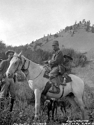
The Tsilhqotʼin or Chilcotin are a North American tribal government of the Athabaskan-speaking ethnolinguistic group that live in what is now known as British Columbia, Canada. They are the most southern of the Athabaskan-speaking Indigenous peoples in British Columbia.

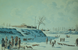
Fort Victoria began as a fur trading post of the Hudson's Bay Company and was the headquarters of HBC operations in the Columbia District, a large fur trading area now part of the province of British Columbia, Canada and the U.S. state of Washington. Construction of Fort Victoria in 1843 highlighted the beginning of a permanent British settlement now known as Victoria, the capital city of British Columbia. The fort itself was demolished in November 1864 as the town continued to grow as a commercial centre serving the local area as well as trading with California, Washington Territory, the United Kingdom, and others.
Chilcotin, meaning "people of the red ochre river" may refer to:
The Chilcotin region of British Columbia is usually known simply as "the Chilcotin", and also in speech commonly as "the Chilcotin Country" or simply Chilcotin. It is a plateau and mountain region in British Columbia on the inland lee of the Coast Mountains on the west side of the Fraser River. Chilcotin is also the name of the river draining that region. In the language of the Tsilhqot'in people, their name and the name of the river means "those of the red ochre river". The proper name of the Chilcotin Country, or Tsilhqotʼin territory, in their language is Tŝilhqotʼin Nen.

Fort Gibraltar was founded in 1809 by Alexander Macdonell of Greenfield of the North West Company in present-day Manitoba, Canada. It was located at the confluence of the Red and Assiniboine rivers in or near the area now known as The Forks in the city of Winnipeg. Fort Gibraltar was renamed Fort Garry after the merger of North West Company and the Hudson's Bay Company in 1821, and became Upper Fort Garry in 1835.

The Spruce Lake Protected Area, formerly known variously as the Southern Chilcotin Mountains Provincial Park, Southern Chilcotins, and also as South Chilcotin Provincial Park, is a 71,347-hectare Protected Area in the British Columbia provincial parks system, approximately 200 km north of Vancouver. The area had been the subject of an ongoing preservationist controversy since the 1930s. In 2007, its status as a provincial park was downgraded to protected area.

The Chilcotin War, the Chilcotin Uprising or the Bute Inlet Massacre was a confrontation in 1864 between members of the Tsilhqot'in (Chilcotin) people in British Columbia and white road construction workers. Fourteen men employed by Alfred Waddington in the building of a road from Bute Inlet were killed, as well as a number of men with a pack-train near Anahim Lake and a settler at Puntzi Lake.

Lhatŝ’aŝʔin, was a chief of the Chilcotin (Tsilhqot'in) people. He led a small group of warriors in attacks on road-building crews near Bute Inlet, British Columbia, in April and May 1864. The road crews had been starving and underpaying Tsilhqot'in workers, which provoked Lhatŝ’aŝʔin to declare war. On 29 April 1864, Lhatŝ’aŝʔin arrived at a ferry site 30 mi (48 km) up the Homathko River. He and his warriors killed ferry-keeper Tim Smith, plundering the food and stores kept there.
Alexis Creek is an unincorporated community in the Chilcotin District of the western Central Interior of the Canadian province of British Columbia, on Highway 20 between Williams Lake and Bella Coola. The creek is named, like the adjacent lake of the same name, for a colonial-era chief of the Tsilhqot'in people, Alexis, who figured in the story of the Chilcotin War of 1864.
ʔEsdilagh is a First Nation community in the North Cariboo region of British Columbia, Canada. It is the smallest of the six member communities that form the Tsilhqot'in National Government. Formerly, the people of this region were known as ʔElhdaqox-t'in, the people of the Sturgeon River. Today, the community goes by the name ʔEsdilagh, which in Tŝilhqot'in language means peninsula.
The Tŝideldel First Nation is the band government of the Tsi Del Del subgroup of the Tsilhqot'in people, located in the Chilcotin District in the western Central Interior region of the Canadian province of British Columbia. It is a member of the Tsilhqot'in National Government.
The Stone First Nation or Yunesitʼin First Nation is a band government of the Yunesit'in subgroup of the Tsilhqot'in people, whose territory is the Chilcotin District in the western Central Interior region of the Canadian province of British Columbia. It is a member of the Tsilhqot'in Tribal Council. The people of the Stone First Nation are known as the Yunesit'in in the Chilcotin language.
The Tlʼetinqox-tʼin Government Office is a First Nations government located in the Chilcotin District in the western Central Interior region of the Canadian province of British Columbia. Governing a reserve communities near Alexis Creek known as Anaham Reserve First Nations or Anaham, it is a member of the Tsilhqotʼin Tribal Council aka known as the Tsilhqotʼin National Government. The main reserve is officially known as Anahim's Flat No. 1, and is more commonly as Anaham. Other reserves are Anahim's Meadow No. 2 and 2A, and Anahim Indian Reserves Nos. 3 through 18. Anaham, or Anahim and Alexis were chiefs of the Tsilhqotʼin during the Chilcotin War of 1864, although they and their people did not take part in the hostilities.
William George Cox was Gold Commissioner for the Cariboo and Boundary Districts in the Colony of British Columbia, Canada during the Rock Creek Gold Rush. He was born in Ireland.

Donald McLean, also known as Samadlin, a First Nations adaptation of Sieur McLean, was a Scottish fur trader and explorer for the Hudson's Bay Company and who later became a cattle rancher near Cache Creek in British Columbia's Thompson Country. McLean was the last casualty of the Chilcotin War of 1864 and the father of outlaw and renegade Allan McLean, leader of the "Wild McLean Boys" gang.
Canadian Forces Camp Chilcotin is a Canadian Forces training camp in the Chilcotin District, to the west of the city of Williams Lake on the eastern Chilcotin Plateau. The 40977 hectares of land is currently owned by the Federal Government. Within its boundaries, the so-called "Military Block" contains Drummond (Island) Lake, Fish Lake, Callanan Lake, as well as innumerable other small lakes. It also contains the Volcanic Neck, Danilʔaz, and parts of Beecher Prairie.
Hanceville is about 90 km west of Williams Lake in the Chilcotin District of the Central Interior of British Columbia, Canada. It is the main community of the Stone First Nation band. It is located southeast of Alexis Creek, on the north side of the Chilcotin River.
Fort Kluskus was a Hudson's Bay Company fort and trading post located near the Kluskus Lakes on the northern perimeter of the Chilcotin District of the Central Interior of British Columbia, Canada. Established in 1844 it was effectively a relocation of trading operations from Fort Chilcotin farther south, which had failed due to disinterest and resistance by the Tsilhqot'in people. Fort Kluskus did not succeed due to already-established strong trade relations between the local Dakelh people and coastal peoples.
Puntzi Lake is a lake in the Chilcotin District of the Central Interior of British Columbia. It is located on the western side of the upper Chilcotin River to the northeast of Tatla Lake, and is connected to the Chilcotin River via Puntzi Creek, of which it is an expansion. The area around the lake has been the setting for many important events in the history of the region.
Pedlar is a term used in Canadian history to refer to English-speaking independent fur traders from Montreal who competed with the Hudson's Bay Company in western Canada from about 1770 to 1803. After 1779 they were mostly absorbed by the North West Company. The name was first used by the Hudson's Bay Company to refer to French coureurs des bois, who travelled inland to trade with the Indians in their villages and camps. This was in contrast to the HBC policy of building posts on Hudson Bay, to where the Indians would bring furs to trade with them.
References
- "North West Company page, Fraser's Expedition", City of Quesnel website [ permanent dead link ]
- Chilcotin War Timeline, "We Do Not Know His Name", Great Unsolved Mysteries in Canadian history website
52°6′N123°27′W / 52.100°N 123.450°W