The French and Indian War (1754–1763) pitted the colonies of British America against those of New France, each side supported by military units from the parent country and by American Indian allies. At the start of the war, the French colonies had a population of roughly 60,000 settlers, compared with 2 million in the British colonies. The outnumbered French particularly depended on the Indians.

Smithfield Township is a township in Monroe County, Pennsylvania, United States. The population was 5,672 at the 2000 census.

The Province of Pennsylvania, also known as the Pennsylvania Colony, was founded in English North America by William Penn on March 4, 1681 as dictated in a royal charter granted by King Charles II. The name Pennsylvania, which translates roughly as "Penn's Woods", was created by combining the Penn surname with the Latin word sylvania, meaning "forest land". The Province of Pennsylvania was one of the two major restoration colonies, the other being the Province of Carolina. The proprietary colony's charter remained in the hands of the Penn family until the American Revolution, when the Commonwealth of Pennsylvania was created and became one of the original thirteen states. "The lower counties on Delaware", a separate colony within the province, would breakaway during the American Revolution as "the Delaware State" and also be one of the original thirteen states.

The Battle of Blue Licks, fought on August 19, 1782, was one of the last battles of the American Revolutionary War. The battle occurred ten months after Lord Cornwallis's surrender at Yorktown, which had effectively ended the war in the east. On a hill next to the Licking River in what is now Robertson County, Kentucky, a force of about 50 Loyalists along with 300 American Indians ambushed and routed 182 Kentucky militiamen. It was the last victory for the Loyalists and Indians during the frontier war. British, Loyalist and Native Indian forces would engage in fighting with American forces once more the following month in Wheeling, West Virginia, during the Siege of Fort Henry.

The Kittanning Path was a major east-west Native American trail that crossed the Allegheny Mountains barrier ridge connecting the Susquehanna River valleys in the center of Pennsylvania to the highlands of the Appalachian Plateau and thence to the western lands beyond drained by the Ohio River. Kittanning Village was the first major Delaware (Lenape) Indian settlement along the descent from the Allegheny Plateau.

The Western theater of the American Revolutionary War (1775–1783) was the area of conflict west of the Appalachian Mountains, the region which became the Northwest Territory of the United States as well as the states of Kentucky, Tennessee, and Missouri. The western war was fought primarily between American Indians with their British allies in Detroit, and American settlers south and east of the Ohio River.
The Kittanning Expedition, also known as the Armstrong Expedition or the Battle of Kittanning, was a raid during the French and Indian War that led to the destruction of the American Indian village of Kittanning, which had served as a staging point for attacks by Delaware (Lenape) warriors against colonists in the British Province of Pennsylvania. Commanded by Lieutenant Colonel John Armstrong, this raid deep into hostile territory was the only major expedition carried out by Pennsylvania Provincial troops during a brutal backcountry war. Early on September 8, 1756, they launched a surprise attack on the Indian village.
Shamokin was a multi-ethnic Native American trading village on the Susquehanna River, located partially within the limits of the modern cities of Sunbury and Shamokin Dam, Pennsylvania. It should not be confused with present-day Shamokin, Pennsylvania, located to the east. Early in the eighteenth century, the village consisted of Iroquois migrants from the north, as well as Shawnee and Lenape settlers moving away from the expanding white settlement of Pennsylvania and Saponi and Tutelo from Virginia.
The Battle of Great Cacapon — also known as Mercer's Massacre — was fought on April 18, 1756 between members of Colonel George Washington's Virginia Regiment and French-allied Shawnee and Delaware Indians. Captain Mercer and a company of his men were pursuing some Indians when they were ambushed by a larger number of Indian raiders. Mercer and at least 16 of his men were killed.
Robert Hunter Morris, was a prominent governmental figure in Colonial Pennsylvania, serving as governor of Pennsylvania and Chief Justice of the New Jersey Supreme Court.

The Conrad Weiser Homestead was the home of Johann Conrad Weiser, who enlisted the Iroquois on the British side in the French and Indian War. The home is located near Womelsdorf, Berks County, Pennsylvania in the United States. A designated National Historic Landmark, it is currently administered as a historic house museum by the Pennsylvania Historical and Museum Commission. The historic site was established in 1923 to preserve an example of a colonial homestead and to honor Weiser, an important figure in the settlement of the colonial frontier.
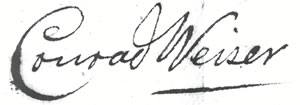
Conrad Weiser, born Johann Conrad Weiser, Jr., was a Pennsylvania Dutch pioneer, interpreter and diplomat between the Pennsylvania Colony and Native Americans. He was a farmer, soldier, monk, tanner and judge. He contributed as an emissary in councils between Native Americans and the colonies, especially Pennsylvania, during the 18th century's tensions of the French and Indian War.
Bemino —known as John Killbuck Sr. to white settlers—was a renowned medicine man and war leader of Shawnee and Delaware (Lenape) warriors during the French and Indian War (1754–63). He was a son of Netawatwees, at one time principal chief of the Delaware, and his own son was Gelelemend, a Delaware chief during the American Revolutionary War. Bemino lived with his people in what is now eastern Ohio, but was mostly active in the upper Potomac River watershed in what is now the Eastern Panhandle of West Virginia.

Fort Granville was a militia stockade located in the colonial Province of Pennsylvania. Its site was about a mile from Lewistown, in what is now Granville Township, Mifflin County. Active from 1755 until 1756, the stockade briefly sheltered pioneer settlers in the Juniata River valley during the French and Indian War.

The Minisink or Minisink Valley is a loosely defined geographic region of the Upper Delaware River valley in northwestern New Jersey, northeastern Pennsylvania and New York.

Fort Hyndshaw was a fort in Middle Smithfield Township, Monroe County, Pennsylvania, built in 1755 and 1756 during the French and Indian War.

The Penn's Creek massacre was an October 16, 1755 raid by Lenape (Delaware) Native Americans on a settlement along Penn's Creek, a tributary of the Susquehanna River in central Pennsylvania. It was the first of a series of deadly raids on Pennsylvania settlements by Native Americans allied with the French in the French and Indian War.

Shawnee on Delaware is an unincorporated community on the Delaware River, part of Smithfield Township in Monroe County, Pennsylvania. It is situated just south of the foothills of the Pocono Mountains, 2.6 miles (4.2 km) southwest of the Shawnee Mountain Ski Area and about 75 miles (121 km) west of New York City.
Nemacolin was a hereditary chief of the Delaware Nation who helped Thomas Cresap widen a Native American path across the Allegheny Mountains to the Ohio River Valley.
Fort Dinwiddie (1755–1789) was a base for the Virginia Militia during the French and Indian War and Revolutionary War. It was located on the Jackson River, five miles west of Warm Springs, Virginia, in present-day Bath County.