Fort Independence (California)

Last updated
Fort Independence
Owens Valley, California, US
CAMP INDEPENDENCE, HOSPITAL, SIERRA NEVADA, CALIFORNIA - NARA - 524159.jpg
Camp Independence in the Owens Valley, in 1871.
USA California location map.svg
Red pog.svg
Fort Independence
Usa edcp location map.svg
Red pog.svg
Fort Independence
Coordinates 36°49′31″N118°22′18″W / 36.82528°N 118.37167°W / 36.82528; -118.37167 Coordinates: 36°49′31″N118°22′18″W / 36.82528°N 118.37167°W / 36.82528; -118.37167
Type Military post
Site information
Owner United States Army
Controlled by Fort Independence Reservation
Open to
the public
Yes
Site history
Built July 4, 1862
Fate Decommission 1877
Official name Camp Independence
Reference no. 349
Camp Independence site, with California Historical Landmark plaque. Camp Independence Site.jpg
Camp Independence site, with California Historical Landmark plaque.

Fort Independence, originally named Camp Independence, was a fort located in the Owens Valley, 3 miles (4.8 km) north of present-day Independence, Inyo County, eastern California. The U.S. Army post was active from 1862 to 1877.

Owens Valley

Owens Valley is the now-arid valley of the Owens River in eastern California in the United States, to the east of the Sierra Nevada and west of the White Mountains and Inyo Mountains on the west edge of the Great Basin. The mountain peaks on either side reach above 14,000 feet (4,300 m) in elevation, while the floor of the Owens Valley is about 4,000 feet (1,200 m), making the valley one of the deepest in the United States. The Sierra Nevada casts the valley in a rain shadow, which makes Owens Valley "the Land of Little Rain." The bed of Owens Lake, now a predominantly dry endorheic alkali flat, sits on the southern end of the valley.

Independence, California census-designated place in California, United States

Independence is a census-designated place in Inyo County, California. Independence is located 41 miles (66 km) south-southeast of Bishop, at an elevation of 3930 feet. It is the county seat of Inyo County, California. The population of this census-designated place was 669 at the 2010 census, up from 574 at the 2000 census.

Inyo County, California County in California, United States

Inyo County is a county in the U.S. state of California. As of the 2010 census, the population was 18,546. The county seat is Independence.

Contents

History

Camp Independence

Camp Independence was established on Oak Creek in the valley on July 4, 1862, [1] during the Owens Valley Indian War. [2] It also served as an American Civil War army post. The fort was briefly abandoned at the end of hostilities with the Owens Valley Paiute in December 1864.

Oak Creek is a tributary stream of the Owens River, in Inyo County, California. Its mouth lies at and elevation of 3,924 feet / 1,196 meters, 2.2 miles north northwest of Independence, California. Its source is at the confluence of South Fork Oak Creek and North Fork Oak Creek at 36°49′57″N118°15′05″W at an elevation of 4,380 feet / 1,335 meters.

The Owens Valley War was fought between 1862 and 1863, by California Volunteers and local settlers against the Owens Valley Paiutes, and their Shoshone and Kawaiisu allies, in the Owens Valley of California and the southwestern Nevada border region. The removal of a large number of the Owens River Native Californians to Fort Tejon in 1863, was considered the end of the war. Minor hostilities continued occasionally until 1867.

American Civil War Civil war in the United States from 1861 to 1865

The American Civil War was a war fought in the United States from 1861 to 1865, between the North and the South. The Civil War is the most studied and written about episode in U.S. history. Primarily as a result of the long-standing controversy over the enslavement of black people, war broke out in April 1861 when secessionist forces attacked Fort Sumter in South Carolina shortly after Abraham Lincoln had been inaugurated as the President of the United States. The loyalists of the Union in the North proclaimed support for the Constitution. They faced secessionists of the Confederate States in the South, who advocated for states' rights to uphold slavery.

However, it was reoccupied by the Nevada Volunteers in March 1865, due to renewed conflict with the local Paiute. The post was finally abandoned on July 5, 1877. The military reservation was transferred to the Interior Department for disposition on July 22, 1884. [3]

Fort Independence Reservation

When the military left the valley, the native Paiute and Shoshone peoples of the area held various allotments of land adjacent to the fort. The Fort Independence Reservation was officially established through executive orders Number 2264 and 2375 in 1915 and 1916. This provided the tribal members with 360 acres (1.5 km2) of land adjacent to Oak Creek in the southern Owens Valley, near the Owens River and town of Independence. [4]

The Shoshone or Shoshoni are a Native American tribe with four large cultural/linguistic divisions:

Owens River river in the United States of America in California

The Owens River is a river in eastern California in the United States, approximately 183 miles (295 km) long. It drains into and through the Owens Valley, an arid basin between the eastern slope of the Sierra Nevada and the western faces of the Inyo and White Mountains. The river terminates at the endorheic Owens Lake south of Lone Pine, at the bottom of a 2,600 sq mi (6,700 km2) watershed.

Historical landmark

The site is a California Historical Landmark, with a historical marker on Highway 395. [3]

California Historical Landmark buildings, structures, sites, or places in California determined to have historical significance

California Historical Landmarks (CHLs) are buildings, structures, sites, or places in the U.S. state of California that have been determined to have statewide historical landmark significance.

See also

The Fort Independence Indian Community of Paiute Indians of the Fort Independence Reservation is a federally recognized tribe of Paiute and Shoshone people in the Owens Valley, in Inyo County, eastern California. As of the 2010 Census the population was 93.

Related Research Articles

The Snake War (1864–1868) was an irregular war fought by the United States of America against the "Snake Indians," the settlers' term for Northern Paiute, Bannock and Western Shoshone bands who lived along the Snake River. Fighting took place in the states of Oregon, Nevada, and California, and in Idaho Territory. Total casualties from both sides of the conflict numbered 1,762 dead, wounded, or captured.

Fort Ter-Waw

Fort Ter-Waw is a former US Army fort that was located six miles from the mouth of the Klamath River in the former Klamath River Reservation and in the present town of Klamath Glen, California.

Idaho in the American Civil War

The history of Idaho in the American Civil War is atypical, as the territory was far from the battlefields.

2nd California Cavalry Regiment

The 2nd Regiment California Volunteer Cavalry was a cavalry regiment in the Union Army during the American Civil War. It spent its entire term of service in the western United States, with most of its companies dispersed to various posts.

Fort Gaston

Fort Gaston was founded on December 4, 1859, in the redwood forests of the Hoopa Valley, in Northern California, on the west bank of the Trinity River, 14 miles (23 km) from where the Trinity flows into the Klamath River. It was located in what is now the Hoopa Valley Indian Reservation. Fort Gaston as part of the Humboldt Military District was intended to control the Hupa Indians and to protect them from hostile white settlers. The post was named for 2nd Lieutenant William Gaston, of the First Dragoons, who had been killed May 17, 1858, during the Spokane–Coeur d'Alene–Paloos War.

The Sebastian Indian Reservation (1853-1864), more commonly known as the Tejon Indian Reservation, was formerly at the southwestern corner of the San Joaquin Valley in the Tehachapi Mountains, in southern central California.

The District of Southern California was a district of a new department of the United States Army called Department of the Pacific.

During the American Civil War, the District of Utah was a subordinate district of the Army's Department of the Pacific.

The District of California was a Union Army command department formed during the American Civil War. The district was part of the Department of the Pacific, the commander of the department also being District commander. The district was created as a separate command on July 1, 1864, after Irvin McDowell took command of the Department of the Pacific, relieving General Wright, who then remained as District of California commander. The District comprised the state of California and the areas of the Rogue River and Umpqua River in Southern Oregon. Its headquarters were in San Francisco, co-located with those of the Department of the Pacific. On March 14, 1865, the District of Oregon was extended to include the entire state of Oregon, removing the Rogue River and Umpqua River areas from the District.

Fort Harney

Fort Harney was a United States Army outpost in eastern Oregon in the United States. It was named in honor of Brigadier General William S. Harney. Fort Harney was used as a supply depot and administrative headquarters from 1867 to 1880 during the Army's campaign against Northern Paiute bands in Eastern Oregon and the Bannock uprising in the same area. Today, nothing remains of Fort Harney except a small cemetery.

Fort Bidwell Indian Community of the Fort Bidwell Reservation of California federally recognized tribe of Northern Paiute Indians in Modoc County, California

The Fort Bidwell Indian Community of the Fort Bidwell Reservation of California is a federally recognized tribe of Northern Paiute Indians in Modoc County in the northeast corner of California.

San Francis Ranch Former settlement in California, United States

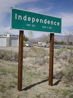
San Francis Ranch was the ranch of Owens Valley pioneer Samuel A. Bishop and his wife, located on a creek later named for him southwest of modern Bishop, California also named after him. Bishop founded the ranch here in August 1861, after he and his wife drove 500 cattle and 50 horses from Fort Tejon to this spot in the Owens Valley, intending to sell cattle to the miners in the boomtown of Aurora and other mining camps in the area.

Joaquin Jim was a Western Mono, war leader of the Owens Valley Indian War. Joaquin Jim, implacable war leader of the Mono allies of the Owens Valley Paiute, never surrendered to American forces or made peace with them, but reported to have ceased warfare against them in 1864.

The California Indian Wars were a series of massacres, wars, and battles between the United States Army, and the Indigenous peoples of California. The wars lasted from 1850, immediately after the acquisition of Alta California during the Mexican–American War became the state of California, to 1880 when the last minor military operation on the Colorado River that ended the Calloway Affair of 1880.

Battle of Bishop Creek was one of the early engagements of the Owens Valley Indian War fought on April 6, 1862 along Bishop Creek, in what is now Inyo County, California.

References