
Aroostook County is a county in the U.S. state of Maine along the Canada–U.S. border. As of the 2010 census, the population was 71,870. Its seat is Houlton with offices in Caribou and Fort Kent.

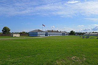
The Aroostook War was a military and civilian-involved confrontation in 1838–1839 between the United States and the United Kingdom over the international boundary between the British colony of New Brunswick and the U.S. state of Maine. Two Canadian militiamen were injured by black bears prior to the diplomatic compromise. Top-level diplomats from the US and Britain met in Washington and forged a peaceful compromise, the Webster–Ashburton Treaty in 1842. It fixed the permanent border. The term "war" was rhetorical; local militia units were called out but never engaged in actual combat. The event is best described as an international incident.

Fort Carillon, the precursor of Fort Ticonderoga, was constructed by Pierre de Rigaud de Vaudreuil, Governor of Canada, to protect Lake Champlain from a British invasion. Situated on the lake some 15 miles (24 km) south of Fort Saint Frédéric, it was built to prevent an attack on Canada and slow the advance of the enemy long enough for reinforcements to arrive.
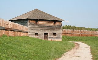
Fort George was a military fortification in Niagara-on-the-Lake, Ontario, Canada. The fort was used by the British Army, the Canadian militia, and the United States Armed Forces for a brief period. The fort was mostly destroyed during the War of 1812. The site of the fort has been a national historic site National Historic Site of Canada since 1921, and features a reconstruction of Fort George.
The 96th Regiment of Foot was a British Army regiment, raised in 1798. Under the Childers reforms it amalgamated with the 63rd Regiment of Foot to form the Manchester Regiment.

New Fort York, later the Stanley Barracks, is a former British and Canadian military base in Toronto, Ontario, Canada, located on the Lake Ontario shoreline. It was built in 1840–1841 to replace Toronto's original Fort York at the mouth of Garrison Creek as the primary military base for the settlement. Unlike the older fort, many of the new fort buildings were made with limestone, instead of wood. A protective wall was planned for the new fort but was never built. The fort was used by the British army until 1870, and the Canadian military subsequently used the fort to train troops for the Second Boer War, World War I and World War II. It also trained one of the first regiments of the North-West Mounted Police. The Canadian military stopped using it after World War II and the fort was demolished in the 1950s. Only the Officers' Quarters building remains on the site.

Fort Amherstburg was built by the Royal Canadian Volunteers at the mouth of the Detroit River to replace Fort Detroit, which Britain was required to cede to the United States of America in 1796 as a result of the Jay Treaty.

The Siege of Fort Erie was one of the last and most protracted engagements between British and American forces during the Niagara campaign of the American War of 1812. From 4 August to 21 September 1814, the Americans successfully defended Fort Erie against a British army. During the siege, the British suffered heavy casualties in a failed storming attempt and also suffered from sickness and exposure in their rough encampments. Unaware that the British were about to abandon the siege, the American garrison later launched a sortie to destroy the British siege batteries, during which both sides again suffered heavy losses.
The Siege of Fort Meigs took place during the War of 1812 (1812–1815), in northwestern Ohio in late April-early May, 1813. A small British Army unit with support from Indians attempted to capture the recently constructed fort to forestall an American offensive against Detroit, and its Fort Detroit in the Great Lakes region which the British from the north in Canada had captured the previous year. An American sortie and relief attempt failed with heavy casualties, but the British failed to capture the fort and were forced to raise the siege.
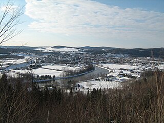
Cabano is a former city in Témiscouata Regional County Municipality within the Bas-Saint-Laurent region of Quebec, Canada. It is situated on Lake Témiscouata on Route 185. On May 5, 2010 it merged with Notre-Dame-du-Lac to form the new city of Témiscouata-sur-le-Lac.
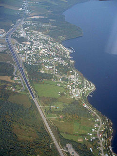
Dégelis is a city in Témiscouata Regional County Municipality within the Bas-Saint-Laurent region of Quebec. Its population in the Canada 2011 Census was 3,051. The Madawaska River flows from Lake Témiscouata, through Degelis, to join the Saint John River at 32 kilometres (20 mi) to the East at Edmundston, New Brunswick.

The 40th Regiment of Foot was an infantry regiment of the British Army, raised in 1717 in Annapolis Royal, Nova Scotia. Under the Childers Reforms it amalgamated with the 82nd Regiment of Foot to form the Prince of Wales's Volunteers in 1881.
The 99th (Lanarkshire) Regiment of Foot was an infantry regiment of the British Army, formed in 1824. It amalgamated with the 62nd (Wiltshire) Regiment of Foot to form the Duke of Edinburgh's in 1881.

The 106th Regiment of Foot was an infantry regiment of the British Army from 1862 to 1881, the third to bear the number after the Black Musqueteers (1761–1763) and a regiment raised briefly in 1794. It was formed by renaming the 2nd Bombay European Regiment, formed by the Honourable East India Company in 1839. In 1881 the 106th Regiment was joined with the 68th (Durham) Regiment of Foot to form the Durham Light Infantry, as its second regular battalion.
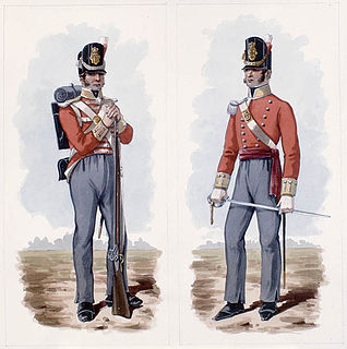
The 100th Regiment of Foot was raised in Ireland in 1804 for service in the Napoleonic Wars. After a few weeks, Lieutenant Colonel John Murray was appointed to command; he was to remain in this post for most of the regiment's active service.
The 83rd Regiment of Foot was a British Army line infantry regiment, which was formed in Ireland in 1793 for service in the French Revolutionary Wars. The regiment served in the West Indies, South Africa and the Peninsular War, and after the end of the wars with France spent much of the nineteenth century in colonial garrisons. Among other service, the 83rd fought in the Ceylon Great Rebellion of 1817–18, the Canadian Rebellions of 1837, and the Indian Rebellion of 1857. Under the Childers Reforms, the regiment amalgamated with the 86th Regiment of Foot to form the Royal Irish Rifles in 1881.
Notre-Dame-du-Lac is a former city in the regional county municipality of Témiscouata in the province of Quebec, Canada, located in the administrative region du Bas-Saint-Laurent. On 5 May 2010, the cities of Cabano and Notre-Dame-du-Lac combined to form a new city named Témiscouata-sur-le-Lac. "Notre-Dame-du-Lac" was designated as a section of the new city.
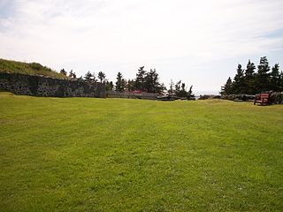
Castle Hill is an area containing the remains of both French and British fortifications, overlooking the town of Placentia in Newfoundland and Labrador, Canada. The site was originally established in order to protect the French fishing interests in Newfoundland and the approaches to the French colony of Canada.

The Chemin du Portage is a historic route located in Quebec, between the St. Lawrence River valley and Acadia. First used for portage by Native Americans, and later as a strategic road by French and British colonists, it was later upgraded into today's Quebec Route 185 and Quebec Autoroute 85, and forms part of the Trans-Canada Highway.
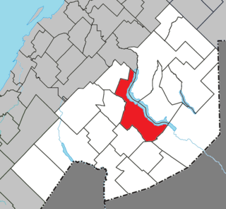
Témiscouata-sur-le-Lac is a municipality in Quebec, Canada, situated in the MRC of Témiscouata in the Bas-Saint-Laurent region. The city was created on May 5, 2010 from the mergers of the city of Cabano and Notre-Dame-du-Lac. The new city was called Cabano–Notre-Dame-du-Lac until November 13, 2010.
