Ellis County is a county located on the western border of the U.S. state of Oklahoma. As of the 2020 census, the population was 3,749, making it the fifth-least populous county in Oklahoma. Its county seat is Arnett.

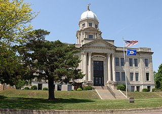
Jackson County is a county in the U.S. state of Minnesota. As of the 2020 census, the population was 9,989. Its county seat is Jackson.

Cottonwood County is a county in the U.S. state of Minnesota. As of the 2020 census, the population was 11,517. Its county seat is Windom.

Vernon Parish is a parish located in the U.S. state of Louisiana. As of the 2020 census, the population was 48,750. The parish seat and most populous municipality is Leesville. Bordered on the west by the Sabine River, the parish was founded in 1871 during the Reconstruction era.
Galliano is an unincorporated community and census-designated place (CDP) on the Bayou Lafourche in Lafourche Parish, Louisiana, United States. As of 2020, its population was 7,100. It is part of the Houma–Bayou Cane–Thibodaux metropolitan statistical area.

Kisatchie National Forest, the only National forest in Louisiana, United States, is located in the forested piney hills and hardwood bottoms of seven central and northern parishes. It is part of the Cenozoic uplands and has large areas of longleaf pine forests. It is one of the largest pieces of natural landscape in Louisiana, with some 604,000 acres (2,440 km2) of public land, more than half of which is vital longleaf pine and flatwoods vegetation. These support many rare plant and animal species. There are also rare habitats, such as hillside seepage bogs and calcareous prairies. The forest also contains and provides a buffer for the Kisatchie Hills Wilderness, a nationally designated wilderness area that contributes to protecting biodiversity of the coastal plain region of the United States.

Fort Johnson, formerly Fort Polk, is a United States Army installation located in Vernon Parish, Louisiana, about 10 miles (15 km) east of Leesville and 30 miles (50 km) north of DeRidder in Beauregard Parish.

A wildlife management area (WMA) is a protected area set aside for the conservation of wildlife and for recreational activities involving wildlife.
Loggy Bayou is a 17.3-mile-long (27.8 km) stream in northwestern Louisiana which connects Lake Bistineau with the Red River. Bistineau is the reservoir of Dorcheat Bayou, which flows 115 miles (185 km) southward from Nevada County, Arkansas, into Webster Parish. Loggy Bayou flows through south Bossier Parish, west of Ringgold, in a southerly direction through Bienville Parish, and into Red River Parish, where north of Coushatta it joins the Red River, a tributary of the Mississippi. At East Point, LA, the river has a mean annual discharge of 1,960 cubic feet per second.
The Sherburne Complex(Sherburn is a joint land management venture of the U.S. Fish and Wildlife Service, the Louisiana Department of Wildlife and Fisheries, and the U.S. Army Corps of Engineers that began in 1983. The area consists of 43,637 acres, and is managed by the Louisiana Department of Wildlife and Fisheries. The complex is located in the Morganza Flood way system of the Atchafalaya Basin about 30 miles west of Baton Rouge, Louisiana and actually extends a little south of the I-10 Atchafalaya Basin Bridge at Whiskey Bay, Louisiana. The bridge crosses the Whiskey Bay Pilot Channel. Located on the graveled

Louisiana Highway 975 (LA 975) is a gravel state highway in central Louisiana. It runs north–south for 18.4 miles (29.6 km). The southern terminus is at Whiskey Bay in Iberville Parish, and the northern terminus is east of Krotz Springs at a junction with U.S. Route 190 (US 190) and the north, south LA 973, in Pointe Coupee Parish. The entire route traverses the Sherburne Complex WMA, which is a combined Sherburne WMA, Atchafalaya National Wildlife Refuge, and Bayou Des Ourse, managed by the Louisiana Department of Wildlife and Fisheries. The road runs between the Atchafalaya River and Whiskey Bay Pilot Channel on the west and the East Protection Levee on the east.

Mattaponi Wildlife Management Area is a 2,542-acre (10.29 km2) Wildlife Management Area (WMA) in Caroline County, Virginia. Located west of Bowling Green, the area protects a mixture of wetlands and upland forests at the confluence of the Mattaponi and South rivers.
Elm Hall Wildlife Management Area is a 2,839-acre (1,149 ha) protected area in Assumption Parish, Louisiana. The WMA is located five miles west of Napoleonville, with Lake Verret on the western border, farmland to the east, and is managed by the Louisiana Department of Wildlife and Fisheries (LDWF).
Clear Creek Wildlife Management Area is a 52,559-acre (21,270 ha) tract of protected area located in Vernon Parish, Louisiana. The Louisiana Department of Wildlife and Fisheries (LDWF) leases the land from Hancock Timber.
Russell Sage Wildlife Management Area, also referred to as Russell Sage WMA, is a 38,213-acre (15,464 ha) protected area in Caldwell, Morehouse, Ouachita, and Richland Parishes, Louisiana. It was the first WMA owned by the Louisiana Department of Wildlife and Fisheries upon purchasing 15,000 acres of property in 1960. The WMA is located about seven miles east of Monroe and 10 miles west of Rayville. The 2,767-acre Kennedy Tract was purchased in 2015. There are 2,955 acres owned by the U.S. Army Corps of Engineers, 1,240 acres owned by the Ouachita Parish School Board, and 13,332 acre Ouachita WMA that was consolidated in 2015.
Fort Johnson North Wildlife Management Area, known locally as Peason Ridge WMA, is a 74,309-acre tract of protected area located in the Parishes of Natchitoches, Sabine, and Vernon, in the state of Louisiana. The WMA is managed by the Louisiana Department of Wildlife and Fisheries (LDWF).
J. C. "Sonny" Gilbert Wildlife Management Area is a 7,524-acre (3,045 ha) wildlife management area in Catahoula, Parish, Louisiana, owned by the Louisiana Department of Wildlife and Fisheries. It is located 6 miles (9.7 km) miles west of Sicily Island. The area contains the 17 ft (5.2 m) high Rock Falls, one of the tallest waterfalls in the state.
Esler Field Wildlife Management Area (WMA) is a 12,500 acres (5,100 ha) protected area in parts of Rapides and Grant parishes in the state of Louisiana.
Buckhorn Wildlife Management Area (WMA), an 11,121 acres (4,501 ha) tract of protected area located in Tensas Parish, in the state of Louisiana. The WMA is owned by the Louisiana Department of Wildlife and Fisheries (LDWF).


