Fort Pillow State Historic Park is a state park in western Tennessee that preserves the American Civil War site of the Battle of Fort Pillow. The 1,642 acre (6.6 km²) Fort Pillow, located in Lauderdale County on the Chickasaw Bluffs overlooking the Mississippi River, is rich in both historic and archaeological significance. In 1861, the Confederate army built extensive fortifications and named the site for General Gideon Johnson Pillow of Maury County. It was attacked and held by the Union Army for most of the American Civil War period except immediately after the Battle of Fort Pillow, when it was retaken by the Confederate Army. The battle ended with a massacre of African-American Union troops and their white officers attempting to surrender, by soldiers under the command of Confederate Major General Nathan Bedford Forrest.

The third USS Lexington was a timberclad gunboat in the United States Navy during the American Civil War.

Fort Fisher was a Confederate fort during the American Civil War. It protected the vital trading routes of the port at Wilmington, North Carolina, from 1861 until its capture by the Union in 1865. The fort was located on one of Cape Fear River's two outlets to the Atlantic Ocean on what was then known as Federal Point or Confederate Point and today is known as Pleasure Island. The strength of Fort Fisher led to its being called the Southern Gibraltar and the "Malakoff Tower of the South". The battle of Fort Fisher was the most decisive battle of the Civil War fought in North Carolina.

Fort Morgan is a historic masonry pentagonal bastion fort at the mouth of Mobile Bay, Alabama, United States. Named for American Revolutionary War hero Daniel Morgan, it was built on the site of the earlier Fort Bowyer, an earthen and stockade-type fortification involved in the final land battles of the War of 1812. Construction was completed in 1834, and it received its first garrison in March of the same year.

The Red River campaign, also known as the Red River expedition, was a major Union offensive campaign in the Trans-Mississippi theater of the American Civil War, which took place from March 10 to May 22, 1864. It was launched through the densely forested gulf coastal plain region between the Red River Valley and central Arkansas towards the end of the war. The offensive was intended to stop Confederate use of the Louisiana port of Shreveport, open an outlet for the sugar and cotton of northern Louisiana, and to split the Confederate lines, allowing the Union to encircle and destroy the Confederate military forces in Louisiana and southern Arkansas. It marked the last major offensive attempted by the Union in the Trans-Mississippi Theater.

The Fort Clinch State Park is a Florida State Park, located on a peninsula near the northernmost point of Amelia Island, along the Amelia River. Its 1,100 acres (4 km2) include the 19th-century Fort Clinch, sand dunes, plains, maritime hammock and estuarine tidal marsh. The park and fort lie to the northeast of Fernandina Beach at the entrance to the Cumberland Sound.

Fort Pocahontas was an earthen fort on the north bank of the James River at Wilson's Wharf, in Charles City County, Virginia which served as a Union supply depot during the American Civil War. The fort was constructed by African American soldiers of the United States Colored Troops under the command of Brigadier General Edward Wild.

Joseph Bailey was a civil engineer who served as a general in the Union Army during the American Civil War.
The Battle of Fort De Russy, Louisiana, was the first engagement in the Red River Campaign of March–May 1864 in the American Civil War.

Fort Lookout, also known as Redoubt A, is a defensive earthworks erected during the American Civil War on the outskirts of Camden, Arkansas. It was the northernmost of a series of five redoubts built in defense of the city by Confederate Army forces in early 1864, preparatory to the Union Army's Camden Expedition. The site has been designated a National Historic Landmark as part of the Camden Expedition Sites, a collection of military sites related to the expedition.

Fort Southerland, also known as Redoubt E and possibly Fort Diamond, is a redoubt built during the American Civil War to protect Camden, Arkansas. Confederate forces built it along with four other redoubts in early 1864 after a Union victory in the Little Rock campaign the previous year. Fort Southerland is about the size of a city block and is roughly oval. It could hold three cannons. When Union forces captured Camden in April 1864 during the Camden Expedition, they improved the defenses of the five redoubts, which were not sufficient for proper defense of the city. After the Confederates retook Camden later that month, they continued to improve the city's defenses.
The Port Hudson State Historic Site is located on the Mississippi River north of Baton Rouge in East Feliciana Parish, Louisiana, just outside the limits of Port Hudson and in the vicinity of Jackson. The site preserves a portion of the fortifications and battle area of the longest siege in American history, during the American Civil War from May 23 through July 9, 1863. The state of Louisiana maintains the site, which includes a museum about the siege, artillery displays, redoubts, and interpretive plaques. Historical reenactments are held each year. It was designated a National Historic Landmark in 1974, significant as the first place where African-American military units fought for the Union Army under African-American field leadership.

Fort DeRussy, located south of Alexandria, Louisiana, and four miles (6 km) north of Marksville, was a Confederate earthwork stronghold during the American Civil War. It was built in 1862 to defend the lower Red River Valley in Louisiana. Located in Avoyelles Parish, the fort, cemetery and water batteries were designated as a state historic site in 1994. The fort and the water battery were listed on the National Register of Historic Places in 2016.

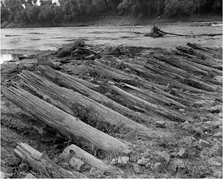
Bailey's Dam was a timber dam on the Red River in Alexandria, Louisiana. It was built in 1864 during the Red River Campaign in the American Civil War. It was planned by Lieutenant Colonel Joseph Bailey to afford passage over the Alexandria rapids for part of Rear Admiral David Dixon Porter's Mississippi River Squadron. The dam successfully raised the level of the river and was then breached in order to allow the boats in its reservoir to pass downstream.

Fort Buhlow is an American Civil War fort site located in Pineville, Louisiana. It was added to the National Register of Historic Places on June 1, 1981. It was one of two forts built for the Confederate States Army by local plantation slave labor in March 1865 to prevent anticipated Union attacks. Alphonse Buhlow was the military engineer for the construction of the forts and this one was named for him.

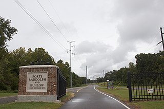
Forts Randolph and Buhlow State Historic Site in Pineville, Louisiana, a state historic site in Louisiana consisting of Fort Randolph and Fort Buhlow. Both of these forts are in the National Register of Historic Places.

Fort Granger was a Union fort built in 1862 in Franklin, Tennessee, south of Nashville, after their forces occupied the state during the American Civil War. One of several fortifications constructed in the Franklin Battlefield, the fort was used by Union troops to defend their positions in Middle Tennessee against Confederate attackers. The Second Battle of Franklin in 1864, part of the Franklin-Nashville Campaign in the Western Theater, was the most notable engagement of this area during the Civil War.

Lee's Mill Earthworks is a historic archaeological site located at Newport News, Virginia. The earthworks formed part of the fortifications along the James River, which included fortifications at Fort Crafford, as well as, Dam No.1, and Wynne's Mill in Newport News Park. On April 5, 1862, advance units of Union Brigadier General Erasmus D. Keyes' IV Corps, under the command of Union Brigadier General William Farrar Smith, encountered Confederate units commanded by Brigadier General Lafayette McLaws at Lee's Mill. Heavy rains and massive earthen fortifications defending the river crossing stopped the Union troops from proceeding to Richmond. Confederate Major General John B. Magruder's extensive defensives beginning at Lee's Mill and extending to Yorktown along the Warwick River caused the Union Army of the Potomac Commander Major General George B. McClellan to initiate a month-long siege of the Warwick-Yorktown Line which lasted until May 3, 1862 and contributed to the eventual failure of McClellan's campaign.

Johnston's River Line, also called Johnston's Line, the Chattahoochee River Line or simply The River Line, is a historic American Civil War defensive line located in the communities of Mableton, Smyrna, and Vinings, Georgia that was used by the Confederate Army under General Joseph E. Johnston during the Atlanta Campaign in early July 1864. While no significant battles took place along the River Line, it remains one of the most impressive defensive fortifications ever constructed, often compared to the French Maginot Line built prior to World War II. Part of the River Line Historic Area and the Chattahoochee River Line Battlefield, the site today consists of the remains of Confederate earthwork battlements including unique fortifications called Shoupades, named after their designer, Confederate Brig. General Francis A. Shoup. The remains are spread across a six to seven mile stretch along the northwest side of the Chattahoochee River from a point just north of where Nickajack Creek joins the Chattahoochee in Mableton to north of S. Atlanta Road in Smyrna/Vinings. It was added to the National Register of Historic Places on July 5, 1973. Although many of the remains are on private property, visitors can access the site off U.S. 78 in Mableton, and off S.R. 280 and S. Atlanta Rd in Smyrna/Vinings. The site's coordinates are 33°47′31″N84°31′23″W.

Bossier High School is a co-educational college preparatory high school in Bossier City, Louisiana, United States.


