
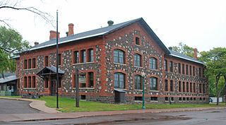
Oregon is a city in and the county seat of Ogle County, Illinois, United States. The population was 3,721 in 2010.

The Mormon Trail is the 1,300-mile (2,100 km) long route from Illinois to Utah that members of the Church of Jesus Christ of Latter-day Saints traveled from 1846–47. Today, the Mormon Trail is a part of the United States National Trails System, known as the Mormon Pioneer National Historic Trail.

Fort Edmonton Park is an attraction in Edmonton, Alberta, Canada. Named for the first enduring European post in the area of modern-day Edmonton, the park is the largest living history museum in Canada by area. It includes both original and rebuilt historical structures representing the history of Edmonton, and is staffed during the summer by costumed historical interpreters.
Pioneer Village is located inside of the Lagoon Amusement Park in Farmington, Utah. Meant to be a "living museum," Pioneer Village includes artifacts and mementos housed in over two dozen structures, intended to make the history of Utah come alive. It was founded in 1938 near Salt Lake City by Horace and Ethel Sorensen. In April 1975, Lagoon bought the collection from the Sons of Utah Pioneers, and it opened at the amusement park in 1976.
Keweenaw National Historical Park is a unit of the U.S. National Park Service. Established in 1992, the park celebrates the life and history of the Keweenaw Peninsula in the Upper Peninsula of the U.S. state of Michigan. As of 2009, it is a partly privatized park made up of two primary units, the Calumet Unit and the Quincy Unit, and 21 cooperating "Heritage Sites" located on federal, state, and privately owned land in and around the Keweenaw Peninsula. The National Park Service owns approximately 1,700 acres (690 ha) in the Calumet and Quincy Units. Units are located in Baraga, Houghton, Keweenaw, and Ontonagon counties.

Cumberland Mountain State Park is a state park in Cumberland County, Tennessee, in the southeastern United States. The park consists of 1,720 acres (7.0 km2) situated around Byrd Lake, a man-made lake created by the impoundment of Byrd Creek in the 1930s. The park is set amidst an environmental microcosm of the Cumberland Plateau and provides numerous recreational activities, including an 18-hole Bear Trace golf course.

Fort Rock is a tuff ring located on an ice age lake bed in north Lake County, Oregon, United States. The ring is about 4,460 feet (1,360 m) in diameter and stands about 200 feet (60 m) high above the surrounding plain. Its name is derived from the tall, straight sides that resemble the palisades of a fort. The region of Fort Rock–Christmas Lake Valley basin contains about 40 such tuff rings and maars and is located in the Brothers Fault Zone of central Oregon's Great Basin. William Sullivan, an early settler in the area, named Fort Rock in 1873 while searching for lost cattle.

Fort Rock is an unincorporated community in Lake County, Oregon, United States, southeast of Fort Rock State Natural Area.
There are numerous heritages and cultural attractions in the province of Saskatchewan. Museums, dinosaur digs, aboriginal cultural and heritage sites, art galleries, professional sport venues, spas, handcraft, antique and tea shops, agricultural tours, theatre and archaeological sites comprise over 600 varied Saskatchewan institutions.

Collier Memorial State Park is a state park in southern Oregon. The park is operated and maintained by the Oregon Parks and Recreation Department. It is located on U.S. Highway 97, approximately 30 miles (48 km) north of Klamath Falls and 105 miles (169 km) south of Bend. The park covers 146 acres (59 ha) along the Williamson River.

The dogtrot, also known as a breezeway house, dog-run, or possum-trot, is a style of house that was common throughout the Southeastern United States during the 19th and early 20th centuries. Some theories place its origins in the southern Appalachian Mountains. Some scholars believe the style developed in the post-Revolution frontiers of Kentucky and Tennessee. Others note its presence in the South Carolina Lowcountry from an early period. The main style point was a large breezeway through the center of the house to cool occupants in the hot southern climate.

The Riddle Brothers Ranch is a pioneer ranch complex located in the Steens Mountain Cooperative Management and Protection Area in Harney County in eastern Oregon, United States. It is a rare extant example of the small family ranch. The ranch is located on both sides of the Little Blitzen River on public land and is administered by the Bureau of Land Management.
The Overland Trail was a stagecoach and wagon trail in the American West during the 19th century. While portions of the route had been used by explorers and trappers since the 1820s, the Overland Trail was most heavily used in the 1860s as a route alternative to the Oregon, California, and Mormon trails through central Wyoming. The Overland Trail was famously used by the Overland Stage Company owned by Ben Holladay to run mail and passengers to Salt Lake City, Utah, via stagecoaches in the early 1860s. Starting from Atchison, Kansas, the trail descended into Colorado before looping back up to southern Wyoming and rejoining the Oregon Trail at Fort Bridger. The stage line operated until 1869 when the completion of the First transcontinental railroad eliminated the need for mail service via stagecoach.

The James Cant Ranch is a pioneer ranch complex in Grant County in eastern Oregon, United States. The ranch is located on both sides of the John Day River in the John Day Fossil Beds National Monument. The ranch was originally homesteaded by Floyd Officer in 1890. Officer sold the property to James Cant in 1910. Cant increased the size of the property and built a modern ranch complex on the west bank of the river. The National Park Service bought the ranch from the Cant family in 1975, and incorporated the property into the John Day Fossil Beds National Monument. The National Park Service used the main house as a visitor center until 2003. Today, the Cant Ranch complex is preserved as an interpretive site showing visitors an early 20th-century livestock ranch. The James Cant Ranch is listed on the National Register of Historic Places.
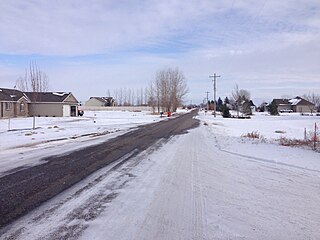
Grant is an unincorporated community in Jefferson County, Idaho, United States.

The Saxon Lutheran Memorial in Frohna, Missouri, commemorates the German Lutheran migration of 1838–1839, and features a number of log cabins and artifacts from that era. The memorial opened in 1962 and was placed on the National Register of Historic Places in 1980.

The Pioneer Living History Museum is located at 3901 W. Pioneer Road in Phoenix, Arizona. The museum, also known as Pioneer Village, has 30 historic original and reconstructed buildings from the 1880s and early 1900s on its 90-acre property.

Stauffer was an unincorporated community located in Lake County, Oregon, United States. The first homesteaders arrived in the area around 1910. By 1918, the local population was declining rapidly due to the harsh environment. Today, Stauffer is a ghost town with no population and no surviving structures. The site is located approximately 12 miles (19 km) south of U.S. Route 20 between Bend and Burns, Oregon. The nearest inhabited place is Hampton, Oregon, 21 miles (34 km) northwest of the Stauffer site.

Fremont was an unincorporated community located in Lake County, Oregon, United States. The first homesteaders arrived in the area around Fremont in 1905. The population grew quickly, and the Fremont post office was opened in 1908. By 1915, the local population was declining rapidly due to a severe drought that dried up surface water and lowered the water table in the area around Fremont. Today, Fremont is a ghost town with no population and no surviving structures. The site is located approximately 5 miles (8.0 km) west of Fort Rock state park. The nearest inhabited place is the small unincorporated community of Fort Rock, Oregon, which is 6 miles (9.7 km) southeast of the Fremont townsite.

Fleetwood was an unincorporated community located in Lake County, Oregon, United States. The first homesteaders arrived in the area around Fleetwood in 1905. The Fleetwood post office was opened in 1913. By 1920, the local population was declining due to a severe drought that dried up surface water and lowered the water table in the area around Fleetwood. Today, Fleetwood is a ghost town with no population and no surviving structures at the townsite. The site is located approximately 10 miles (16 km) east of Fort Rock state park. The nearest inhabited place is the small unincorporated community of Fort Rock, Oregon, which is 9 miles (14 km) west of the Fleetwood townsite.


