
The Province of the Cape of Good Hope, commonly referred to as the Cape Province and colloquially as The Cape, was a province in the Union of South Africa and subsequently the Republic of South Africa. It encompassed the old Cape Colony, and had Cape Town as its capital. Following the end of the Apartheid era, the Cape Province was split up to form the new Eastern Cape, Northern Cape and Western Cape provinces, along with part of the North West.

The University of Fort Hare is a public university in Alice, Eastern Cape, South Africa.

John Maxwell Coetzee is a South African-born novelist, essayist, linguist, translator and recipient of the 2003 Nobel Prize in Literature. He relocated to Australia in 2002 and lives in Adelaide. He became an Australian citizen in 2006.
The following lists events that happened during 1981 in South Africa.

Port Elizabeth or The Bay is one of the major cities in South Africa; it is situated in the Eastern Cape Province, 770 km (478 mi) east of Cape Town. The city, often shortened to PE and nicknamed "The Windy City", stretches for 16 km along Algoa Bay, and is one of the major seaports in South Africa. Port Elizabeth is the southernmost large city on the African continent, just farther south than Cape Town. Port Elizabeth was founded as a town in 1820 to house British settlers as a way of strengthening the border region between the Cape Colony and the Xhosa. It now forms part of the Nelson Mandela Bay Metropolitan Municipality, which has a population of over 1.3 million.

The 1820 Settlers were several groups of white British colonists settled by the government of the Kingdom of Great Britain government and the Cape Colony authorities in the Eastern Cape of South Africa in 1820.

White South Africans are South Africans descended from any of the white racial or ethnic groups of Europe. In linguistic, cultural and historical terms, they are generally divided into the Afrikaans-speaking descendants of the Dutch East India Company's original settlers, known as Afrikaners, and the Anglophone descendants of predominantly British colonists. In 2016, 57.9% were native Afrikaans speakers, 40.2% were native English speakers, and 1.9% spoke another language as their mother tongue, such as Portuguese or German. White South Africans are by far the largest European-descended population group in Africa.

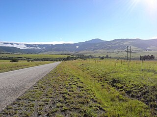
Cathcart is a town in the Eastern Cape province of South Africa, named after Sir George Cathcart, governor of the Colony of the Cape of Good Hope 1852–1853. The town is situated on the N6, 48 kilometres (30 mi) north of Stutterheim en route to Queenstown.

Colonel James Henry Bowker, was a South African naturalist and soldier. He was co-author with Roland Trimen of South African Butterflies.
This is a list of alleged sightings of unidentified flying objects or UFOs in South Africa.
Döhne is a South African agricultural research station 6 kilometres north of Stutterheim in the Eastern Cape. It is noted for having developed the Döhne Merino from Peppin Merino ewes and German mutton merino sires in 1939. The program bred for high fertility, rapid lamb growth and fine wool production under pastoral conditions. The breed was introduced to Australia in 1998.
Griffiths Mlungisi Mxenge was born in KwaRayi, a rural settlement outside of King Williams Town, Eastern Cape. He was a civil rights lawyer, a member of the African National Congress (ANC) and a South African anti-apartheid activist.

The Africa Open was a golf tournament on the Sunshine Tour held in Eastern Cape, South Africa. It was first contested in February 2008, over the Gary Player designed championship course at the Fish River Sun Country Club, near Port Alfred.

Roland Athol Price Trollip is a South African politician of the Democratic Alliance (DA) and former Executive Mayor of Nelson Mandela Bay Metropolitan Municipality, serving from August 2016 until he was unseated in a vote of no confidence in August 2018.

Assegaaibosch Nature Reserve is an historic estate and currently a CapeNature nature reserve and World Heritage Site situated in the Jonkershoek Valley near Stellenbosch in the Western Cape province of South Africa. The historic estate was established by Dirk Coetsee, the progenitor of the Coetsee family in South Africa.
Fort Cox near Middledrift in the Eastern Cape, South Africa was a frontier fort in the Amatola Mountains on a loop of the Keiskamma River.
The Tyhume River is a river in Amathole District Municipality in the central part of the Eastern Cape province of South Africa. It springs in the forested mountains of Hogsback, part of the Amatola Mountains, and runs down the Tyhume River Valley and through the eastern verge of the small town of Alice, Eastern Cape, bordering most of the Fort Hare University grounds.
Allister Coetzee is a South African rugby union coach and former player, current in charge of Japanese Top League side Canon Eagles. He served as the head coach of the South African national team from April 2016 to February 2018.
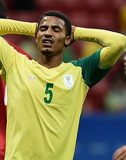
Rivaldo Roberto Genino Coetzee is a South African professional footballer who plays as a defender for Mamelodi Sundowns and the South Africa national team.


