Fort de Cindey

Last updated
Fort de Cindey
Part of Fortress Saint-Maurice
Western Switzerland
Cindey 105rechts.jpg
Rear of a 105mm gun at the Fort de Cindey
Switzerland adm location map.svg
Red pog.svg
Fort de Cindey
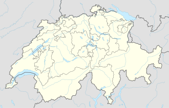
Coordinates 46°13′15″N7°00′12″E / 46.22074°N 7.00346°E / 46.22074; 7.00346
Site information
Controlled bySwitzerland
Open to
the public
Yes
ConditionPreserved
Site history
Built1941-46 and 1948-1952
MaterialsRock excavation

The Fort de Cindey (Swiss designation A155) is a component of Fortress Saint-Maurice, which is in turn one of the three principal fortified regions of the National Redoubt of Switzerland. The Fort de Cindey was built in two steps: the first, between 1941 and 1946 and the second step, between 1948 and 1954 (the hospital, the artilleries casemates with the gunnery command and the ammunition magazines) . It was taken out of service in 1995. This fort was built in the Scex cliff face immediately to the west of Saint-Maurice to complement the existing Fort du Scex, built earlier in the same cliff. With the Fort du Scex, it comprises a fortress complex encased in rock high above the strategic Saint-Maurice valley. The fort was deactivated in 1995. It is now open for public tours during the summer months.
Contents

Site

The Fort de Cindey is located in the western cliffs of the Saint-Maurice valley where the defile narrows dramatically. The location was previously fortified in the 19th century. The Château Saint-Maurice remains extant, while extensive fortifications on either side of the Rhône, constructed between 1831 and 1860 by General Guillaume Henri Dufour have disappeared. [1]

Description

The Fort de Cindey is arranged along a mined gallery paralleling the face of the Scex escarpment at a distance from the rock face of about 25 metres (82 ft), with side galleries extending to the cliff face for observation posts and artillery positions. Lateral branches to the interior of the mountain lead to troop accommodations, the command post, ammunition magazines and utility areas. The fort was planned as a mixed artillery and infantry position that could provide supporting fire to the anti-tank barrier across the Rhône valley at Lavey. [2] [3]

Cindey is connected to the adjoining Fort du Scex by the natural caves of the Grotte aux Fées. [4] [5] The Fort de Cindey was initially armed with two 105 mm guns in individual casemates. [3] Four 90 mm anti-tank guns and three machine guns were added in the 1950s. The fort was also equipped with four mobile 81 mm mortars. Ammunition magazines and an infirmary were added at this time. Routine access to the fort for supplies was provided by an aerial cableway. [4] The fort's power and communications were provided by the Fort du Scex, which had had its guns deactivated and was used as a command post until 1995. [6]

The fort continued in service until 1995, when it was deactivated. All of the guns remain in place. [6]

Present status

The fort is available for public tours in summer months, together with the Fort du Scex and the Grotte aux Fées. [7]

Related Research Articles

<span class="mw-page-title-main">Fortress of Luxembourg</span> Fortifications in and around Luxembourg City, Luxembourg, largely dismantled in 1867

The Fortress of Luxembourg is the former fortifications of Luxembourg City, the capital of the Grand Duchy of Luxembourg, which were mostly dismantled beginning in 1867. The fortress was of great strategic importance for the control of the Left Bank of the Rhine, the Low Countries, and the border area between France and Germany.

<span class="mw-page-title-main">Ouvrage Cap Martin</span> Fortification in France

Ouvrage Cap Martin is a work of the Maginot Line's Alpine extension, the Alpine Line, also called the Little Maginot Line. The ouvrage, located on high ground in Roquebrune, consists of two artillery blocks and one combination block facing Italy. The ouvrage was at the southernmost end of the Alpine Line and overlooked the Mediterranean Sea coastline at an altitude of 21 meters between Nice and Menton, facing towards Italy. The ouvrage and its advance casemate at Pont Saint Louis controlled the coastal roads along the Mediterranean.

<span class="mw-page-title-main">Grauerort fortress</span> Museum in Germany

Grauerort fortress is a German artillery fort on Elbe river about 9 km (5.6 mi) north of Stade which was built between 1869 and 1879 to defend the Port of Hamburg. Its shape is hexagonal, taking advantage of the topography of the area and the location of the previously existing levee. The main armament of the fort were probably ten 21 cm breech-loading guns, but they are no longer in place. There were also 4 12 cm and six 9 cm guns. Construction materials were cement and brick; concrete was only used from 1885 onward.

<span class="mw-page-title-main">Fortified Sector of the Crusnes</span>

The Fortified Sector of the Crusnes was the French military organization that in 1940 controlled the section of the Maginot Line extending eastwards approximately 28 kilometres (17 mi) from Longuyon. The sector roughly follows the valley of the Crusnes river. Crucially, the trace of the Maginot Line in the Crusnes sector is about 7 kilometres (4.3 mi) behind the industrial city of Longwy which sits directly against the French borders with Belgium and Luxembourg. The Crusnes sector was one of the strongest Maginot Line sectors. It was attacked in 1940 by German forces in the Battle of France. Despite the withdrawal of the mobile forces that supported the fixed fortifications, the sector successfully fended off German assaults before the Second Armistice at Compiègne. The positions and their garrisons finally surrendered on 27 June 1940. Following the war many positions were reactivated for use during the Cold War. Three locations are now preserved and open to the public, with a fourth position under restoration.

<span class="mw-page-title-main">Fortified Sector of Maubeuge</span>

The Fortified Sector of Maubeuge was the French military organization that in 1940 controlled the section of the Maginot Line between the French border with Belgium and Maubeuge, a distance of about 70 kilometres (43 mi). The sector was not as strongly defended as other sections of the Maginot Line; large portions of the Maubeuge sector were defended by blockhouses or casemates. The sector includes only four ouvrages of the type found in stronger sections of the Line, arranged in an arc to the north and east of the fortified city of Maubeuge, incorporating defenses from the First World War. The Maubeuge sector and the Fortified Sector of the Escaut were the final sections of the Maginot line to be authorized, and were termed the "New Fronts". In the Battle of France, the large fortifications of Maubeuge successfully resisted determined German bombardments and infantry attacks, despite their failure to protect Maubeuge against the Germans, who had outflanked the defensive line and who assaulted the fortification lines from the rear. Surrender or evacuation came only after the positions were surrounded and cut off from any hope of reinforcement. One ouvrage and one pre-Maginot fortification have been preserved.

<span class="mw-page-title-main">Fortified Sector of the Dauphiné</span>

The Fortified Sector of the Dauphiné was the French military organization that in 1940 controlled the section of the Alpine Line portion of the Maginot Line facing Italy in the vicinity of Briançon. By comparison with the integrated defenses of the main Maginot Line, or even of the Fortified Sector of the Maritime Alps to the south, the Dauphiné sector consisted of a series of distinct territories that covered two main invasion routes into France: the route from Turin over the Col de Montgenèvre to Briançon and Grenoble, and the route from Coni over the Col de Larche to Barcelonette and Gap. The sector was the scene of probing attacks by Italian forces during the Italian invasion of France in 1940, in which the French defenses successfully resisted Italian advances until the June 1940 armistice that granted Italy access to southeastern France.

<span class="mw-page-title-main">Fortress Saint-Maurice</span>

Fortress Saint-Maurice is one of the three main fortification complexes comprising the Swiss National Redoubt. The westernmost of the three, Fortress Saint-Maurice complements Fortress Saint Gotthard and Fortress Sargans to secure the central alpine region of Switzerland against an invading force. The National Redoubt was first conceived in the 1880s as an easily defensible area to secure the survival of the Swiss Confederation. In the late 1930s and 1940s when neutral Switzerland was threatened with invasion from Germany, the National Redoubt and its components were modernized and expanded on a massive scale. The fortification system was maintained and upgraded during the Cold War. With the collapse of the Soviet Union, the possibility of a Warsaw Pact invasion disappeared, and by 1995 many positions were abandoned by the military.

<span class="mw-page-title-main">Grotte aux Fées (Switzerland)</span>

The Grotte aux Fées in the cliffs above Saint-Maurice, Switzerland is a natural limestone solution show cave, featuring a 77-metre (253 ft) high underground waterfall, claimed as the world's highest waterfall in a show cave. The cave was the first show cave in Switzerland. The cave was known until the mid 19th century as the Trou aux Fayes or "Sheep Hole," as it was used as a sheepfold. The cave was known from Roman times, but was first publicized in 1863 as a tourist attraction, with the present name being used from 1865.

<span class="mw-page-title-main">Fort du Scex</span> Military museum in Switzerland

The Fort du Scex is a component of Fortress Saint-Maurice, which is in turn one of the three principal fortified regions of the National Redoubt of Switzerland. The Fort du Scex was built in the Scex cliff face immediately to the west of Saint-Maurice beginning in 1911. With the later Fort de Cindey, it comprises a fortress complex encased in rock high above the strategic Saint-Maurice valley. The fort lost its combat function in 1984 and was entirely deactivated in 1995. It is now open for public tours during the summer months.

<span class="mw-page-title-main">Fort de Dailly</span>

The Fort de Dailly is the largest component of Fortress Saint-Maurice, which is in turn one of the three principal fortified regions of the National Redoubt of Switzerland. Almost entirely subterranean, the Fort de Dailly was built in the Massif de Dailly to the east of Saint-Maurice beginning in 1892. With the Fort de Savatan, it comprises a fortress complex encased in rock high above the strategic Saint-Maurice valley, capable of commanding the valley from Chillon to Martigny. It is the central component of Fortress Saint-Maurice in terms of both its position and its military power. Construction began in 1892 and the fort became operational in 1894. The fort was nearly constantly upgraded with new artillery in increasingly secure positions. Following an incident in which three ammunition magazines exploded in close succession in 1946, the fort was repaired and upgraded with two fully automatic 150 mm gun turrets with a range of 24 kilometres (15 mi). After reassessments by the Swiss Armed Forces of their requirements for fixed fortifications, Dailly was progressively closed down starting in 1995, with full closure at the end of 2003.

The Fort de Champillon is a twentieth-century Swiss fortification located in the heights overlooking the Rhône valley from the north between Montreux and Monthey. Completed in 1944, the fort secures the road and rail lines running east from Lausanne to the mountainous interior of Switzerland. The position is an advanced work protecting the approaches to Fortress Saint-Maurice, part of the Swiss National Redoubt. It is entered from the plateau just downhill from Corbeyrier, a village on the heights at the foot of the Tour d'Aï.

<span class="mw-page-title-main">Fort de Pré-Giroud</span> Historical museum in Vallorbe (Switzerland)

The Fort de Pré-Giroud, also known as the Fort de Vallorbe, is a 20th-century Swiss fortification located in the Jura Mountains near the Swiss border with France. The fort defended the Col de Jougne at Vallorbe, one of the few points in the Jura that could be easily traversable by an invading force. It was a component of the Swiss Border Line of defenses. Built between 1937 and 1939, the fort covers the Swiss end on the Mont d'Or railroad tunnel and the Joux valley. It is armed with three artillery blocks for 75mm guns and two machine gun blocks. All are camouflaged, the artillery blocks as rock formations, and the machine gun blocks as houses. Deactivated as a military post in the 1980s, it is operated as a museum.

<span class="mw-page-title-main">Fortified Sector of the Lower Rhine</span>

The Fortified Sector of the Lower Rhine was the French military organization that in 1940 controlled the section of the French frontier with Germany in the vicinity of Strasbourg. The sector's principal defence was the Rhine itself, which could be crossed only by boat or by seizing a bridge crossing. While it was constructed by CORF, the organization responsible for the construction of the Maginot Line, the SF Lower Rhine was not a part of the core Line fortifications. The sector's fortifications chiefly took the form of individual casemates and blockhouses. Additional support was provided by the fortress ring around Strasbourg, whose fortifications were still active in 1940. The SF Lower Rhine was flanked to the north by the Fortified Sector of Haguenau and to the south by the Fortified Sector of Colmar. The Rhinau section of the SF Lower Rhine was attacked by German forces in June 1940 as a diversion from the main German invasion operation in the SF Colmar. Follow-up incursions from the north and at Strasbourg left much of the SF Lower Rhine in German hands by the armistice of 25 June.

<span class="mw-page-title-main">Fortified Sector of Haguenau</span> Historic French border fortifications

The Fortified Sector of Haguenau was the French military organization that in 1940 controlled the most easterly section of the Maginot Line, to the north of Strasbourg. The left (western) wing of the Haguenau sector adjoined the Fortified Sector of the Vosges, includes two of the largest Maginot fortifications, Ouvrage Hochwald and Ouvrage Schoenenbourg. The right wing, started after 1931, was progressively scaled back in order to save money during the Great Depression, abandoning plans for four petit ouvrages and substituting casemates. The sector's northern and eastern sides bordered on Germany. To the south the sector borders the Fortified Sector of the Lower Rhine, from which it received several casemates in a boundary shift in 1940.

<span class="mw-page-title-main">Fortified Sector of Rohrbach</span>

The Fortified Sector of Rohrbach was the French military organization that in 1940 controlled the section of the Maginot Line in the vicinity of Bitche. The sector was bordered to the west by the Fortified Sector of the Sarre and to the east by the Fortified Sector of the Vosges. With lower priority than other sectors, the SF Rohrbach was built somewhat later than its neighbors to the east and west, and in company with positions on the extreme western end of the Maginot Line, became one of the "New Fronts." The sector contains several major ouvrages and was the scene of fighting in both 1940 and 1944. It was attacked in 1940 by German forces in the Battle of France. The sector was heavily engaged by German forces in mid-June 1940, with several casemates and the petit ouvrage Welschhof surrendering before the Second Armistice at Compiègne. The remaining positions and their garrisons finally surrendered on 27 June 1940. In 1944 German forces occupied several positions in the SF Rohrbach, forcing advancing American forces to attack them individually or to bypass them. The German Operation Nordwind offensive of early 1945 caused American forces to fall back, returning to complete the capture of the Rohrbach sector in March 1945. Following the war many positions were reactivated for use during the Cold War. Two locations are now preserved and open to the public.

The Fortified Sector of the Sarre was the French military organization that in 1940 controlled the section of the Maginot Line on either side of the Sarre river. The sector's defenses relied primarily on a system of inundations that could be created by fortified dikes and regulating weirs, backed by blockhouses. Weakly defended compared with other sections of the Maginot Line, the sector received a measure of attention and funding from the mid-1930s when the formerly demilitarized Saarland was reintegrated into Germany. However, with a single petit ouvrage it remained a weak point in the Line. In 1940 the Sarre sector was attacked by German forces in the Battle of France. The inundations were only partly successful, and German forces were able to pierce the Maginot Line at the Sarre, allowing German divisions to move behind the main French line.

<span class="mw-page-title-main">Defensive Sector of the Rhône</span> French military organization

The Defensive Sector of the Rhône was the French military organization that in 1940 controlled the section of the French border with Switzerland and Italy in the area of Geneva. The area was not regarded as a likely point of invasion, owing to the neutrality of Switzerland and the extremely difficult terrain along the Italian portion of the border. It was therefore lightly fortified. Its chief fortified position was the 19th-century Fort l'Écluse, manned by a small force, which held its strategic position against a Panzerkorps for a week in June 1940.

<span class="mw-page-title-main">National Redoubt (Switzerland)</span> Defensive plan developed by the Swiss government

The Swiss National Redoubt is a defensive plan developed by the Swiss government beginning in the 1880s to respond to foreign invasion. In the opening years of the Second World War the plan was expanded and refined to deal with a potential German invasion. The term "National Redoubt" primarily refers to the fortifications begun in the 1880s that secured the mountainous central part of Switzerland, providing a defended refuge for a retreating Swiss Army.

<span class="mw-page-title-main">Fortified Sector of Savoy</span>

The Fortified Section of Savoy(Secteur fortifié de la Savoie) was the French military organization that in 1940 controlled the section of the Alpine Line portion of the Maginot Line facing Italy in the Savoy region. The sector constituted part of the Alpine Line portion of the Maginot Line, between the Defensive Sector of the Rhône to the north, and the Fortified Sector of the Dauphiné to the south. The works combined a number of pre-1914 fortifications with Maginot-style ouvrages, with many forward-positioned cavern-style frontier stations or avant-postes that proved effective in holding invading forces near the order.

References

  1. "Position de barrage de Saint-Maurice" (PDF). Monuments militaires dans le canton du Valais. Swiss Ministry of Defense, Public Protection and Sport. p. 18. Archived from the original (PDF) on 2011-02-06. Retrieved 2011-01-06.
  2. Moret, J.-C. "Barrage antichars de Lavey" (in French). Association Fort de Litroz. Retrieved 4 January 2011.
  3. 1 2 Schneider, Hans Rudolf. "A155 Fort Cindey" (in German). festung-oberland.ch. Archived from the original on 4 October 2011. Retrieved 5 January 2011.
  4. 1 2 "Fort Cindey: Plan". Forteresse Historique de Saint-Maurice. Retrieved 3 January 2011.
  5. "Access to the Fort Cindey of the 'Grotte aux Fées'". Forteresse Historique de Saint-Maurice. Retrieved 3 January 2011.
  6. 1 2 "Fort Cindey". Forteresse Historique de Saint-Maurice. Retrieved 5 January 2011.
  7. "Fortresses of Cindey and du Scex/Saint-Maurice". Valais/Wallis Promotion. Retrieved 3 January 2011.