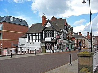
Newport is a market town in the borough of Telford and Wrekin in Shropshire, England. It lies 7 miles (11 km) north-east of Telford town centre, 12 miles (19 km) west of Stafford, and is near the Shropshire-Staffordshire border. The 2001 census recorded 10,814 people living in the town's parish, which rose to 11,387 by the 2011 census.

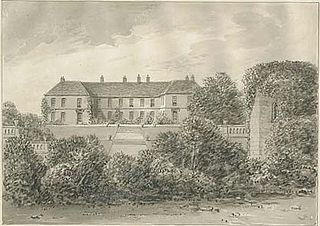
Eccleshall Castle is located in Eccleshall, Staffordshire, England. It was originally built in the 13th century. It is a Scheduled Ancient Monument and a Grade II* listed building.

The Borough of Stafford is a local government district with borough status in Staffordshire, England. It is named after Stafford, its largest town, which is where the council is based. The borough also includes the towns of Stone and Eccleshall, as well as numerous villages and surrounding rural areas.

Eccleshall is a town and civil parish in the Stafford district, in the county of Staffordshire, England. It is located seven miles northwest of Stafford, and six miles west-southwest of Stone. Eccleshall is twinned with Sancerre in France.

Benthall Hall is a 16th-century English country house in Benthall in the town of Broseley, Shropshire, England, and a few miles from the historic Ironbridge Gorge. It retains much of its fine oak interior, and an elaborate 17th-century staircase. It is still occupied by the Benthall family, but has been owned by the National Trust since 1958, and is open to the public every Monday, Tuesday, Wednesday, Saturday, Sunday and Bank Holiday Monday.

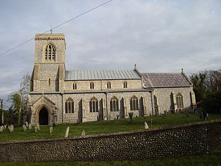
Blickling is a village and civil parish in the Broadland district of Norfolk, England, about 1.5 miles (2.4 km) north-west of Aylsham. In the 2011 census, it had a population of 113 and covered 862 hectares, before dropping to 110 residents as of the 2021 census. Since the 17th century the village has been concentrated in two areas, around the church and also at the park gates of Blickling Hall. Most of the village is contained in the Blickling Estate, which has been owned by the National Trust since 1940.

King's Norton is a village and civil parish in the Harborough district of Leicestershire, England. It is situated to the east of Leicester, and about 2+1⁄2 miles (4 km) south-west from Billesdon. According to the 2001 census the parish had a population of 69. At the 2011 census the population remained less than 100 and is included in the civil parish of Gaulby.

Yarnfield is a village in Staffordshire, England. Population details as taken in the 2011 census can be found under Swynnerton It is considered part of historic Stone, and is near to other historic locations such as Eccleshall and Swynnerton.
Elkington is a civil parish in the East Lindsey district of Lincolnshire, England. It comprises the village of South Elkington, and the hamlets of North Elkington, Boswell, and Thorpe, and is situated approximately 3 miles (5 km) north-west from the market town of Louth.

Langley Chapel is an Anglican church, built in 1601, located in a remote area approximately 1.5 miles to the south of Acton Burnell, Shropshire, England.
Croxton is a village on the B5026 between Eccleshall and Loggerheads. Population details for the 2011 census can be found under Eccleshall. It is notable for having an old windmill. The village church is called St. Pauls.
This is a list of the sheriffs and high sheriffs of Staffordshire.
Chebsey is a small village in Staffordshire 2.5 miles southeast of Eccleshall on a confluence of Eccleshall water and the River Sow some 5 miles northwest of Stafford. The population of the civil parish at the 2011 census was 566. It comprises a number of houses and cottages and a village church dedicated to All Saints.

Aqualate Hall, a 20th-century country house, is located in Forton, Staffordshire, England, some 2 miles (3.2 km) east of the market town of Newport, Shropshire and 10 miles (16 km) west of the county town of Stafford. It is a Grade II* listed building.
Chetwynd Park is an 18th-century landscape garden with woodland, on the edge of Newport, Shropshire.

Forton is a small village and civil parish in Staffordshire, England, situated east of the market town of Newport, Shropshire. The civil Parish population at the 2011 census was 308.

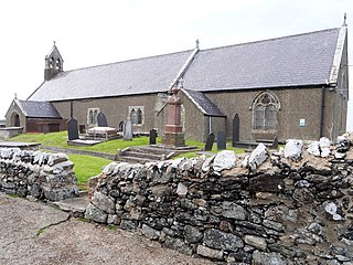
St Peter's Church is a medieval church situated on the western side of the village of Newborough, Anglesey, Wales. The building dates from the early 14th century and underwent restorations in the 19th century. It was designated a Grade II*-listed building on 30 January 1968. It has an interesting history and is the longest church on Anglesey.

Holy Trinity Church in Eccleshall, Staffordshire, England, is a Grade I listed Anglican church.
Forton is a civil parish in the Borough of Stafford, Staffordshire, England. It contains eleven listed buildings that are recorded in the National Heritage List for England. Of these, three are at Grade II*, the middle of the three grades, and the others are at Grade II, the lowest grade. The parish contains the village of Forton and the surrounding area, which includes Aqualate Park. In the park is Aqualate Hall, a country house which is listed, together with other buildings in the park. The other listed buildings are houses, a church, a bridge, and a structure which is either a folly or and ruined windmill.

The Church of St John the Evangelist is a Church of England parish church in Tatworth, Somerset, England. It was built in 1850–51 to the design of Charles Pinch of Bath and is a Grade II listed building.


