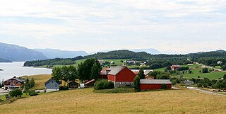
Bjugn is a municipality in Trøndelag county, Norway. It is part of the Fosen region. The village of Botngård is the administrative centre of Bjugn municipality. Other villages in Bjugn include Høybakken, Jøssund, Lysøysundet, Nes, Oksvoll, and Vallersund. Bjugn was on the Robek-list in 2015.

Vaillant Arena is an arena in Davos, Switzerland. It is primarily used for ice hockey and is the home arena of HC Davos. It holds 7,080 people, of which 3,280 are seated. Every year the Spengler Cup is played in this arena.

Vaasa Arena is an arena in Vaasa, Finland. It is primarily used for ice hockey, and is the home arena of Vaasan Sport. It opened in 1971 and holds 4,164 people, but plans are ready to expand the capacity. Some extra seats were installed before the Finnish ice hockey elite league qualification series in spring 2009.

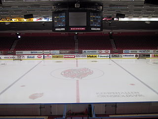
Kempehallen was an indoor sporting arena located in Örnsköldsvik, Sweden, built in 1964. The capacity of the arena was 5,114 during the last years. It was however opened already in 1939 as an outdoor rink, and in 1958 artificial ice was installed. It was later rebuilt into an indoor arena, opened on 4 October 1964, with an original capacity of 10,000. About 2,000 seats were installed in 1969, and the capacity was lowered to 6,700. In 1995 the arena got an overhaul, with a few luxury boxes added among other improvements.
Kvevlax, is a church village in the municipality of Korsholm, Finland. It is located approximately 15 kilometres (9 mi) north of the city of Vaasa. Kvevlax became an independent parish in 1857. Until 1 January 1973 it was an independent municipality. Kvevlax has a lower grade primary education school, a kindergarten, a running track and an ice rink. There are two local grocery shops, a library and a bank.

Eis Arena Wolfsburg is an arena in Wolfsburg, Germany. It is primarily used for the ice hockey club EHC Wolfsburg Grizzly Adams. Eisarena Wolfsburg opened in 2006 and holds 4,660 people.

Kanda-Surugadai is a district of Chiyoda, Tokyo, Japan. It was named after Tokugawa Ieyasu's death, when the Edo government allowed officials from Sunpu to live in the area. Their postal code is 101-0062. Kanda-Surugadai is often called Surugadai or, colloquially, Sundai.

Bukhar-Zhyrau District is a district of Karaganda Region in central Kazakhstan. The administrative center of the district is the settlement of Botakara. Population: 63,236 ; 64,003 ; 69,617.
Janowo is a village in the administrative district of Gmina Narewka, within Hajnówka County, Podlaskie Voivodeship, in north-eastern Poland, close to the border with Belarus.

Pokrzywna is a village in the administrative district of Gmina Rawa Mazowiecka, within Rawa County, Łódź Voivodeship, in central Poland. It lies approximately 6 kilometres (4 mi) north of Rawa Mazowiecka and 54 km (34 mi) east of the regional capital Łódź.

Grochocice is a village in the administrative district of Gmina Ożarów, within Opatów County, Świętokrzyskie Voivodeship, in south-central Poland. It lies approximately 9 kilometres (6 mi) south of Ożarów, 15 km (9 mi) east of Opatów, and 72 km (45 mi) east of the regional capital Kielce.

Nowa Ruskołęka is a village in the administrative district of Gmina Andrzejewo, within Ostrów Mazowiecka County, Masovian Voivodeship, in east-central Poland. It lies approximately 5 kilometres (3 mi) south-west of Andrzejewo, 17 km (11 mi) east of Ostrów Mazowiecka, and 102 km (63 mi) north-east of Warsaw.

Karolewo is a village in the administrative district of Gmina Rogoźno, within Oborniki County, Greater Poland Voivodeship, in west-central Poland. It lies approximately 9 kilometres (6 mi) north-west of Rogoźno, 20 km (12 mi) north-east of Oborniki, and 46 km (29 mi) north of the regional capital Poznań.

Gierłoż Polska is a village in the administrative district of Gmina Lubawa, within Iława County, Warmian-Masurian Voivodeship, in northern Poland. It lies approximately 14 km (9 mi) east of Iława and 53 km (33 mi) west of the regional capital Olsztyn.

Babigoszcz is a village in the administrative district of Gmina Przybiernów, within Goleniów County, West Pomeranian Voivodeship, in north-western Poland. It lies approximately 9 kilometres (6 mi) south of Przybiernów, 15 km (9 mi) north of Goleniów, and 34 km (21 mi) north-east of the regional capital Szczecin.

Więcław is a village in the administrative district of Gmina Dębno, within Myślibórz County, West Pomeranian Voivodeship, in north-western Poland. It lies approximately 5 kilometres (3 mi) north-east of Dębno, 21 km (13 mi) south-west of Myślibórz, and 74 km (46 mi) south of the regional capital Szczecin.

Lipnica is a village in the municipality of Čačak, Serbia. According to the 2011 census, the village has a population of 556 people.
Koela is a village in Lääne-Nigula Parish, Lääne County, in western Estonia.
Richmond Ice Rink was an ice skating rink at Clevedon Road, Twickenham, formerly in Middlesex and now in the London Borough of Richmond upon Thames. When it opened, in 1928, it had the longest ice surface in any indoor rink in the world and it soon became the premier rink in London. The rink closed in 1992 and the building was demolished.


