
Mackinac Island is an island and resort area, covering 4.35 square miles (11.3 km2) in land area, in the U.S. state of Michigan. The name of the island in Odawa is Michilimackinac and "Mitchimakinak" in Ojibwemowin, meaning "Great Turtle". It is located in Lake Huron, at the eastern end of the Straits of Mackinac, between the state's Upper and Lower Peninsulas. The island was long home to an Odawa settlement and previous indigenous cultures before European colonization began in the 17th century. It was a strategic center of the fur trade around the Great Lakes. Based on a former trading post, Fort Mackinac was constructed on the island by the British during the American Revolutionary War. It was the site of two battles during the War of 1812 before the northern border was settled and the US gained this island in its territory.

Mackinac County is a county in the Upper Peninsula of the U.S. state of Michigan. As of the 2020 census, the population was 10,834. The county seat is St. Ignace. Formerly known as Michilimackinac County, in 1818 it was one of the first counties of the Michigan Territory, as it had long been a center of French and British colonial fur trading, a Catholic church and Protestant mission, and associated settlement.
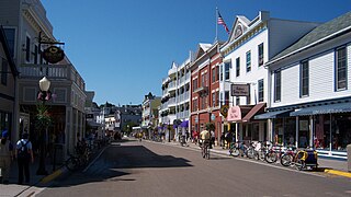
Mackinac Island is a city in Mackinac County in the U.S. state of Michigan. As of the 2020 census, the city had a population of 583.

South Manitou Island is located in Lake Michigan, approximately 16 miles (26 km) west of Leland, Michigan. It is part of Leelanau County and the Sleeping Bear Dunes National Lakeshore. The uninhabited island is 8.277 sq mi (21.44 km2) in land area and can be accessed by a ferry service from Leland. Guided tours on open-air vehicles are available to visitors, but most traffic is on foot. Larger North Manitou Island lies to its north.

Fort Mackinac is a former British and American military outpost garrisoned from the late 18th century to the late 19th century in the city of Mackinac Island, Michigan, on Mackinac Island. The British built the fort during the American Revolutionary War to control the strategic Straits of Mackinac between Lake Michigan and Lake Huron, and by extension the fur trade on the Great Lakes. The British did not relinquish the fort until thirteen years after the end of the American Revolutionary War. Fort Mackinac later became the scene of two strategic battles for control of the Great Lakes during the War of 1812. During most of the 19th century, it served as an outpost of the United States Army. Closed in 1895, the fort has been adapted as a museum on the grounds of Mackinac Island State Park.

Fort Michilimackinac was an 18th-century French, and later British, fort and trading post at the Straits of Mackinac; it was built on the northern tip of the lower peninsula of the present-day state of Michigan in the United States. Built around 1715, and abandoned in 1783, it was located along the Straits, which connect Lake Huron and Lake Michigan of the Great Lakes of North America.

Mackinac Island State Park is a state park located on Mackinac Island in the U.S. state of Michigan. A Lake Huron island, it is near the Straits of Mackinac. The island park encompasses 1,800 acres (7.3 km2), which is approximately 80% of the island's total area. The park is also within the boundaries of the city of Mackinac Island and has permanent residents within its boundaries. M-185 circles the perimeter of the park as the only motorless highway in the state due to the island's ban of automobiles. The park is governed by the Michigan Department of Natural Resources and the Mackinac Island State Park Commission. On July 15, 2009, the park celebrated its 20 millionth visitor.
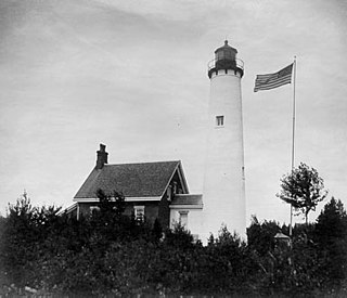
The buildings of the St Helena Light complex are the sole surviving structures on St. Helena Island, in Mackinac County in the U.S. state of Michigan. The lighthouse on the St. Helena Island's southeastern point was built in 1872-1873 and went into operation in September 1873. It became one of a series of lighthouses that guided vessels through the Straits of Mackinac, past a dangerous shoal that extends from the island.

Bewabic State Park is a public recreation area covering 315 acres (127 ha) on the shore of Fortune Lake, four miles (6.4 km) west of Crystal Falls in Iron County, Michigan. The state park's rich Civilian Conservation Corps history is evidenced by the CCC structures still in use. The park was listed on the National Register of Historic Places for its CCC-related architecture in 2016.
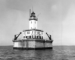
The DeTour Reef Light is a non-profit-operated lighthouse marking the southern entrance of the DeTour Passage between the eastern end of Michigan's Upper Peninsula and Drummond Island. The light is an automated active aid to navigation. It marks the northern end of Lake Huron. The passage is used by almost all of the Great Lakes commercial freighter traffic moving to and from Lake Superior, with approximately 5,000 vessel movements annually. It is said to be "the gateway to Lake Superior." In addition, many recreational boaters use the passage. The Light is located in Lake Huron, three miles (5 km) south of the nearest town, DeTour Village, Michigan.

Old Mackinac Point Light is a deactivated lighthouse located at the northern tip of the Lower Peninsula in the U.S. state of Michigan. The lighthouse is part of Fort Michilimackinac State Park in the village of Mackinaw City just east of the Mackinac Bridge.
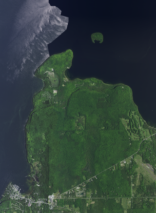
Peninsula State Park is a 3,776-acre (1,528 ha) Wisconsin state park with eight miles (13 km) of Green Bay shoreline in Door County. Peninsula is the third largest state park in Wisconsin and is visited by an estimated one million visitors annually.

The Mission House, on Mackinac Island, is a historic structure owned by the state of Michigan. Built in 1825, it is listed on the National Register of Historic Places and is operated as part of the Mackinac Island State Park. The Mission House is a wood-frame structure covered in clapboard siding and constructed in a U shape. The center section is three stories, and the flanking wings are two stories. The front facade has a single-story porch covering the entrance in the center.

For the lighthouse of the same name in the St. Mary's River, see Round Island Light
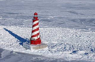
The White Shoal Light is a lighthouse located 20 miles (32 km) west of the Mackinac Bridge in Lake Michigan. It is an active aid to navigation. It is also the tallest lighthouse on the Great Lakes.

Bluff Point Light, also known as the Valcour Island Light, on Valcour Island in Lake Champlain was in service from its construction in 1874 until 1930 and was one of the last lighthouses on Lake Champlain to be named. It is now part of Adirondack State Park and operated as a museum by the Clinton County Historical Association, an affiliate of the Adirondack Coast Cultural Alliance (ACCA).

Spectacle Reef Light is a lighthouse 11 miles (18 km) east of the Straits of Mackinac and is located at the northern end of Lake Huron, Michigan. It was designed and built by Colonel Orlando Metcalfe Poe and Major Godfrey Weitzel, and was the most expensive lighthouse ever built on the Great Lakes.

Round Island Passage Light is an automated, unmanned lighthouse located in the Round Island Channel in the Straits of Mackinac, Michigan. The channel is a branch of Lake Huron.

The Wawashkamo Golf Club is a nine-hole links golf course on Mackinac Island in the U.S. state of Michigan. The course was laid out by Alex Smith in 1898. The golf course retains many of the features of a nineteenth-century golf links, including a relatively treeless layout, comparatively short holes, and very long rough. Smith, a native Scotsman from Carnoustie, was familiar with the links courses of his boyhood home.

The Robert Stuart House, also known as the Agent's House or Agency House, is a building located at 34 Market Street on Mackinac Island, Michigan. It was listed on the National Register of Historic Places in 1971 and designated a Michigan State Historic Site in 1965.


