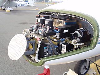
Avionics are the electronic systems used on aircraft. Avionic systems include communications, navigation, the display and management of multiple systems, and the hundreds of systems that are fitted to aircraft to perform individual functions. These can be as simple as a searchlight for a police helicopter or as complicated as the tactical system for an airborne early warning platform.

In aviation, instrument flight rules (IFR) is one of two sets of regulations governing all aspects of civil aviation aircraft operations; the other is visual flight rules (VFR).
In aviation, visual flight rules (VFR) are a set of regulations under which a pilot operates an aircraft in weather conditions generally clear enough to allow the pilot to see where the aircraft is going. Specifically, the weather must be better than basic VFR weather minima, i.e., in visual meteorological conditions (VMC), as specified in the rules of the relevant aviation authority. The pilot must be able to operate the aircraft with visual reference to the ground, and by visually avoiding obstructions and other aircraft.

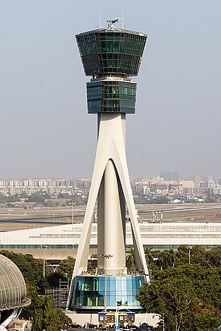
Air traffic control (ATC) is a service provided by ground-based air traffic controllers (people) who direct aircraft on the ground and through a given section of controlled airspace, and can provide advisory services to aircraft in non-controlled airspace. The primary purpose of ATC worldwide is to prevent collisions, organise and expedite the flow of traffic in the air, and provide information and other support for pilots.

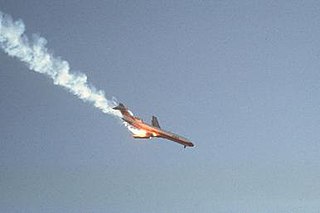
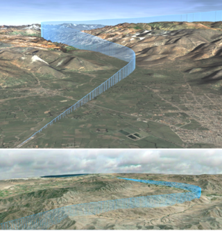
Pacific Southwest Airlines Flight 182 was a scheduled flight on September 25, 1978, by Pacific Southwest Airlines (PSA), from Sacramento to San Diego (SAN), with a stopover at Los Angeles (LAX). The aircraft serving the flight, a Boeing 727-214, collided mid-air with a private Cessna 172 over San Diego, California. It was Pacific Southwest Airlines' first fatal accident, and it remains the deadliest air disaster in California history. At the time, it was the deadliest air crash to occur in the United States, and remained so until the crash of American Airlines Flight 191 in May 1979.

The Irish Aviation Authority (IAA) is a commercial semi-state company in Ireland responsible for the regulation of safety aspects of air travel. Its head office is in The Times Building in Dublin.

A traffic alert and collision avoidance system is an aircraft collision avoidance system designed to reduce the incidence of mid-air collision (MAC) between aircraft. It monitors the airspace around an aircraft for other aircraft equipped with a corresponding active transponder, independent of air traffic control, and warns pilots of the presence of other transponder-equipped aircraft which may present a threat of MAC. It is a type of airborne collision avoidance system mandated by the International Civil Aviation Organization to be fitted to all aircraft with a maximum take-off mass (MTOM) of over 5,700 kg (12,600 lb) or authorized to carry more than 19 passengers. CFR 14, Ch I, part 135 requires that TCAS I be installed for aircraft with 10-30 passengers and TCAS II for aircraft with more than 30 passengers. ACAS/TCAS is based on secondary surveillance radar (SSR) transponder signals, but operates independently of ground-based equipment to provide advice to the pilot on potentially conflicting aircraft.
The world's navigable airspace is divided into three-dimensional segments, each of which is assigned to a specific class. Most nations adhere to the classification specified by the International Civil Aviation Organization (ICAO) and described below, though they might use only some of the classes defined below, and significantly alter the exact rules and requirements. Similarly, individual nations may also designate special use airspace (SUA) with further rules for reasons of national security or safety.

Required navigation performance (RNP) is a type of performance-based navigation (PBN) that allows an aircraft to fly a specific path between two 3D-defined points in space.
The Future Air Navigation System (FANS) is an avionics system which provides direct data link communication between the pilot and the air traffic controller. The communications include air traffic control clearances, pilot requests and position reporting. In the FANS-B equipped Airbus A320 family aircraft, an Air Traffic Services Unit (ATSU) and a VHF Data Link radio (VDR3) in the avionics rack and two data link control and display units (DCDUs) in the cockpit enable the flight crew to read and answer the controller–pilot data link communications (CPDLC) messages received from the ground.
Controller–pilot data link communications (CPDLC), also referred to as controller pilot data link (CPDL), is a method by which air traffic controllers can communicate with pilots over a datalink system.
The Next Generation Air Transportation System (NextGen) is an ongoing United States Federal Aviation Administration (FAA) project to modernize the National Airspace System (NAS). The FAA began work on NextGen improvements in 2007 and plans to finish the final implementation segment by 2030. The goals of the modernization include using new technologies and procedures to increase the safety, efficiency, capacity, access, flexibility, predictability, and resilience of the NAS while reducing the environmental impact of aviation.

The Grand Canyon mid-air collision occurred in the western United States on June 30, 1956, when a United Airlines Douglas DC-7 struck a Trans World Airlines Lockheed L-1049 Super Constellation over Grand Canyon National Park, Arizona. The first plane fell into the canyon while the other slammed into a rock face. All 128 on board both airplanes perished, making it the first commercial airline incident to exceed one hundred fatalities. The airplanes had departed Los Angeles International Airport minutes apart from each other and headed for Chicago and Kansas City, respectively. The collision took place in uncontrolled airspace, where it was the pilots' responsibility to maintain separation. This highlighted the antiquated state of air traffic control, which became the focus of major aviation reforms.
The National Airspace System (NAS) is the airspace, navigation facilities and airports of the United States along with their associated information, services, rules, regulations, policies, procedures, personnel and equipment. It includes components shared jointly with the military. It is one of the most complex aviation systems in the world, and services air travel in the United States and over large portions of the world's oceans.

The Air Traffic Organization (ATO) is an air navigation service provider in the United States of America. The ATO is the operational division of the Federal Aviation Administration (FAA).

Automatic Dependent Surveillance–Broadcast (ADS-B) is an aviation surveillance technology and form of electronic conspicuity in which an aircraft determines its position via satellite navigation or other sensors and periodically broadcasts its position and other related data, enabling it to be tracked. The information can be received by air traffic control ground-based or satellite-based receivers as a replacement for secondary surveillance radar (SSR). Unlike SSR, ADS-B does not require an interrogation signal from the ground or from other aircraft to activate its transmissions. ADS-B can also receive point-to-point by other nearby equipped "ADS-B In" equipped aircraft to provide traffic situational awareness and support self-separation. ADS-B is "automatic" in that it requires no pilot or external input to trigger its transmissions. It is "dependent" in that it depends on data from the aircraft's navigation system to provide the transmitted data.
Single European Sky ATM Research (SESAR) is a collaborative project to completely overhaul European airspace and its air traffic management (ATM). The actual program is managed by the SESAR Joint Undertaking as a public–private partnership (PPP).
The Polish Air Navigation Services Agency (PANSA) started its duty in 2007 as an independent unit, after isolating from "Polish Airports". It is running as a state agency which deals with air traffic management (ATM). PANSA's main obligations and objects are:
Next Generation (NextGen) Data Communications, an element of the Next Generation Air Transportation System, will significantly reduce controller-to-pilot communications and controller workload, whilst improving safety. NextGen comprises complex integrated and interlinked programs, portfolios, systems, policies, and procedures. NextGen has modernized air traffic infrastructure in communications, navigation, surveillance, automation, and information management.
Aircraft self-separation is the capability of an aircraft maintaining acceptably safe separation from other aircraft without following instructions or guidance from a referee agent for this purpose, such as air traffic control. In its simplest forms, it can be described by the concept of see and avoid, in the case of human-piloted aircraft, or sense and avoid, in the case of non-human piloted aircraft. However, because of several factors such as weather, instrument flight rules and air traffic complexity, the self-separation capability involves other elements and aspects such as rules of the air, communication technologies and protocols, air traffic management and others.


