
Waseca County is a county in the U.S. state of Minnesota. As of the 2010 United States Census, the population was 19,136. Its county seat is Waseca.

Steele County is a county in the U.S. state of Minnesota. As of the 2010 United States Census, the population was 36,576. Its county seat is Owatonna.

Freeborn County is a county in the state of Minnesota. As of the 2010 United States Census, the population was 31,255. Its county seat is Albert Lea.

Faribault County is a county in the U.S. state of Minnesota. As of the 2010 United States Census, the population was 14,553. Its county seat is Blue Earth.

Crow Wing County is a county in the East Central part of the U.S. state of Minnesota. As of the 2010 United States Census, the population was 62,500. Its county seat is Brainerd. The county was formed in 1857, and was organized in 1870.

London is an unincorporated community in London Township, Freeborn County, Minnesota, United States. It is along County Road 34, 903rd Avenue near 120th Street.

Lake Louise State Park is a Minnesota state park just north of the Iowa border near the small town of Le Roy in Mower County, Minnesota, directly south of Rochester. It has a 25 acre man-made lake and 1,168 acres (5 km2) of mixed prairie and deciduous forest. It is used for picnics, swimming, camping, hiking, horseback riding, and other outdoor recreation. It is noted for butterfly watching, as some rare species have been seen. It features a picnic shelter which dates to the Public Works Administration era.
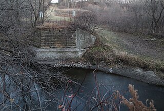
The Shell Rock River is a 113-mile-long (182 km) tributary of the West Fork Cedar River in southern Minnesota and northern Iowa in the United States. Via the Cedar and Iowa rivers, it is part of the Mississippi River watershed.
The Cobb River and its tributary the Little Cobb River are small rivers in southern Minnesota in the United States. The Cobb River is a 78.6-mile-long (126.5 km) tributary of the Le Sueur River. Via the Le Sueur, Blue Earth and Minnesota rivers, it is part of the watershed of the Mississippi River.
Bachelor Lake is a lake in Brown County, Minnesota in the northeastern part of Stark township. Covering 79.80 acres, it is an officially protected water of the State of Minnesota. The lake is within the Cottonwood River Major Watershed. The lake’s elevation is 1,004 feet (306 m), and it is zoned as a shoreland area which is regulated as a shoreland management water.
Crystal Lake is a lake located in Lida Township in Otter Tail County, Minnesota, USA.

Minnesota is the northernmost state outside Alaska; its isolated Northwest Angle in Lake of the Woods is the only part of the 48 contiguous states lying north of the 49th parallel. Minnesota is in the U.S. region known as the Upper Midwest. The state shares a Lake Superior water border with Michigan and Wisconsin on the northeast; the remainder of the eastern border is with Wisconsin. Iowa is to the south, North Dakota and South Dakota are west, and the Canadian provinces of Ontario and Manitoba are north. With 87,014 square miles (225,370 km2), or approximately 2.26 % of the United States, Minnesota is the 12th largest state.

Wisconsin is a state in the Midwestern United States. It has a vast and diverse geography famous for its landforms caused by glaciers during the ice age 17 thousand years ago. The southwestern part of the state is called the Driftless Area, as it was not covered by glaciers during the most recent ice age, the Wisconsin Glaciation. This is responsible for the formation of the Wisconsin Dells, Devil's Lake, and the Baraboo Range.

Wakonda State Park is a public recreation area covering 1,054 acres (427 ha) near La Grange in Lewis County, Missouri. The state park features water recreation on six small lakes.

Maple Island is an unincorporated community in Freeborn County, Minnesota, United States. It is located within Newry Township and Moscow Township.
Ross Lake is a lake in Crow Wing County, in the U.S. state of Minnesota, covering 491 acres.
Armstrong is an unincorporated community in Freeborn County, in the U.S. state of Minnesota.
Gordonsville is an unincorporated community in Shell Rock Township, Freeborn County, Minnesota, United States. It is southeast of Albert Lea, along U.S. Highway 65.
Pickerel Lake is a lake in Freeborn County, in the U.S. state of Minnesota.
Anchor Lake is a lake in St. Louis County, in the U.S. state of Minnesota. It is approximately 2 miles north of Central Lakes alongside U.S. Route 53. The 216-acre Anchor Lake Wildlife Management Area is located along the southern and eastern shores of the lake.
