Human interaction
Parts of Freshwater Bay are designated ski areas. Due to Point Walter's spit and the high surrounding limestone cliffs, the bay has relatively calm waters and is protected from winds, making the area suited for jet skiing, rowing, sailing and other water recreations.
Royal Freshwater Bay Yacht Club [3] and Claremont Yacht Club are situated in the bay, both of which provide recreational boat mooring space and other club facilities as well as conducting races.
Christ Church Grammar School and Methodist Ladies' College are also situated atop the limestone cliffs along the northern section of the bay, often using it for rowing training and also kayaking for physical education classes.

The Swan River is a major river in the southwest of Western Australia. The river runs through the metropolitan area of Perth, Western Australia's capital and largest city.
Claremont is a western suburb of Perth, Western Australia, on the north bank of the Swan River.

Peppermint Grove is an affluent western suburb of Perth, Western Australia on the north bank of the Swan River at Freshwater Bay. Its local government area, the smallest in the country, is the Shire of Peppermint Grove. The suburb was named after the Swan River peppermint trees lining many streets. The suburb has long been associated with Western Australia's wealthiest and oldest families. Their prosperity is reflected in the many historical houses in the area, such as The Cliffe and the Federation Queen Anne style St Just. Colin Barnett, a former Premier of Western Australia, dubbed the suburb "Monaco of WA" due to its small size and concentration of wealth. It is also known as millionaire’s row and had the highest income of any suburb in Australia in 2022.

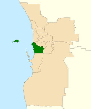
The Division of Curtin is an Australian electoral division in Western Australia.
The Division of Fremantle is an electoral division of the Australian House of Representatives in Western Australia.

Bicton is an affluent riverside suburb of Perth, Western Australia, located 10 kilometres (6.2 mi) south-west of the central business district. The suburb is mostly residential, and falls within the City of Melville local government area. Bicton borders the Swan River to the north, with the northern third of the suburb taken up by a Class-A reserve at Point Walter.
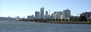
Perth Water is a section of the Swan River on the southern edge of the central business district of Perth, Western Australia. It is between the Causeway to the east, and Narrows Bridge to the west – a large wide but shallow section of river, and the northern edge of the suburb South Perth. It is considered a landmark of the City of Perth.

Applecross is an affluent riverside suburb of Perth, Western Australia, bounded by Canning Highway and the Swan River. It is located within the City of Melville.

Stirling Highway is, for most of its length, a four-lane single carriageway and major arterial road between Perth, Western Australia and the port city of Fremantle in Western Australia on the northern side of the Swan River. The speed limit is 60 km/h (37 mph). East of Crawley, it continues as Mounts Bay Road which links Crawley and the nearby University of Western Australia to the Perth central business district.

Matilda Bay or Crawley Bay is a natural bay in the Swan River in Western Australia, adjacent to the Perth suburb of Crawley. It extends from Pelican Point to Mounts Bay Road below Kings Park.

Point Walter is a point on the Swan River, Western Australia, notable for its large sandbar that extends into the river. It is located on the southern shore of Melville Water, and forms its western end. Point Walter is located in the suburb of Bicton, approximately 12 kilometres (7 mi) southwest of the Perth central business district, and 7 kilometres (4 mi) north-east of Fremantle, and is on the opposite side of the river to the suburbs of Mosman Park, Peppermint Grove, and Dalkeith.

The Royal Perth Yacht Club (RPYC) is a yacht club in Perth, Western Australia. It is the third oldest yacht club in Australia after the Royal Yacht Club of Victoria and the Royal Sydney Yacht Squadron. It is based at the Crawley Marina on Pelican Point and at the Fremantle Annexe in Challenger Harbour.

Barrack Square is an open public square on the foreshore of Perth Water on the Swan River, located at the southern end of Barrack Street near the central business district of Perth, Western Australia.

Blackwall Reach is a section of the Swan River in Western Australia.
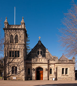
The Royal Freshwater Bay Yacht Club is a yacht club situated in Freshwater Bay on the Swan River in Peppermint Grove, a suburb of Perth, Western Australia.

The Albion Hotel on Stirling Highway in Cottesloe, Western Australia is a historical building, trading as a hotel since 1870.

Riverside Drive in Perth, Western Australia, is a road on the northern side of Perth Water. It was built on reclaimed land in the 1930s, and links The Causeway to the Narrows Bridge.
Sir James Mitchell Park is a park along the southern foreshore of Perth Water in Perth, Western Australia. It lies within the suburb of South Perth from Mends Street Jetty, to just south of Heirisson Island.
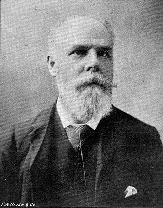
Edward Vivian Harvey Keane was an Australian engineer, businessman, and politician. Born in Birkenhead, England, he was educated at Christ's Hospital, and emigrated to Melbourne, Victoria, in 1876. Keane then moved to South Australia, where he worked as a railway engineer. He later moved to Western Australia, where he served in both the Legislative Assembly and the Legislative Council.

The western suburbs are an informally defined group of suburbs of Perth, Western Australia, located west of the city's central business district and north of the Swan River. The western suburbs are well known for high incomes, high house prices, riverfront mansions, private schools and proximity to ocean beaches.
