
The province of Brescia is a province in the Lombardy region of Italy. It has a population of some 1,265,964 and its capital is the city of Brescia.

The province of Mantua is a province in the Lombardy region of Italy. Its capital is the city of Mantua. It is bordered to the north-east by the province of Verona, to the east by the province of Rovigo, to the south by the province of Ferrara, province of Modena, province of Reggio Emilia and province of Parma, to the west by the province of Cremona, and to the north-west by the province of Brescia.
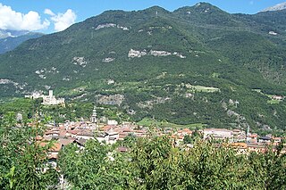
Breno is an Italian comune of 4,986 inhabitants in Val Camonica, province of Brescia, in Lombardy.
Corte de' Frati is a municipality (comune) in the province of Cremona, in the Lombardy Italian region.

Pisogne is a comune of 8156 inhabitants in the province of Brescia, in Lombardy, Italy. It is located about 30 kilometers (19 mi) northwest of Brescia, 51 kilometers northeast of Bergamo, and 97 kilometers northeast of Milan.

Lake Iseo or Iseo lake, also known as Sebino, is the fourth largest lake in Lombardy, Italy, fed by the Oglio River.

Ponte di Legno is an Italian comune of 1,729 inhabitants in Val Camonica, province of Brescia, in Lombardy.

Pontevico is a comune in the province of Brescia in Lombardy. It is on the left bank of the river Oglio. As of 2021 Pontevico had a population of 7,038.
Quinzano d'Oglio is a comune in the province of Brescia, in Lombardy, northern Italy. The river Oglio runs across its territory, separating Quinzano from the province of Cremona.

Temù is an Italian comune of 1,113 inhabitants in the province of Brescia, in Lombardy, Italy.

Vezza d'Oglio is a comune in the province of Brescia, in Lombardy, northern Italy. It is located in the upper Camonica Valley.

Val Camonica or Valcamonica, also Valle Camonica and anglicized as Camonica Valley, is one of the largest valleys of the central Alps, in eastern Lombardy, Italy. It extends about 90 kilometres (56 mi) from the Tonale Pass to Corna Trentapassi, in the commune of Pisogne near Lake Iseo. It has an area of about 1,335 km2 (515 sq mi) and 118,323 inhabitants. The River Oglio runs through its full length, rising at Ponte di Legno and flowing into Lake Iseo between Pisogne and Costa Volpino.

The Oglio is a left-side tributary of the river Po in Lombardy, Italy. It is 280 kilometres (170 mi) long. In the hierarchy of the Po's tributaries, with its 280 kilometres (170 mi) of length, it occupies the 2nd place per length, while it is the 4th per basin surface, and the 3rd per average discharge at the mouth.

Gazoldo degli Ippoliti is a comune (municipality) in the Province of Mantua in the Italian region Lombardy, located about 110 kilometres (68 mi) east of Milan and about 15 kilometres (9 mi) west of Mantua.

Viadana is a comune (municipality) in the Province of Mantua in the Italian region Lombardy, located about 120 kilometres (75 mi) southeast of Milan and about 35 kilometres (22 mi) southwest of Mantua.

The Chiese, also known in the Province of Brescia as the Clisi, is a 160-kilometre (99 mi) Italian river that is the principal immisary and sole emissary of the sub-alpine lake Lago d’Idro, and is a left tributary of the Oglio.
Cemmo, is a frazione of Capo di Ponte, located right of river Oglio, beneath the Concarena.

Monastero di San Salvatore is located on the left bank of the Oglio river, in the municipality of Capo di Ponte in Val Camonica, Italy. Established at the end of the 11th century, it was the first and only Cluniac priory in Val Camonica. The monastery is an important example of early medieval Romanesque architecture.

Upper Mantua is a geographical area located northwest of the city of Mantua in the province of the same name and bordering the provinces of Brescia and Verona, bordered to the north by the morainic hills of Lake Garda, to the east by the province of Verona, to the northwest by the province of Brescia, and to the south by the plains of Middle Mantua.

