
Fulton County is a county located in the U.S. state of Ohio west of Toledo. As of the 2020 census, the population was 42,713. Its county seat and largest city is Wauseon. The county was created in 1850 with land from Henry, Lucas, and Williams counties and is named for Robert Fulton, inventor of the steamboat. Fulton County is a part of the Toledo metropolitan area.

The Ottawa River, also known as Ottawa Creek, is a short river, approximately 20 miles (32 km) long, in northwest Ohio and southeast Michigan in the United States. It drains an area on the Ohio-Michigan border along the eastern and northern fringes of the city of Toledo, goes through Ottawa Hills, and empties directly into Lake Erie. It is one of two rivers in northwestern Ohio that share the same name, along with the Ottawa River that is a tributary of the Auglaize River. The upper 4 miles (6 km) of the river in Michigan north of Sylvania, Ohio is called North Tenmile Creek on federal maps, while another branch rising in Fulton County, Ohio, is called Tenmile Creek.

The Toledo Metropolitan Area, or Greater Toledo, or Northwest Ohio is a metropolitan area centered on the American city of Toledo, Ohio. As of the 2020 census, the four-county Metropolitan Statistical Area (MSA) had a population of 646,604. It is the sixth-largest metropolitan area in the state of Ohio, behind Cincinnati–Northern Kentucky, Cleveland, Columbus, Dayton, and Akron.
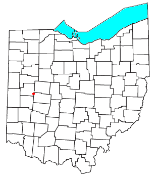
Springhills is an unincorporated community in northwestern Harrison Township, Champaign County, Ohio, United States. It lies at the intersection of State Route 245 with Crowl and Springhill-DeGraff Roads. Graves Creek, a subsidiary of the Great Miami River through Stony Creek, runs along the western edge of Springhills. It is located 6 miles (9.5 km) west of West Liberty and 11.5 miles (18.5 km) northwest of Urbana, the county seat of Champaign County.

Brokensword is an unincorporated community on the border between the Holmes and Lykens townships of Crawford County, Ohio, United States. Located at the intersection of the concurrent State Routes 19 and 100 with Brokensword Road, it is six miles north and two miles west of the city of Bucyrus, the county seat. Broken Sword Creek flows a short distance to the south of the community.

Bridgeport is an unincorporated community in far western Darby Township, Union County, Ohio, United States. It lies at the intersection of State Route 38 with Orchard Road, midway between the villages of Milford Center and Unionville Center. At Bridgeport, Buck Run meets the Big Darby Creek, which meets the Scioto River at Circleville. It is located 6 miles (9.7 km) south of Marysville, the county seat of Union County.
Tawawa is an unincorporated community in northeastern Green Township, Shelby County, Ohio, United States. It lies along State Route 29 less than one mile away from the Champaign County border. Mosquito Creek, a tributary of the Great Miami River, flows northwestward along the southern edge of Tawawa. The community lies 8 miles southeast of the city of Sidney, the county seat of Shelby County.

Wakarusa Township is a township in Douglas County, Kansas, United States. As of the 2010 census, its population was 2,318. It was named for the Wakarusa River which flows through Douglas County from Wabaunsee County to the Kansas River near Eudora.
The Wrede Range is a small subrange of the Swannell Ranges of the Omineca Mountains, located between Ingenika River and Wrede Creek in northern British Columbia, Canada.
Tymochtee is an unincorporated community in Wyandot County, in the U.S. state of Ohio.

The South Toe River is a river in Yancey County in Western North Carolina. The name Toe is taken from its original name Estatoe, pronounced 'S - ta - toe', a native American name associated with the Estatoe trade route leading down from the NC mountains through Brevard where there is a historical plaque with information that affirms the route, on into South Carolina where a village of the same name was located.

Maysville is an unincorporated community in Allen and Hardin counties, in the U.S. state of Ohio.

Silver Creek is an unincorporated community in Hardin County, in the U.S. state of Ohio.
Kingscreek is an unincorporated community in Champaign County, in the U.S. state of Ohio.
Cones Mills is a ghost town in Delaware County, in the U.S. state of Ohio. It was located in Thompson Township.

Inlet is an unincorporated community in Fulton County, in the U.S. state of Ohio.

Lytton is an unincorporated community in Fulton County, in the U.S. state of Ohio.
Swago Creek is a stream in the U.S. state of West Virginia.
Ceylon is an unincorporated community in Erie County, in the U.S. state of Ohio.
Sinkin is an extinct town in northern Shannon County, in the U.S. state of Missouri. The community was located on a sharp meander in Sinking Creek at an area known as The Sinks where the stream goes underground for a short distance.
