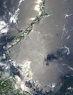
The Sulu Sea is a body of water in the southwestern area of the Philippines, separated from the South China Sea in the northwest by Palawan and from the Celebes Sea in the southeast by the Sulu Archipelago. Borneo is found to the southwest and Visayas to the northeast.
New Edubiase is a small town and is the capital of Adansi South, a district in the Ashanti Region of Ghana. it was formerly called the Adansi East district in the Ashanti Region. It shares boundaries on the north with Adansi North and the northeast with the Amansie East District and on the east side shares boundary with Birim East in the Eastern Region, share boundary with Obuasi Municipal from the west and the south with Assin North in the Central Region.
Azam Basti is a neighborhood in Karachi East district of Karachi, Pakistan. It was previously administered as part of Jamshed Town, which was disbanded in 2011.
Adilcevaz is a town and district capital of the same-named district within Bitlis Province of Turkey. The city is on the shore of Lake Van. The mayor is Necati Gürsoy from the AKP.

This is a list of the extreme points of Azerbaijan, the points that are farther north, south, east or west than any other location.

Sunamganj Sadar is an upazila of Sunamganj District in the Division of Sylhet, Bangladesh.
Anhalt-Bitterfeld is a district in Saxony-Anhalt, Germany. Its capital is Köthen (Anhalt).
Gorslas is a village and a community in Carmarthenshire, Wales, located on the A476 road northwest of Cross Hands. The village population at the 2011 census was 4,066. Neighbouring villages are Cefneithin and Penygroes. The community is bordered by the Carmarthenshire communities of Llanarthney, Llanfihangel Aberbythych, Llandybie, Llannon, Pontyberem, and Llanddarog. The community includes the settlements of Drefach, Cwmmawr, Foelgastell, and Cefneithin.

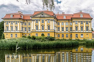
Radomierzyce is a village in the administrative district of Gmina Zgorzelec, within Zgorzelec County, Lower Silesian Voivodeship, in south-western Poland, close to the German border. It is located in the historical region of Lusatia.

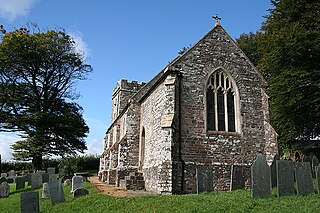
Twitchen is a village and civil parish in Devon, England, located within the North Devon local authority area. Historically it formed part of South Molton Hundred. The population was 145 in 1801; 163 in 1901 and 70 in 2001. Twitchen is recorded in the Domesday Book as being part of the manor of Alvred D'Epaignes having been held by freely by Beorhtweald in the time of King Edward, before the Norman conquest in 1066.
Polowa is a village in the administrative district of Gmina Szczerców, within Bełchatów County, Łódź Voivodeship, in central Poland. It lies approximately 4 kilometres (2 mi) south-west of Szczerców, 22 km (14 mi) west of Bełchatów, and 59 km (37 mi) south-west of the regional capital Łódź.
Brenica is a village in the administrative district of Gmina Lubochnia, within Tomaszów Mazowiecki County, Łódź Voivodeship, in central Poland. It lies approximately 4 kilometres (2 mi) north of Lubochnia, 14 km (9 mi) north of Tomaszów Mazowiecki, and 45 km (28 mi) east of the regional capital Łódź.
Turzec is a village in the administrative district of Gmina Stoczek Łukowski, within Łuków County, Lublin Voivodeship, in eastern Poland. It lies approximately 9 kilometres (6 mi) south-east of Stoczek Łukowski, 22 km (14 mi) west of Łuków, and 82 km (51 mi) north-west of the regional capital Lublin.
Łopoczno is a village in the administrative district of Gmina Józefów nad Wisłą, within Opole Lubelskie County, Lublin Voivodeship, in eastern Poland. It lies approximately 14 kilometres (9 mi) south-west of Opole Lubelskie and 56 km (35 mi) west of the regional capital Lublin.
Opoka is a village in the administrative district of Gmina Końskowola, within Puławy County, Lublin Voivodeship, in eastern Poland. It lies approximately 3 kilometres (2 mi) south-east of Końskowola, 8 km (5 mi) east of Puławy, and 39 km (24 mi) north-west of the regional capital Lublin.
Palczew is a village in the administrative district of Gmina Warka, within Grójec County, Masovian Voivodeship, in east-central Poland. It lies approximately 12 kilometres (7 mi) south-west of Warka, 22 km (14 mi) south-east of Grójec, and 56 km (35 mi) south of Warsaw.
Bolkowo is a village in the administrative district of Gmina Połczyn-Zdrój, within Świdwin County, West Pomeranian Voivodeship, in north-western Poland. It lies approximately 10 kilometres (6 mi) north of Połczyn-Zdrój, 22 km (14 mi) east of Świdwin, and 110 km (68 mi) north-east of the regional capital Szczecin.
Pootsiku is a village in Alutaguse Parish, Ida-Viru County in northeastern Estonia.


