
The Eastern Berber languages are a group of Berber languages spoken in Libya and Egypt. They include Awjila, Sokna and Fezzan (El-Fogaha), Siwi and Ghadamès, though it is not clear that they form a valid genealogical group.

In Libya there are currently 106 districts, second level administrative subdivisions known in Arabic as baladiyat. The number has varied since 2013 between 99 and 108. The first level administrative divisions in Libya are currently the governorates (muhafazat), which have yet to be formally delineated, but which were originally tripartite as: Tripolitania in the northwest, Cyrenaica in the east, and Fezzan in the southwest; and later divided into ten governorates.

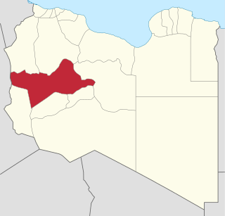
Murzuq is one of the districts of Libya. It is in the south of the country. Its capital is Murzuk. The city was occupied by the Ottoman Empire in 1578 and served as the capital of Fezzan off and on until the Ottomans ceded Libya to Italy in 1912. It was not occupied by the Italians until 1914.

Sabha is one of the districts of Libya, situated near the center of the country in the Fezzan region. The city of Sabha serves as its capital. The district shares borders with the following districts: Wadi Al Shatii to the north, Al Jufrah to the east, Murzuq to the south, and Wadi Al Hayaa to the west.

Murzuk, Murzuq, Murzug or Merzug is an oasis town and the capital of the Murzuq District in the Fezzan region of southwest Libya. It lies on the northern edge of the Murzuq Desert, an extremely arid region of ergs or great sand dunes which is part of the greater Sahara Desert.

In archaeology, a cleaver is a type of biface stone tool of the Lower Palaeolithic.

Wadi al Hayaa is one of the districts of Libya. Its capital is the city of Ubari. As of 2006, it had a population of 72,587, area of 31,890 square kilometres (12,310 sq mi) and a population density of 2.28 persons per square kilometer.
Wadi al Shati, sometimes referred to as Ashati, is one of the districts of Libya in the central-west part of the country. The area is mostly desert. Wadi al Shati District is named after the depression of the same name, Wadi Ashati.
Tmassa is a small town in the Sahara Desert of central Libya about 482 kilometres (300 mi) from the Gulf of Sidra. It lies about 161 kilometres (100 mi) south-east of Sabha. Its population is 500.
The Elephant Field is an oil field located in onshore in Libya's Murzuq Basin.

Qatrun, Al Katrun, Gatrone, or Al Gatrun is a village in the Murzuq District in southern Libya on the main road to Chad and Niger. It has a filling station and a Niger consulate office is located there. When the border checkpoint 310 kilometres south at Tumu is closed, travelers crossing into Libya from Niger report in at Qatrun.

The Murzuq Desert, Idehan Murzuq, Idhan Murzuq,, is an erg in southwestern Libya with a surface of approximately 58,000 km2. It is named after the town of Murzuk in the Fezzan. Like the Idehan Ubari further north, the Idehan Murzuq is part of the greater Sahara Desert region. It is separated from the southern Sahara Desert by the Tibesti Mountains and the Tassili n'Ajjer.
Tajarhi, Tegerhi or Tajirhi is an oasis and crossroads village in the Murzuq District of Libya. It lies in the Sahara Desert and is the last refueling point in Libya before reaching Madama, the first station in Niger, some 282 kilometers to the south, or 361 km by track. Tajarhi has an airstrip (HL-57) south of town.
Sebha University is a public university in the southern city of Sabha, Libya, with campuses in Sabha, Awbari, Murzuq, Brak, and Ghat.
Zizau or Zezow is a village in the Murzuk Desert in Murzuq District in southwest Libya. It is located east of Murzuk and just to the southwest of Funqul. A good high road is said to connect Zizau to Traghan, with frequent incrustations of salt. The village was visited by western explorers in the early 1820s who described it at the time as having "merely a few huts".
Traghan or Traghen is a small town in the Murzuk Desert in Murzuq District in southwest Libya. It is located east of Murzuk and Zizau. A good high road is said to link Traghan to Zizau in the west, with frequent incrustations of salt.
The El Sharara oil field is an oil field located in Murzuq Desert in Libya. It was discovered in 1980 and developed by Petrom. The oil field is operated and owned by Repsol. The total proven reserves of the El Sharara oil field are 3 billion barrels (403×106tonnes), and production is centered on 300,000 barrels per day (48,000 m3/d).

In late January 2019, the Libyan National Army (LNA) led by Marshal Khalifa Haftar launched an offensive to take control of the city of Sabha and the rest of southern Libya from the internationally recognised Government of National Accord (GNA) and local factions. Officially, the LNA announced that the reason for the operation was to remove terrorists, Chadian rebel groups, and to secure the border, but it has expanded Haftar's territorial control and acquired him oil fields near Sabha. It has also restarted some interethnic conflicts as the LNA has allied with local Arab tribes, while the Tuareg and Toubou tribal militias are loyal to the GNA.

Fezzan province is one of the three traditional Provinces of Libya. It was a formal province from 1934 until 1963, when it was subdivided into the Governorates of Libya. Its capital was the city of Sabha.
On 5 August 2019, a drone airstrike by forces of the Libyan National Army (LNA) hit the town hall in the southern Libyan town of Murzuq and killed 43 people and injured 60. The LNA confirmed the airstrike but denied it had targeted any civilians. It claimed its strike had targeted “Chadian opposition fighters,” referring to Tebu tribesmen opposing them in the area. Khalifa Haftar's forces captured the Murzuq earlier on 22 February 2019 as part of the Southern Libya offensive to control the oil-producing south, but later withdrew.
