Rękawczynek is a village in the administrative district of Gmina Orchowo, within Słupca County, Greater Poland Voivodeship, in west-central Poland. It lies approximately 2 kilometres (1 mi) north-west of Orchowo, 28 km (17 mi) north of Słupca, and 76 km (47 mi) east of the regional capital Poznań.

Linowiec is a village in the administrative district of Gmina Orchowo, within Słupca County, Greater Poland Voivodeship, in west-central Poland. It lies approximately 5 kilometres (3 mi) east of Orchowo, 28 km (17 mi) north-east of Słupca, and 81 km (50 mi) east of the regional capital Poznań.
Orchówek is a village in the administrative district of Gmina Orchowo, within Słupca County, Greater Poland Voivodeship, in west-central Poland. It lies approximately 4 kilometres (2 mi) south of Orchowo, 23 km (14 mi) north-east of Słupca, and 74 km (46 mi) east of the regional capital Poznań.
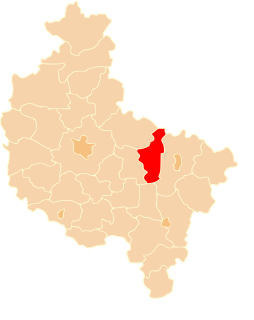
Orchowo is a village in Słupca County, Greater Poland Voivodeship, in west-central Poland. It is the seat of the gmina called Gmina Orchowo. It lies approximately 27 kilometres (17 mi) north-east of Słupca and 76 km (47 mi) east of the regional capital Poznań.
Osowiec is a village in the administrative district of Gmina Orchowo, within Słupca County, Greater Poland Voivodeship, in west-central Poland. It lies approximately 5 kilometres (3 mi) south-east of Orchowo, 24 km (15 mi) north-east of Słupca, and 78 km (48 mi) east of the regional capital Poznań.
Ostrówek is a village in the administrative district of Gmina Orchowo, within Słupca County, Greater Poland Voivodeship, in west-central Poland. It lies approximately 3 kilometres (2 mi) north-west of Orchowo, 28 km (17 mi) north of Słupca, and 74 km (46 mi) east of the regional capital Poznań.
Podbielsko is a village in the administrative district of Gmina Orchowo, within Słupca County, Greater Poland Voivodeship, in west-central Poland. It lies approximately 5 kilometres (3 mi) east of Orchowo, 30 km (19 mi) north-east of Słupca, and 81 km (50 mi) east of the regional capital Poznań.
Rękawczyn is a village in the administrative district of Gmina Orchowo, within Słupca County, Greater Poland Voivodeship, in west-central Poland. It lies approximately 6 kilometres (4 mi) west of Orchowo, 25 km (16 mi) north of Słupca, and 71 km (44 mi) east of the regional capital Poznań.
Skubarczewo is a village in the administrative district of Gmina Orchowo, within Słupca County, Greater Poland Voivodeship, in west-central Poland. It lies approximately 6 kilometres (4 mi) west of Orchowo, 23 km (14 mi) north of Słupca, and 70 km (43 mi) east of the regional capital Poznań.
Słowikowo is a village in the administrative district of Gmina Orchowo, within Słupca County, Greater Poland Voivodeship, in west-central Poland. It lies approximately 6 kilometres (4 mi) west of Orchowo, 25 km (16 mi) north of Słupca, and 71 km (44 mi) east of the regional capital Poznań.
Suszewo is a village in the administrative district of Gmina Orchowo, within Słupca County, Greater Poland Voivodeship, in west-central Poland. It lies approximately 6 kilometres (4 mi) south-east of Orchowo, 26 km (16 mi) north-east of Słupca, and 80 km (50 mi) east of the regional capital Poznań.
Szydłowiec is a village in the administrative district of Gmina Orchowo, within Słupca County, Greater Poland Voivodeship, in west-central Poland. It lies approximately 5 kilometres (3 mi) south-east of Orchowo, 24 km (15 mi) north-east of Słupca, and 78 km (48 mi) east of the regional capital Poznań.
Wólka Orchowska is a village in the administrative district of Gmina Orchowo, within Słupca County, Greater Poland Voivodeship, in west-central Poland. It lies approximately 4 kilometres (2 mi) east of Orchowo, 36 km (22 mi) north-east of Słupca, and 80 km (50 mi) east of the regional capital Poznań.
Lipnica is a village in the administrative district of Gmina Ostrowite, within Słupca County, Greater Poland Voivodeship, in west-central Poland. It lies approximately 7 kilometres (4 mi) north-west of Ostrowite, 15 km (9 mi) north-east of Słupca, and 72 km (45 mi) east of the regional capital Poznań.
Mieczownica is a village in the administrative district of Gmina Ostrowite, within Słupca County, Greater Poland Voivodeship, in west-central Poland. It lies approximately 6 kilometres (4 mi) west of Ostrowite, 11 km (7 mi) north-east of Słupca, and 72 km (45 mi) east of the regional capital Poznań.
Piotrowice is a village in the administrative district of Gmina Słupca, within Słupca County, Greater Poland Voivodeship, in west-central Poland. It lies approximately 3 kilometres (2 mi) north-east of Słupca and 68 km (42 mi) east of the regional capital Poznań.
Wierzbno is a village in the administrative district of Gmina Słupca, within Słupca County, Greater Poland Voivodeship, in west-central Poland. It lies approximately 4 kilometres (2 mi) south of Słupca and 68 km (42 mi) east of the regional capital Poznań.
Brudzewo is a village in the administrative district of Gmina Strzałkowo, within Słupca County, Greater Poland Voivodeship, in west-central Poland. It lies approximately 6 kilometres (4 mi) north-west of Strzałkowo, 9 km (6 mi) north-west of Słupca, and 59 km (37 mi) east of the regional capital Poznań.
Grądzeń is a village in the administrative district of Gmina Zagórów, within Słupca County, Greater Poland Voivodeship, in west-central Poland. It lies approximately 7 kilometres (4 mi) south-west of Zagórów, 21 km (13 mi) south of Słupca, and 70 km (43 mi) south-east of the regional capital Poznań.