
Kruger National Park is a South African National Park and one of the largest game reserves in Africa. It covers an area of 19,623 km2 (7,576 sq mi) in the provinces of Limpopo and Mpumalanga in northeastern South Africa, and extends 360 km (220 mi) from north to south and 65 km (40 mi) from east to west. The administrative headquarters are in Skukuza. Areas of the park were first protected by the government of the South African Republic in 1898, and it became South Africa's first national park in 1926.

Phalaborwa is a town in the Mopani District Municipality, Limpopo province, South Africa.

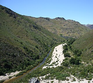
The Olifants River,Lepelle, iBhalule or Obalule is a river in South Africa and Mozambique, a tributary of the Limpopo River. It falls into the Drainage Area B of the Drainage basins of South Africa. The historical area of the Pedi people, Sekhukhuneland, is located between the Olifants River and one of its largest tributaries, the Steelpoort River.
The Olifants River is a river in the northwestern area of the Western Cape Province of South Africa. The upper and main catchment area of the Olifants river is around Ceres and the Cederberg mountains. The Clanwilliam and Bulshoek dams are located on the river and provide water for the towns and farms along the watercourse. The river is approximately 285 km long with a catchment area of 46,220 km2. It flows into the Atlantic Ocean at Papendorp, 250 km north of Cape Town.

The Bushveld is a sub-tropical woodland ecoregion of Southern Africa. The ecoregion straddles the Tropic of Capricorn and constitutes the southern part of the Zambezian region. It encompasses most of Limpopo and a small part of North West in South Africa, the Central and North-East Districts of Botswana and the Matabeleland South and part of Matabeleland North provinces of Zimbabwe. The Kruger National Park has a number of 'Bushveld' camps, but these are strictly speaking in the lowveld, as these terms are sometimes used interchangeably. Although their limits are somewhat blurred, lowveld is generally restricted to the more easterly parts of South Africa and Zimbabwe.

The R40 is a provincial route in South Africa that connects the Eswatini border at Bulembu via Barberton, Mbombela, Bushbuckridge, Acornhoek and Hoedspruit with Phalaborwa. The route spans two provinces and passes through several private game reserves.

The R71 is a provincial route in Limpopo, South Africa that connects Polokwane with the Kruger National Park via Tzaneen and Phalaborwa.
Olifants River is a river in the Klein Karoo area of the Western Cape, South Africa.
The Sand River or Polokwane River is a watercourse in Limpopo Province, South Africa, a right hand tributary of the Limpopo River. Its new name "Polokwane River" is homonymous with the name of the town of Polokwane, formerly Pietersburg, about 200 kilometres (120 mi) upriver from its mouth. The Sand River flows by the western edge of this town.

Balule Nature Reserve is a protected area in Limpopo Province, South Africa which forms part of the Greater Kruger National Park as a member of the Associated Private Nature Reserves (APNR). As part of a wildlife conservation initiative, all fences separating APNR reserves – Balule, Timbavati, Klaserie, Umbabat, – and the Kruger National Park have been removed.
The Selati Game Reserve is protected wildlife area situated between the towns of Gravelotte and Phalaborwa, in the Limpopo province of South Africa, the reserve has an area of about 30,000 ha.

Blyderivierpoort Dam is a gravity-arch dam on the Blyde River, in the lower Blyde River Canyon, near Hoedspruit in Mpumalanga, South Africa. It also floods the lower reaches of the Blyde's Ohrigstad River tributary. The dam was completed in 1974. The 71 m high dam wall and 22 m deep is situated 3 km from Swadini resort by road.

The Motlatse River, Blyde River, or Umdhlazi River is a river in the Mpumalanga and Limpopo provinces of South Africa. It has a northwards course in steep-sided valleys and ravines of the Mpumalanga Drakensberg, before it enters the lowveld region of the Limpopo province. It has its ultimate origins at around 2,000 m altitude in the Hartebeesvlakte conservation area, to the north of Long Tom Pass. It runs through the Blyde River Canyon.
The Doring River is a river in the Western Cape Province, South Africa. It is part of the Olifants/Doring River system.

The Bronkhorst Spruit, meaning watercress stream or creek, is a river in the Mpumalanga and Gauteng provinces of South Africa. In the 19th century it as was known as the Kalkoenkransrivier or Rhenosterpoortrivier. It is a tributary of the Wilge River in the Olifants River basin, and it lends its name to the town of Bronkhorstspruit, situated mainly on its right bank.
The Wilge River (iKuthu) is a river in Mpumalanga and Gauteng provinces, South Africa. It is a tributary of the Olifants River.

The Wolkberg is a mountain range in Tzaneen, Limpopo Province, South Africa. It is a northern termination and a subrange of the Drakensberg mountain range which lines up from Eastern Cape, Lesotho, Kwazulu Natal and Mpumalanga. At 2200 m (7200 ft) above sea level, it is the highest mountain range in Limpopo, together with the Iron crown mountain. Its Meteorological significance is that it brings along cold fronts and is a source of cold winters throughout the Limpopo province, the cold front gets transferred from greater Drakensberg mountains in Kwazulu Natal all the way to the Wolkberg. Without the Wolkberg, Limpopo will not experience cold winters at all. The range extends for about 30 km (19 mi) in a NW/SE direction north of Sekhukhuneland. The nearest towns are Haenertsburg and Tzaneen.

The Shingwedzi River is a river in Limpopo Province, South Africa, and Gaza Province, Mozambique. It is a left hand tributary of the Olifants River (Rio dos Elefantes) and the northernmost river of its catchment area, joining it at the lower end of its basin. The Shingwedzi is a seasonal river whose riverbed is dry for prolonged periods.

The Marañón dry forests (NT0223) is an ecoregion in northern Peru. It covers the lower valley of the Marañón River and its tributaries along the eastern edge of the Andes. It has a dry climate due to rain shadow from mountains further east. The habitat has long been modified by farming, ranching and logging and is now threatened by construction of hydroelectric and irrigation dams.

Lekgalameetse Provincial Park is a conserved mountain wilderness of 18,718 ha in the northern Drakensberg of Limpopo Province, South Africa. The reserve entrance is 5 km by dirt road from Ofcolaco. Indigenous forest and mixed woodland occupy the valleys, while the mountain crests are covered in grassland. In the north the Park is contiguous with the Wolkberg Wilderness Area.
