Related Research Articles

Pago Pago is the capital of American Samoa. It is in Maoputasi County on Tutuila, the main island of American Samoa.

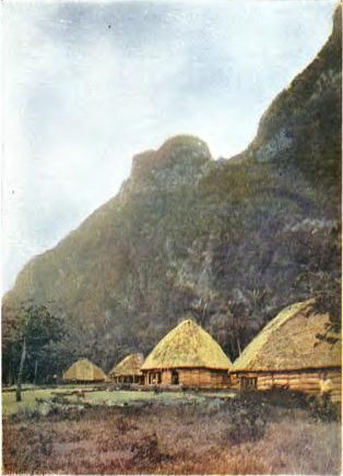
Tutuila is the largest and most populous island of American Samoa and is part of the archipelago of the Samoan Islands. It is the third largest island in the Samoan Islands chain of the Central Pacific. It is located roughly 4,000 kilometers (2,500 mi) northeast of Brisbane, Australia and lies over 1,200 kilometers (750 mi) to the northeast of Fiji. It contains a large, natural harbor, Pago Pago Harbor, where Pago Pago, the capital of American Samoa, is situated. Pago Pago International Airport is also located on Tutuila. The island's land expanse is about 68% of the total land area of American Samoa. With 56,000 inhabitants, it is also home to 95% of the population of American Samoa. The island has six terrestrial and three marine ecosystems.
The islands of Samoa were originally inhabited by humans as early as 1000 BC. After being invaded by European explorers in the 18th century, by the 20th and 21st century, the islands were incorporated into Samoa and American Samoa.

The American Samoa Fono is the territorial legislature of American Samoa. Like most states and territorial legislatures of the United States, it is a bicameral legislature with a House of Representatives and a Senate. The legislature is located in Fagatogo along Pago Pago harbor.

Fagatogo is the downtown area of Pago Pago. Located in the low grounds at the foot of Matafao Peak, it was the location of the first American settlement on Tutuila Island. It includes the sub-village of Malaloa. Today, Fagatogo is the government, commercial, financial, and shipping center of Tutuila. It is also the administrative capital of American Samoa. It is the location of the American Samoa Fono (legislature), and is listed in the Constitution of American Samoa as the territory's official seat of government. Its population is 1,737.
Utulei or ʻUtulei is a village in Maoputasi County, in the Eastern District of Tutuila, the main island of American Samoa. Utulei is traditionally considered to be a section of Fagatogo village, the legislative capital of American Samoa, and is located on the southwest edge of Pago Pago Harbor. Utulei is the site of many local landmarks: The A. P. Lutali Executive Office Building, which is next to the Feleti Barstow Library; paved roads that wind up to a former cablecar terminal on Solo Hill; the governor's mansion, which sits on Mauga o Alii, overlooking the entrance to Goat's Island, and the lieutenant governor's residence directly downhill from it; the Lee Auditorium, built in 1962; American Samoa's television studios, known as the Michael J. Kirwan Educational Television Center; and the Rainmaker Hotel. Utulei Terminal offers views of Rainmaker Mountain.

Aunuʻu is a small volcanic island off the southeastern shore of Tutuila in Saʻole County, American Samoa. It has a land area of 374.83 acres, and a 2010 census population of 436 persons. Politically, it is a part of the Eastern District, one of the two primary political divisions of American Samoa.

The Eastern District is one of the primary districts of American Samoa. It consists of the eastern portion of Tutuila, American Samoa's largest island, plus the island of Aunu'u. The district has a land area of 67.027 km2 (25.879 sq mi) and a 2010 census population of 23,030. It contains 34 villages plus a portion of Nuʻuuli village. Among these are Pago Pago, Fagatogo, and Utulei.

The Western District is one of the three primary divisions of American Samoa. It consists of the western portion of Tutuila Island. It has a land area of 74.781 km2 (28.873 sq mi) and contains 29 villages plus a part of Nuʻuuli village. Among these is the largest village of American Samoa, Tafuna, at its eastern end. The district's total population as of the 2010 census was 31,329.
Aūa is a village on Tutuila Island in American Samoa. It is located along American Samoa Highway 001, and is the southern terminus of American Samoa Highway 006. Aūa is located at the foothills of Mount Peiva on the eastern shore of Pago Pago Bay. The hamlet of Leloaloa is also a part of Aūa.

Leone is the second-largest city on Tutuila Island's west coast. The village is on the south-west coast of Tutuila Island, American Samoa. Leone was the ancient capital of Tutuila Island. Leone was also where the Samoan Islands’ first missionary, John Williams, visited on October 18, 1832. A monument in honor of Williams has been erected in front of Zion Church. Its large church was the first to be built in American Samoa. It has three towers, a carved ceiling and stained glass. Until steamships were invented, Leone was the preferred anchorage of sailing ships which did not risk entering Pago Pago Harbor. Much early contact between Samoans and Europeans took place in Leone. In the early 20th century, Leone was one of the centers for the Mau movement in American Sāmoa.
Nuʻuuli is a village on the central east coast of Tutuila Island, American Samoa. It is located on a peninsula several miles up from Pago Pago International Airport. Nuʻuuli is located between Pago Pago International Airport and Coconut Point. It is a shopping district which is home to stores, groceries and many more shops. In the early 20th century, Nuʻuuli was the headquarters for the Mau movement in American Sāmoa.

United States Naval Station Tutuila was a naval station in Pago Pago Harbor on the island of Tutuila, part of American Samoa, built in 1899 and in operation until 1951. During the United States Navy rule of American Samoa, from 1900 to 1951, it was customary for the commandant of the station to also serve as Military Governor of the territory. Benjamin Franklin Tilley was the first commandant and the first officer responsible for the naval station's construction.

American Samoa is an unincorporated territory of the United States located in the Polynesia region of the South Pacific Ocean. Centered on 14.3°S 170.7°W, it is 40 miles (64 km) southeast of the island country of Samoa, east of the International Date Line and the Wallis and Futuna Islands, west of the Cook Islands, north of Tonga, and some 310 miles (500 km) south of Tokelau. American Samoa is the southernmost territory of the United States, situated 2,200 miles (3,500 km) southwest of the U.S. state of Hawaii, and one of two U.S. territories south of the Equator, along with the uninhabited Jarvis Island and the Ofu-Olosega peak, which is a volcanic island in American Samoa.
Fatu-ma-futi is a village in central Tutuila Island, American Samoa. It is located at the easternmost point of the entrance to Pago Pago Harbor, south of Pago Pago. Flowerpot Rock, also known as Fatu Rock, is found along the highway in Fatumafuti. Legend says Fatu and Futi were lovers living in the Manu’a Islands. They wanted to get married but were forbidden to do so. The couple sailed from Savai'i (Samoa), looking for Tutuila Island; their canoe sank, and the pair were transformed into these tree-topped islands.

The Courthouse of American Samoa, formerly Administration Building, Navy No. 21, is a historic building near Pago Pago Harbor in Fagatogo, American Samoa. It is a two-story wood-frame building mounted on concrete piers, with a two-story veranda on three sides. A concrete vault is located at the back of the building. The court house was reported by the local commander to have been completed about 1904. It housed the offices and other facilities from which the United States Navy administered the island from its construction until 1952, and was where advisory councils of the island's indigenous leaders were held. The building is one of the oldest standing in American Samoa, having survived typhoons and other perils.
The Treaty of Cession of Tutuila, also known as the Deed of Cession of Tutuila, was a treaty between several chiefs of the island of Tutuila and the United States signed on April 17, 1900, whereby the chiefs swore allegiance to, and ceded the island of Tutuila to, the United States, which now forms part of American Samoa. In the late 19th century there was increased competition among the United States, Germany and the United Kingdom for influence and control in the Pacific region, which was a strategic location for naval bases. The Second Samoan Civil War occurred between 1898 and 1899 because of conflicts among high-ranking Samoan chiefs and the influence of Germany, the United States and the United Kingdom for control over the Samoan islands. The Tripartite Convention of 1899 ended the Second Samoan Civil War and was signed between the United States, the United Kingdom, and the German Empire partitioning the Samoan islands under German and U.S. control. The Samoan Islands had also experienced political instability and conflict among rival chiefs. U.S. representatives in the region engaged with local chiefs to persuade them of the benefits of ceding the territory to the U.S. The chiefs agreed and the treaty was formally signed on April 17, 1900, in the Gagamoe area in Pago Pago. The first American flag was raised later that same day on Sogelau Hill in Fagatogo. It was ratified by the United States Congress by the Ratification Act of 1929 officially incorporating Tutuila into what is now American Samoa. This treaty marked the beginning of American Samoa as a U.S. territory. Initially, the U.S. Navy governed the island for over fifty years before the territory became self-governing. American Samoa remains an unincorporated territory of the United States.
Maʻopūtasi County is located in the Eastern District of Tutuila Island in American Samoa. Maʻopūtasi County comprises the capital of Pago Pago and its harbor, as well as surrounding villages. It was home to 11,695 residents as of 2000. Maʻopūtasi County is 6.69 square miles (17.3 km2) The county has a 7.42-mile (11.94 km) shoreline which includes Pago Pago Bay.
The Mau movement in American Samoa or American Samoa Mau, was an anti-colonial movement and an independence movement formed in American Sāmoa in the 1920s, which was suppressed by the United States. Established in early 1920, it aimed to challenge the overreach of the U.S. Navy's authority.
Mauga Moi Moi (1852–1935) was a statesman and paramount Aliʻi, the highest ranking chief of Pago Pago, and signatory of the Deed of Cession. In 1920, he initiated the Mau movement in 1920 and in 1900, he signed the Deed of Cession and became a District Governor under the new U.S. naval station. He was the High Chief of Pago Pago from 1900 to 1934 and therefore also the District Governor of the Eastern District according to U.S. Naval rule.
References
- ↑ "American Samoa: U.S. Naval and World War II History" (PDF). National Park Service History Electronic Library & Archive (Brochure). Archived (PDF) from the original on November 24, 2024. Retrieved November 24, 2024.
- ↑ Stoler, Ann Laura; Joseph, Gilbert M.; Rosenberg, Emily S., eds. (2006). Haunted by Empire: Geographies of Intimacy in North American History. American Encounters/Global Interactions. With contributions by Damon Salesa. Duke University Press. p. 88. doi:10.1515/9780822387992. ISBN 9780822337249.
- ↑ Sunia, Fofō I. F. (1998). The Story of the Legislature of American Samoa. Legislature of American Samoa. Pages 61 and 86. ISBN 9789829008015.
- ↑ "Samoa Bowl IX: Live the experience through the Samoa Bowl!". www.samoanews.com. December 19, 2011. Archived from the original on August 29, 2023. Retrieved November 25, 2024.