Galagedara, Western Province

Last updated
Galagedara
Sri Lanka location map.svg
Red pog.svg
Galagedara
Galagedara in Sri Lanka
Coordinates: 6°51′0″N80°05′0″E / 6.85000°N 80.08333°E
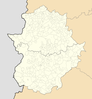
 / 6.85000; 80.08333
Province Western Province
Time zone Sri Lanka Standard Time Zone (UTC+5:30)

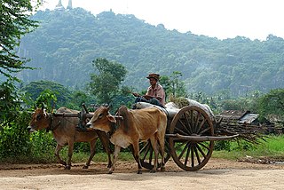
Coordinates: 6°51′N80°05′E / 6.850°N 80.083°E / 6.850; 80.083 Galagedara is a village in the Western Province of Sri Lanka.

Geographic coordinate system Coordinate system

A geographic coordinate system is a coordinate system that enables every location on Earth to be specified by a set of numbers, letters or symbols. The coordinates are often chosen such that one of the numbers represents a vertical position and two or three of the numbers represent a horizontal position; alternatively, a geographic position may be expressed in a combined three-dimensional Cartesian vector. A common choice of coordinates is latitude, longitude and elevation. To specify a location on a plane requires a map projection.

Western Province, Sri Lanka Province in Sri Lanka

The Western Province is one of the nine provinces of Sri Lanka, the first level administrative division of the country. The provinces have existed since the 19th century but did not have any legal status until 1987 when the 13th Amendment to the Constitution of Sri Lanka established provincial councils. The province is the most densely populated province in the country and is home to the legislative capital Sri Jayawardenepura Kotte as well to Colombo, the nation's administrative and business center.

Sri Lanka Island country in South Asia

Sri Lanka, officially the Democratic Socialist Republic of Sri Lanka, is an island country in South Asia, located in the Indian Ocean to the southwest of the Bay of Bengal and to the southeast of the Arabian Sea. The island is historically and culturally intertwined with the Indian subcontinent, but is geographically separated from the Indian subcontinent by the Gulf of Mannar and the Palk Strait. The legislative capital, Sri Jayawardenepura Kotte, is a suburb of the commercial capital and largest city, Colombo.

Related Research Articles

Battambang Municipality Municipality in Battambang, Cambodia

Battambang District is a district (srok) of Battambang Province, in north-western Cambodia. The capital lies at Battambang city.

El Torno municipality in Extremadura, Spain

El Torno is a municipality located in the province of Cáceres, Extremadura, Spain. According to the 2005 census (INE), the municipality has a population of 938 inhabitants.

Stins

A stins is a former stronghold or villa in the province of Friesland, the Netherlands. Many stinsen carry the name "state".

Galagedara may refer to:

Galagedara (7°46′N 80°10′E) Place in North Western Province, Sri Lanka

Galagedara is a village in the North Western Province of Sri Lanka.

Galagedara (7°36′N 80°23′E) Place in North Western Province

Galagedara is a village in the North Western Province of Sri Lanka.

Galagedara (7°36′N 80°18′E) Place in North Western Province

Galagedara is a village in the North Western Province of Sri Lanka.

Galagedara (7°32′N 80°08′E) Place in North Western Province

Galagedara is a village in the North Western Province of Sri Lanka.

Galagedara (7°26′N 80°02′E) Place in North Western Province

Galagedara is a village in the North Western Province of Sri Lanka.

Galagedara (7°19′N 79°57′E) Place in North Western Province

Galagedara is a village in the North Western Province of Sri Lanka.

Galagedara, Central Province Place in Central Province

Galagedara is a village in the Central Province of Sri Lanka.

Galagedara, North Western Province may refer to one of six villages in the North Western Province of Sri Lanka:

Wola Gardzienicka Village in Lublin, Poland

Wola Gardzienicka is a village in the administrative district of Gmina Piaski, within Świdnik County, Lublin Voivodeship, in eastern Poland. It lies approximately 6 kilometres (4 mi) south of Piaski, 19 km (12 mi) south-east of Świdnik, and 27 km (17 mi) south-east of the regional capital Lublin.

Guareña Municipality in Extremadura, Spain

Guareña is a Spanish municipality in the province of Badajoz, Extremadura. It has a population of 7,326 (2007) and an area of 283.3 km².

Toffo Commune and city in Atlantique Department, Benin

Toffo is a town and commune in the Atlantique Department of southern Benin. The commune covers an area of 515 square kilometres and as of 2002 had a population of 74,717 people.

Nam Hao or Huai Nam Hao (ห้วยน้ำฮาว) is a watercourse of Thailand. It joins the Nan River near Ban Aham in Nan Province.

Bắc Lý is a commune () and village in Hiệp Hòa District, Bắc Giang Province, in northeastern Vietnam.

Peressaare is a village in Alutaguse Parish, Ida-Viru County in northeastern Estonia.

The A 10 road is an A-Grade trunk road in Sri Lanka. It connects the Katugastota with Puttalam.

Galabawa is a village in Sri Lanka. It is located within Central Province.Its situated in west border of central province near the border of north western province .Its history makes back to BC where the King Walagamba once reside here before became the king of sri lanka Its population is about 1000 most of them are sinhala buddhists. the main access road to galabawa is via Kandy kurunegala route 10 from the hatharaliyadda road,it has another access road via galagedara,

References

The GEOnet Names Server (GNS) provides access to the National Geospatial-Intelligence Agency's (NGA) and the U.S. Board on Geographic Names's (BGN) database of geographic feature names and locations for locations outside the United States. The database is the official repository of foreign place-name decisions approved by the US BGN. Approximately 20,000 of the database's features are updated monthly. The database never removes an entry, "except in cases of obvious duplication".