Aude is a department in Southern France, located in the Occitanie region and named after the river Aude. The departmental council also calls it "Cathar Country" after a group of religious dissidents active in the 12th to 14th centuries.

Tarn is a department in the Occitania region in Southern France. Named after the river Tarn, it had a population of 389,844 as of 2019. Its prefecture and largest city is Albi; it has a single subprefecture, Castres. In French, the inhabitants of Tarn are known as Tarnais (masculine) and Tarnaises (feminine). Its INSEE and postcode number is 81.

Haute-Garonne is a department in the southwestern French region of Occitanie. Named after the river Garonne, which flows through the department. Its prefecture and main city is Toulouse, the country's fourth-largest. In 2019, it had a population of 1,400,039.

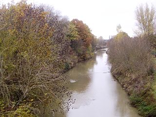
The Aude is a river of southern France that is 224 kilometres (139 mi) long. Its source is in the Pyrenees mountains then runs to Carcassonne and finally reaches the Mediterranean Sea near Narbonne. The river is navigable by raft or canoe for nearly all of its length. It is registered as essential to the Languedoc-Roussillon region.

The Canal du Midi is a 240 km (150 mi) long canal in Southern France. Originally named the Canal Royal en Languedoc and renamed by French revolutionaries to Canal du Midi in 1789, the canal is considered one of the greatest construction works of the 17th century.

Moissac is a commune in the Tarn-et-Garonne department in the Occitanie region in southern France. The town is situated at the confluence of the rivers Garonne and Tarn at the Canal de Garonne. Route nationale N113 was constructed through the town and between Valence-d'Agen and Castelsarrasin. It is served by Moissac station on the Bordeaux-Toulouse line.

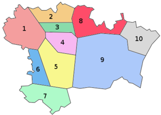
The arrondissement of Toulouse is an arrondissement of France in the Haute-Garonne department in the Occitanie region. It has 225 communes. Its population is 1,049,948 (2016), and its area is 2,538.9 km2 (980.3 sq mi).

The Hers-Mort is a 89.3-kilometre (55.5 mi) long river in southern France, a right-bank tributary of the Garonne. Its average flow rate is 4 cubic metres per second (140 cu ft/s). The Hers-Mort rises in the Lauragais region, near the village Fonters-du-Razès, in the Aude department. It flows northwest through the following departments and towns:

The Canal de Garonne, formerly known as Canal latéral à la Garonne, is a French canal dating from the mid-19th century that connects Toulouse to Castets-en-Dorthe. The remainder of the route to Bordeaux uses the river Garonne. It is the continuation of the Canal du Midi which connects the Mediterranean with Toulouse.

A summit-level canal, sometimes called a "watershed canal" or just "summit Canal", is an artificial waterway connecting two separate river valleys. The term refers to a canal that rises to cross a summit then falls down the other side.

Baraigne is a commune in the Aude department in the Occitanie region of southern France.

The Lauragais is an area of the south-west of France that is south-east of Toulouse.

Bodega or craba is an Occitan term for a type of French bagpipe played in Montagne Noire, particularly within the French departments of Tarn, Aude, Hérault, and Haute-Garonne. It is also the name given to outdoor bars or cellars with festive music during ferias.

The Bassin de Saint-Ferréol was created as the result of a large earth dam across the mouth of the valley of Laudot stream at St. Ferréol in the Montagne Noire. It was originally proposed by Chevalier de Clerville and accepted by Pierre Paul Riquet as an integral part of the Canal du Midi. Riquet needed to provide a sufficient water reservoir to allow the locks to function year round, even in the dry summer season. The dam was begun on 15 April 1667 and was completed in four years. It was the first dam built specifically to supply water to a navigable canal and was by far the greatest single work of civil engineering undertaken during the building of the Canal du Midi.

The rigole de la montagne was an important facet of the Canal du Midi, engineered by Pierre-Paul Riquet in southern France. The canal itself was built during 1666-1681. A critical aspect of the Canal du Midi was the supply of sufficient water to feed the canal. Each boat traversing its length would require a large quantity of water in the locks in order to climb or descend.

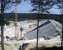
Sivens Dam was a dam which was planned for construction across the Tescou, a tributary of the Tarn in the basin of the Garonne in Southern France, near to Toulouse. The construction site was 10 km north of Lisle-sur-Tarn, in the Department of Tarn (Midi-Pyrénées). The dam was named after the nearby Forest of Sivens. Construction work began in 2014 and was then halted after Rémi Fraisse, a 21-year-old man protesting against the construction project, was killed by a stun grenade fired by police. His death sparked further protests across France, some of which were violent. The project was then closed in 2015 by the Minister of Ecology Ségolène Royal. There was a later proposal for a smaller dam.

The Tescou is a tributary of the Tarn in the basin of the Garonne in southern France. It flows 48.8 kilometres (30.3 mi) through the departments of Tarn, Tarn-et-Garonne and Haute-Garonne.

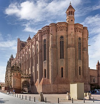
Southern French Gothic, or Meridional Gothic, is a specific and militant style of Gothic architecture developed in the South of France, especially in the Toulouse region. It arose in the early 13th century following the victory of the Catholic church over the Cathars, as the church sought to re-establish its authority in the region. As a result, church buildings typically present features drawn from military architecture. Taking into account the Cathars' criticism of the Catholic Church, Southern French Gothic is simpler and less ornate than northern French Gothic, and further differs in that the construction material is typically brick rather than stone. Over time, the style came to influence secular buildings as well as churches and spread beyond the area where Catharism had flourished.

The French Great South-West is a geographical, sociological, economic and cultural entity bringing together the administrative regions of Nouvelle-Aquitaine and Occitanie, resulting from the merger on January 1, 2016, of five previous regions; in these two regions combined, it covers 156,000 km2, or 29% of the territory of metropolitan France. It is a grouping devoid of its own political or administrative structures, set up, with the objective of an interregional reflection on spatial planning at the level of new European issues, at the initiative of the Interministerial Delegation at territory planning and regional attractiveness.

The Ortolo Reservoir is a reservoir in the Corse-du-Sud department of France on the island of Corsica.


