
Scouting in Alabama has a long history, from the 1910s to the present day, serving thousands of youth in programs that suit the environment in which they live.

Tuscaloosa is a city in and the seat of Tuscaloosa County in west central Alabama. Located on the Black Warrior River at the Atlantic Seaboard fall line of the Piedmont, it is the fifth-largest city in Alabama, with an estimated population of 100,287 in 2017. The city was originally known as Tuskaloosa until the early 20th century.
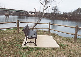
The Black Warrior River is a waterway in west-central Alabama in the southeastern United States. The river rises in the extreme southern edges of the Appalachian Highlands and flows 178 miles (286 km) to the Tombigbee River, of which the Black Warrior is the primary tributary. The river is named after the Mississippian paramount chief Tuskaloosa, whose name meant 'Black Warrior' in Muskogean. The Black Warrior is impounded along nearly its entire course by a series of locks and dams to form a chain of reservoirs that not only provide a path for an inland waterway, but also yield hydroelectric power, drinking water, and industrial water.

The Tallapoosa River runs 265 miles (426 km) from the southern end of the Appalachian Mountains in Georgia, United States, southward and westward into Alabama. It is formed by the confluence of McClendon Creek and Mud Creek in Paulding County, Georgia. Lake Martin at Alexander City, Alabama is a large and popular water recreation area formed by a dam on the river. The Tallapoosa joins the Coosa River about 10 miles (16 km) northeast of Montgomery near Wetumpka to form the Alabama River.

The University of West Alabama is a public university located in Livingston, Alabama, United States.
State Route 216, also known as SR-216, is a numbered state highway in Tuscaloosa County, Alabama. SR-216 follows the former route of U.S. Highway 11 through eastern Tuscaloosa County. It serves as an alternate route between Bessemer and Tuscaloosa. The route was commissioned in April 1978 after ALDOT took over the route formerly maintained by Tuscaloosa County as County Road 116.

Area code 205 is the North American telephone area code for western and central Alabama, including the cities of Birmingham and Tuscaloosa.

Bankhead Lake is a reservoir along the Black Warrior River that begins in Walker County in the state of Alabama. The lake forms the border between Jefferson and Tuscaloosa County, as well as the border dividing Jefferson and Walker County. It eventually empties into Holt Lake.

Alabama's 7th congressional district is a United States congressional district in Alabama that elects a representative to the United States House of Representatives. The district encompasses Choctaw, Dallas, Greene, Hale, Lowndes, Marengo, Pickens, Perry, Sumter and Wilcox counties, and portions of Clarke, Jefferson, Montgomery and Tuscaloosa counties. The district encompasses portions of the Birmingham, Montgomery and Tuscaloosa/Northport urban areas. The largest city entirely within the district is Selma.
There are two lakes named Gallant Lake within the United States:

Big Mound City (8PB48) is a prehistoric site near Canal Point, Florida, United States. It is located 10 miles east of Canal Point, off U.S. Route 98. On May 24, 1973, it was added to the U.S. National Register of Historic Places. It is located inside the J.W. Corbett Wildlife Management Area.

Smuteye or Smut Eye is an unincorporated community in Bullock County, Alabama, United States, located northeast of Perote.

Lake Lurleen State Park is a publicly owned recreation area located on U.S. Highway 82 approximately 9 miles (14 km) northwest of Northport in Tuscaloosa County, Alabama. The state park's 1,625 acres (658 ha) include 250-acre (100 ha) Lake Lurleen and a 23-mile (37 km) trail system. It is operated by the Alabama Department of Conservation and Natural Resources.

The Tuscaloosa metropolitan area, as defined by the United States Census Bureau, is an area consisting of three counties in west central Alabama, anchored by the city of Tuscaloosa. As of the 2010 census, the MSA had a population of 219,461.
The 1942 Cotton Bowl Classic, part of the 1941 bowl game season, took place on January 1, 1942, at the Cotton Bowl in Dallas, Texas. The competing teams were the Alabama Crimson Tide, representing the Southeastern Conference (SEC), and the Texas A&M Aggies, representing the Southwest Conference (SWC) as conference champions. Alabama won the game 29–21.

The 2011 Tuscaloosa–Birmingham tornado was a large and violent EF4 multiple-vortex tornado that devastated portions of Tuscaloosa and Birmingham, Alabama, as well as smaller communities and rural areas between the two cities, during the late afternoon and early evening of Wednesday, April 27, 2011. It is one of the costliest tornadoes on record. It was one of the 360 tornadoes in the 2011 Super Outbreak, the largest tornado outbreak in United States history. The tornado reached a maximum path width of 1.5 miles (2.4 km) during its track through Tuscaloosa, and once again when it crossed Interstate 65 north of Birmingham, and attained estimated winds of 190 mph (310 km/h) shortly after passing through the city. It then went on to impact parts of Birmingham as a high-end EF4 before dissipating. This was the third tornado to strike the city of Tuscaloosa in the past decade, and the second in two weeks.

Charles A. Farquhar State Cattle Ranch was an Alabama Department of Corrections state prison for men, located south of the town of Greensboro in unincorporated Hale County, Alabama.
Simcoe is an unincorporated community in Cullman County, Alabama, United States, located on Alabama State Route 69, 3.7 miles (6.0 km) southwest of Fairview.


