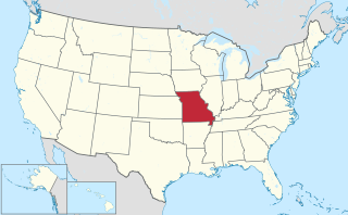
Turners or Turner is a small unincorporated community in Greene County, Missouri, United States. It lies on the southeast side of the James River floodplain approximately 3.5 miles east of U.S. Route 65 in east Springfield. The community lies at the intersection of Routes D and J near the confluence of Turner Creek with the James River. The old St. Louis - San Francisco Railroad passed through the community.

Plano is an unincorporated community on former U.S. Route 66, now Route 266 in Greene County, Missouri, United States. The community is part of the Springfield, Missouri Metropolitan Statistical Area.

Tunas is an unincorporated community in northern Dallas County, Missouri, United States. It lies fourteen miles north of Buffalo on Route 73 and approximately seven miles east of Urbana on Route D. The town is located on Route 73, just southwest of the Little Niangua River. Tunas is part of the Springfield, Missouri Metropolitan Statistical Area.

Logan is a school and small unincorporated community in southeastern Greene County, Missouri, United States. It is located approximately 5 mi (8.0 km) west-northwest of Rogersville, one mile north of U.S. Route 60 and one mile west of Route 125. The community is centered on the school and includes several homes and the Logan Cemetery.
Ebenezer is an unincorporated community in Greene County, Missouri, United States. It lies two miles north of McDaniel Lake north of Springfield and 1.25 miles east of Route 13. The community is at the head of the King Branch of the North Dry Sac River.

Garrison is an unincorporated community in southeast Christian County, Missouri, United States. It is located on Route 125, approximately 15 miles southeast of Sparta.
Brighton is an unincorporated community in southern Polk County, Missouri, United States. It is located at the intersection of Missouri Routes 13 and 215, approximately fifteen miles north of Springfield. Brighton is part of the Springfield Metropolitan Statistical Area.
Chestnutridge is an unincorporated community in southwestern Christian County, Missouri, United States and is located approximately fourteen miles south of Ozark and about 3.5 miles southeast of Spokane. The community is located on Chestnut Ridge, at an elevation of 1325 feet. It is on Missouri Route BB just east of Missouri Route 176 and about two miles west of U.S. Route 65.
Elkland is an unincorporated community in northwestern Webster County, Missouri, United States. It is located on Route 38, approximately ten miles northwest of Marshfield. Elkland is part of the Springfield, Missouri Metropolitan Statistical Area.

Goodson is an unincorporated community in Polk County, Missouri, United States. It is located at the intersection of Missouri Supplemental Routes C and P and is approximately sixteen miles northeast of Bolivar. Goodson is part of the Springfield, Missouri Metropolitan Statistical Area.

Polk is an unincorporated community in Polk County, Missouri, United States. It is located on Missouri Supplemental Route D, approximately twelve miles northeast of Bolivar. Polk is part of the Springfield, Missouri Metropolitan Statistical Area.
James River Freeway is a 14-mile-long (23 km) freeway located largely on the south side of Springfield, Missouri. Its western terminus is at Interstate 44 (I-44) north of Brookline and its eastern terminus is at U.S. Route 65 (US 65) in southeastern Springfield. It is named for the James River, which passes near the highway at the freeway's eastern terminus. A total of four highways are routed on the highway: Route 360, US 60, US 160, Route 13, and Business US 65.
Hugo is an unincorporated community in southern Camden County, in the U.S. state of Missouri. The community is located approximately 3.5 miles east-southeast of Camdenton on Missouri Route V, just north of Missouri Route 7.
Olive is an unincorporated community in southeastern Dallas County, in the U.S. state of Missouri.
Cody is an unincorporated community in southeastern Greene County, in the U.S. state of Missouri.
Harold is an unincorporated community in northwest Greene County, in the U.S. state of Missouri. Harold is located on Missouri Route 123, southeast of Walnut Grove and 1.5 miles east of Phenix.
Haseltine is an unincorporated community in Greene County, in the U.S. state of Missouri. The community location was west of Springfield on U.S. Route 266, adjacent to Interstate 44.
Mentor is an unincorporated community in southern Greene County, in the U.S. state of Missouri. The community is located southeast of Springfield, south of U.S. Route 60, west of Missouri Route NN and one mile north of the Greene-Christian county line.
Mumford is an unincorporated community in Greene County, in the U.S. state of Missouri. The community was located at the junction of Jones Branch and Pierson Creek about 1.3 miles east of the current U.S. 65 bypass of east Springfield. The old St. Louis - San Francisco Railroad passes just southwest of the location. The old Mt. Pisgah School was located just to the north.
Pierson Creek or Pearson Creek is a stream in southeastern Greene County in the Ozarks of southwest Missouri. The stream is a tributary of the James River.


