
Tong is a ward within the City of Bradford Metropolitan District Council, West Yorkshire, England, named after Tong village which is its oldest settlement. The population at the 2011 Census was 20,608.

The A58 is a major road in Northern England running between Prescot, Merseyside and Wetherby, West Yorkshire.
Weetwood is an area between Headingley and Meanwood in north-west Leeds, West Yorkshire, England. It is bounded on the north by the A6120, on the west by the A660, on the east by Meanwood Beck and to the south by Hollin Lane. Weetwood Lane runs north and south through it.

Sheepscar is an inner city district of Leeds in West Yorkshire England, lying to the north east of Leeds city centre. The district is in the City of Leeds Metropolitan Council. It is overlooked by the tower blocks of Little London and Lovell Park to the west, and gives way to Meanwood in the north-west, Chapeltown in the north-east and Burmantofts in the east.

City Square is a paved area north of Leeds railway station at the junction of Park Row to the east and Wellington Street to the south. It is a triangular area where six roads meet: Infirmary Street and Park Row to the north, Boar Lane and Bishopsgate Street to the south-east, and Quebec Street and Wellington Street to the south-west. The only building with a direct frontage is the former General Post Office, on the north-west side.

Bradford Moor is an electoral ward within the City of Bradford Metropolitan District Council. The population of the ward at the 2011 Census was 21,210. The ward includes the areas of Laisterdyke and Thornbury.

Miles Hill is a district in Leeds. It is about 1.5 miles (2 km) north of Leeds city centre, West Yorkshire, England and is situated between Meanwood and Chapel Allerton next to Beck Hill. The district is located in the Chapel Allerton ward of Leeds Metropolitan Council.

Quarry Hill is an area of central Leeds, West Yorkshire, England. It is bounded by the Leeds Inner Ring Road in the east and north and the Leeds – York / Hull railway in the south. The area falls within the City and Hunslet ward of Leeds City Council.

The Headrow is an avenue in Leeds city centre, West Yorkshire, England.

Cottingley is an urban area in the south-west of Leeds, West Yorkshire, England.

Tinshill is a district of Leeds, 4 miles (7 km) north of Leeds city centre, West Yorkshire, England. It was the Danes in the 9th century who named the hill "Tyndr's Hyll".
Osmondthorpe a district of east Leeds in West Yorkshire, England is considered part of the Halton Moor district.

Holbeck Urban Village is an area of Leeds city centre, close to Leeds railway station that has been undergoing a period of urban renewal.

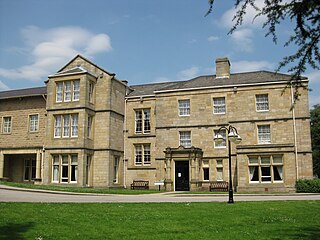
This is a list of halls of residence both on and off campus at the University of Leeds in Leeds, England.

Cross Green is a mainly industrial area of Leeds, West Yorkshire, England. It is around 1 mile (1.6 km) on a hill to the south east of Leeds city centre, with the A63 road running through the middle and dividing it into a residential estate with playing fields and housing to the north, and a large industrial estate to the south. The area lies in the LS9 Leeds postcode area between Osmondthorpe, Richmond Hill and Hunslet.

Lincoln Green is a mainly residential area of Leeds, West Yorkshire, England around Lincoln Green Road, and is adjacent to and southwest of St James's University Hospital. It falls within the Burmantofts and Richmond Hill ward of the City of Leeds Council. The area was given this name in 1954, at the start of major redevelopment by the City Council.
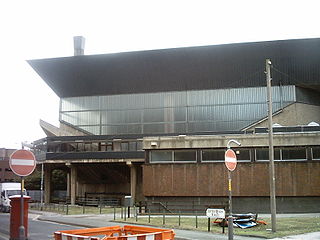
The Leeds International Pool often referred to as the Leeds International Baths, was a swimming facility in Leeds city centre, West Yorkshire, England. The pool was situated at the lower end of Westgate and was notable for its brutalist architecture. The pool was constructed in the 1960s and designed by architect John Poulson.

Leeds City bus station serves the city of Leeds, England. Owned and managed by West Yorkshire Metro, it is situated between the Quarry Hill and Leeds Kirkgate Markets areas of Leeds city centre. The National Express Dyer Street Coach Station adjoins the bus station.
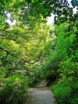
Woodhouse Ridge is a strip of woodland on the South West hillside of the Meanwood valley in urban area of Leeds, West Yorkshire, England. Locally known as 'The Ridge', the area is notable as a significant area of mature woodland in an otherwise highly developed urban area. The woods are centred at grid reference 53.820061, -1.560144 and are enclosed by Meanwood Road to the east and by Headingley to the north and Woodhouse, Leeds to the South.

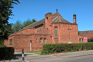
Mill Hill Chapel is a Unitarian church in Leeds, West Yorkshire, England. It is a member of the General Assembly of Unitarian and Free Christian Churches, the umbrella organisation for British Unitarians. The building, which stands in the centre of the city on City Square, was granted Grade II* listed status in 1963.
