Swinnow | |
---|---|
Swinnow Avenue, Swinnow, 2009 | |
Location within West Yorkshire | |
Metropolitan borough | |
Metropolitan county | |
Region | |
Country | England |
Sovereign state | United Kingdom |
Historic county | |
Post town | PUDSEY |
Postcode district | LS13 |
Dialling code | 0113 |
Police | West Yorkshire |
Fire | West Yorkshire |
Ambulance | Yorkshire |
UK Parliament | |
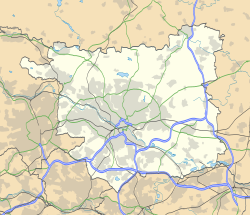
Swinnow (derived from Anglo-Saxon Swin (swine) and how (hill), [1] possibly also a contraction of "Swine Moor" in the Yorkshire dialect) is a housing estate in west Leeds, West Yorkshire, England. It is situated between Bramley and Pudsey on the west side of the outskirts of Leeds and is currently part of the Leeds City Council ward of Pudsey.
Swinnow was part of the civil parish of Bramley. [2] Bramley and Swinnow were part of the Leeds rhubarb fields, a part of the so-called 'Rhubarb Triangle', which accounted for a large portion of British rhubarb production from the 1800s until the second world war. Every January at rhubarb picking time a special train would depart Bramley station at 8:30 pm every night bound for market towns all over the country ready for the next day.
After the second world war the population of Leeds was growing and consequently new cheap council houses were needed. The area of the fields in the Swinnow/Bramley area were considered a perfect location.[ citation needed ] They were sold on compulsory purchase to the council, and development started on housing estates over the old rhubarb fields. An industrial estate was established south of the settlement, where soft drinks manufacturer Britvic is a major employer.
Swinnow is now clearly integrated into the larger Leeds area. Nevertheless, the history of the area is preserved, in that the stories, memories and knowledge of the residents were compiled into a small volume published by Patchwork press in 1994.
There are two churches in Swinnow, Christ the Saviour Anglican Church [3] and St. Mark's Methodist Church. [4]
Pudsey is a market town in West Yorkshire, England. Once independent, it was incorporated into the City of Leeds metropolitan borough in 1974. It is located midway between Bradford city centre and Leeds city centre. Historically in the West Riding of Yorkshire, it has a population of 22,408. It also lends its name and sits in the local Leeds City Council ward of Pudsey and Pudsey parliamentary constituency.
Armley is a district in the west of Leeds, West Yorkshire, England. It starts less than 1 mile (1.6 km) from Leeds city centre. Like much of Leeds, Armley grew in the Industrial Revolution and had several mills, one of which houses now the Leeds Industrial Museum at Armley Mills. Armley is predominantly and historically a largely working class area of the city, still retains many smaller industrial businesses, and has many rows of back-to-back terraced houses.
Moortown is a suburb of Leeds, West Yorkshire, England in the LS17 postcode area. It is a civil parish and sits in the Moortown ward of Leeds City Council in the north east of the city.
Yeadon is a town within the metropolitan borough of the City of Leeds, West Yorkshire, England.
Horsforth is a town and civil parish within the City of Leeds, in West Yorkshire, England, lying about five miles north-west of Leeds city centre. Historically a village within the West Riding of Yorkshire, it had a population of 18,895 at the 2011 Census. It became part of the City of Leeds metropolitan borough in 1974. In 1999 a civil parish was created for the area, and the parish council voted to rename itself a town council. The area sits within the Horsforth ward of Leeds City Council, which also includes the southern part of Rawdon.
Seacroft is an outer-city suburb/township consisting mainly of council estate housing covering an extensive area of east Leeds, West Yorkshire, England. It lies in the LS14 Leeds postcode area, around 4 miles (6.4 km) east of Leeds city centre.
Alwoodley is a civil parish and suburb of Leeds in West Yorkshire, England. It is 5 miles (8.0 km) north of central Leeds and is one of the most affluent areas of the city. Alwoodley lies in Leeds 17 which was reported to contain the most expensive housing area in Yorkshire and the Humber by The Times.
Bramley is a district in west Leeds, West Yorkshire, England. It is part of the City of Leeds Ward of Bramley and Stanningley with a population of 21,334 at the 2011 Census. The area is an old industrial area with much 19th century architecture and 20th century council housing in the east and private suburban housing in the west.
Cookridge is a suburb of north-west Leeds, West Yorkshire, England, north of the Leeds Outer Ring Road. In 1715 Ralph Thoresby described it as a village four miles from Leeds and three from Otley, dating from 1540.
Meanwood is a suburb and former village in north-east Leeds, West Yorkshire, England.
Farnley is a district in Leeds, West Yorkshire, England, 2 miles (3.2 km) south-west of Leeds city centre, between Wortley, Bramley and the countryside around Pudsey and Gildersome, in the LS12 Leeds postcode area. It is part of the Leeds City Ward Farnley and Wortley with a population of 24,213 according to the 2011 Census. New Farnley is a nearby commuter village.
Farsley is a town in the City of Leeds metropolitan borough, West Yorkshire, England 6 miles (9.7 km) to the west of Leeds city centre, 4 miles (6.4 km) east of Bradford. Farsley is situated between the two cities and near the town of Pudsey. Before April 1974, Farsley was part of the Borough of Pudsey. Before 1934 it was its own urban district council. It had its own council offices opposite the cenotaph, which is now a dental practice. The ward of Calverley and Farsley also includes the estate of Swinnow and some northern parts of Pudsey.
Pudsey was a local government district in the West Riding of Yorkshire from 1872 to 1974 around the town of Pudsey, covering Farsley, Calverley, Stanningley, Swinnow and Rodley.
Richmond Hill is a district of Leeds, West Yorkshire, England. The district lies a mile to the east of the city centre between York Road, East End Park and Cross Green. The appropriate City of Leeds ward is Burmantofts and Richmond Hill.
Stanningley is a district of Pudsey, West Yorkshire, England. It is situated approximately 5 miles (8 km) west of Leeds city centre on the A647 road, the original main road from Leeds to Bradford. The appropriate Leeds Metropolitan Ward is Bramley and Stanningley. The parish is part of the Anglican Diocese of Leeds.
Fulneck Moravian Settlement is a village in Pudsey in the City of Leeds metropolitan borough, West Yorkshire, England. The village lies on a hillside overlooking a deep valley. Pudsey Beck flows along the bottom of the valley.
Swarcliffe, originally the Swarcliffe Estate, is a district of Leeds, West Yorkshire, England. It is 4.9 miles (8 km) east of Leeds city centre, and within the LS14 Leeds postcode area. The district falls within the Cross Gates and Whinmoor ward of the Leeds Metropolitan Council.
The City of Leeds is a city and metropolitan borough in West Yorkshire, England. The metropolitan borough includes the administrative centre of Leeds and the towns of Farsley, Garforth, Guiseley, Horsforth, Morley, Otley, Pudsey, Rothwell, Wetherby and Yeadon. It has a population of 793,139 (mid-2019 est.), making it technically the second largest city in England by population behind Birmingham. It is governed by Leeds City Council.
Pudsey is an electoral ward of Leeds City Council in west Leeds, West Yorkshire, including the town of Pudsey and residential areas of Swinnow and Tyersal.
Swinnow Memories A celebration of stories from the past - Patchwork press - 1994 - ISBN 1-873247-16-8
Wikimedia Commons has media related to Swinnow . |