
The Aller is a 215-kilometre-long (134 mi) river in the states of Saxony-Anhalt and Lower Saxony in Germany. It is a right-hand, and hence eastern, tributary of the Weser and is also its largest tributary. Its last 117 kilometres (73 mi) form the Lower Aller federal waterway. The Aller was extensively straightened, widened and, in places, dyked during the 1960s to provide flood control of the river. In a 20-kilometre-long (12 mi) section near Gifhorn, the river meanders in its natural river bed.

The Leine is a river in Thuringia and Lower Saxony, Germany. It is a left tributary of the Aller and the Weser and is 281 km (175 mi) long.

Northeim is a district in Lower Saxony, Germany. It is bounded by the districts of Holzminden, Hildesheim, Goslar and Göttingen, and the state of Hesse.

The Saale, also known as the Saxon Saale and Thuringian Saale, is a river in Germany and a left-bank tributary of the Elbe. It is not to be confused with the smaller Franconian Saale, a right-bank tributary of the Main, or the Saale in Lower Saxony, a tributary of the Leine.
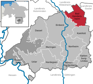
Bad Gandersheim is a town in southern Lower Saxony, Germany, located in the district of Northeim. As of December 2020, it had a population of 9,492.

The Ihme is a river of Lower Saxony, Germany. It is a left tributary of the Leine.
The Innerste is a river in Lower Saxony, Germany. It is a right tributary of the Leine river and 101 km (63 mi) in length.
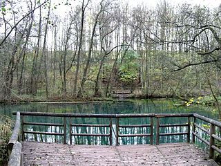
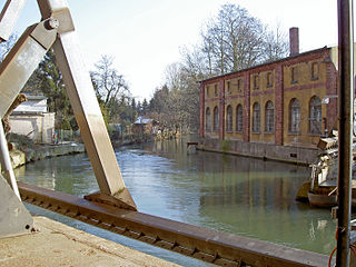
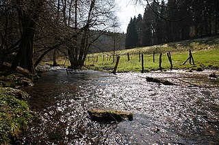
The Rhume is a 48 km (30 mi) long river in Lower Saxony, Germany. It is a right tributary of the Leine. Its source is the karstic spring of Rhume Spring in Rhumspringe, south of the Harz mountain range. The water drains with high pressure from the ground of the funnel-shaped well, known for its turquoise colour.

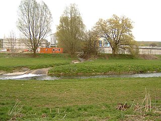
The Oder is a 56-kilometre-long (35 mi) river in Lower Saxony, Germany, and a right tributary of the Rhume. Its source is in the Harz mountains, near Sankt Andreasberg. It flows southwest through Bad Lauterberg, Pöhlde and Hattorf am Harz. The Oder flows into the Rhume in Katlenburg-Lindau.
The Grindau is an 11-kilometre-long (6.8 mi) right-hand tributary of the River Leine in Lower Saxony (Germany).
Lutter is a river in Göttingen, Lower Saxony, Germany. It is a tributary from the right (east) to the Leine.
The Ilme is a left-bank, western tributary of the River Leine in Lower Saxony, Germany. It is 33.0 km (20.5 mi) long.

Haller is a river of Lower Saxony, Germany. It flows into the Leine near Nordstemmen.
Aue is a river of Lower Saxony, Germany. It flows into the Leine near Kreiensen.

Saale is a river of Lower Saxony, Germany. It is a left tributary of the Leine. Its source is near the village Duingen. It flows into the Leine in Elze.
The Ahrensberg, at 374 metres, is the highest hill in the Sackwald range in the district of Hildesheim, in the north German state of Lower Saxony.

The Sackwald is a ridge, up to 374 m above sea level (NN) high, in the Lower Saxon Hills in the district of Hildesheim in the North German state of Lower Saxony. It is named after the village of Sack in the borough of Alfeld, the name meaning "Sack Forest".
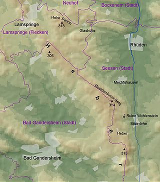
The Heber is a hogback ridge, relatively small in area and up to 313.5 metres high, in the Lower Saxon Hills within the districts of Goslar, Northeim and Hildesheim in the German state of Lower Saxony.
The Steinberg is a small hill ridge, up to 300.3 m above NN, in the Lower Saxon Hills in the districts of Holzminden and Hildesheim in the German state of Lower Saxony.

The Helleberg is a hill ridge up to 297.5 m above NN in the Lower Saxon Hills and within the counties of Hildesheim and Northeim in Lower Saxony, Germany.

