Gangapurna Lake

Last updated

Gangapurna Lake
Beautiful Gangapurna Lake.jpg
Gangapurna Lake in 2015
Nepal Gandaki rel location map.svg
Red pog.svg
Gangapurna Lake
Nepal rel location map.svg
Red pog.svg
Gangapurna Lake
Location Manang, Manang District, Nepal
Coordinates 28°39′47″N84°01′01″E / 28.66314087953114°N 84.0168365263016°E / 28.66314087953114; 84.0168365263016 Coordinates: 28°39′47″N84°01′01″E / 28.66314087953114°N 84.0168365263016°E / 28.66314087953114; 84.0168365263016
Type Lake
Surface area21.08 hectares (52.1 acres)
Gangapurna Lake

Gangapurna Lake
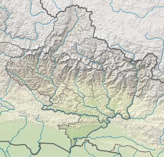
 is a glacial lake in Manang, Gandaki Province, Nepal. [1] [2] It was formed by glaciers from Mt Gangapurna (7,454m), Annapurna IV (7,525m), Khangsar Kang and Glacier Dom. [3] [4]

Related Research Articles

Kangchenjunga Third highest mountain in the world

Kangchenjunga, also spelled Kanchenjunga, is the third highest mountain in the world. It rises with an elevation of 8,586 m (28,169 ft) in a section of the Himalayas called Kangchenjunga Himal delimited in the west by the Tamur River, in the north by the Lhonak Chu and Jongsang La, and in the east by the Teesta River. It lies between India and Nepal, with three of the five peaks, namely Main, Central and South, directly on the border, and the peaks West and Kangbachen in Nepal's Taplejung District.

Himalayas Mountain range in Asia

The Himalayas, or Himalaya, are a mountain range in Asia separating the plains of the Indian subcontinent from the Tibetan Plateau. The range has some of the planet's highest peaks, including the highest, Mount Everest. Over 100 peaks exceeding 7,200 m (23,600 ft) in elevation lie in the Himalayas. By contrast, the highest peak outside Asia is 6,961 m (22,838 ft) tall.

Ama Dablam Mountain in Nepal

Ama Dablam is a mountain in the eastern Himalayan range of Province No. 1, Nepal. The main peak is 6,812 metres (22,349 ft), the lower western peak is 6,170 metres (20,243 ft). Ama Dablam means "Mother's necklace"; the long ridges on each side like the arms of a mother (ama) protecting her child, and the hanging glacier thought of as the dablam, the traditional double-pendant containing pictures of the gods, worn by Sherpa women. For several days, Ama Dablam dominates the eastern sky for anyone trekking to Mount Everest Base Camp. For its soaring ridges and steep faces Ama Dablam is sometimes referred as the "Matterhorn of the Himalayas."

Dudh Koshi

Dudh Koshi is a river in eastern Nepal. It is the highest river in terms of elevation.

Pokhara Metropolitan city in Gandaki Province, Nepal

Pokhara is a metropolitan city in Nepal, which serves as the capital of Gandaki Province. It is the second most populous city of Nepal after Kathmandu, with 518,452 inhabitants living in 101,669 households in 2021. It is the country's largest metropolitan city in terms of area. The city also serves as the headquarters of Kaski District. Pokhara is located 200 kilometres west of the capital, Kathmandu. The city is on the shore of Phewa Lake, and sits at an elevation of approximately 822m. The Annapurna Range, with three out of the ten highest peaks in the world—Dhaulagiri, Annapurna I and Manaslu—is within 15–35 mi (24–56 km) of the valley.

Serac Large block or column of glacial ice

A serac is a block or column of glacial ice, often formed by intersecting crevasses on a glacier. Commonly house-sized or larger, they are dangerous to mountaineers, since they may topple with little warning. Even when stabilized by persistent cold weather, they can be an impediment to glacier travel.

Pithoragarh district District of Uttarakhand in India

Pithoragarh district is the easternmost district in the state of Uttarakhand. It is located in the Himalayas and has an area of 7,110 km2 (2,750 sq mi) and a population of 483,439. The city of Pithoragarh, located in Saur Valley, is its headquarters. The district is within the Kumaon division of Uttarakhand state. The Tibet plateau is situated to the north and Nepal is to the east. The Kali River which originates from the Kalagiri Mountain flows south, forming the eastern border with Nepal. The Hindu pilgrimage route for Mount Kailash-Lake Manasarovar passes through this district via Lipulekh Pass in the greater Himalayas. The district is administratively divided into six Tehsils: Munsyari; Dharchula; Didihat; Berinag; Gangolihat; and Pithoragarh. Naini Saini Airport is the nearest civil airport, but it does not have a regular scheduled commercial passenger service. The mineral deposits present in the district are magnesium ore, copper ore, limestone and slate. There are 11 tehsil.

Dolpa District District in Karnali Province, Nepal

Dolpa District, is a district, located in Karnali Province of Nepal, It is one of the seventy-seven districts of Nepal and one of ten district of Karnali. The district, with Dunai as its district headquarters, covers an area of 7,889 km2 (3,046 sq mi) and has a population (2011) of 36,700. Dolpa is the largest district of Nepal.

Kosi River River in Tibet, Nepal, and India

The Kosi or Koshi is a trans-boundary river which flows through Tibet, Nepal and India. It drains the northern slopes of the Himalayas in Tibet and the southern slopes in Nepal. From a major confluence of tributaries north of the Chatra Gorge onwards, the Kosi River is also known as Saptakoshi for its seven upper tributaries. These include the Tamor River originating from the Kanchenjunga area in the east and Arun River and Sun Kosi from Tibet. The Sun Koshi's tributaries from east to west are Dudh Koshi, Bhote Koshi, Tamakoshi River, Likhu Khola and Indravati. The Saptakoshi crosses into northern Bihar, India where it branches into distributaries before joining the Ganges near Kursela in Katihar district.

Glacial lake outburst flood Type of outburst flood that occurs when the dam containing a glacial lake fails

A glacial lake outburst flood (GLOF) is a type of outburst flood caused by the failure of a dam containing a glacial lake. An event similar to a GLOF, where a body of water contained by a glacier melts or overflows the glacier, is called a jökulhlaup. The dam can consist of glacier ice or a terminal moraine. Failure can happen due to erosion, a buildup of water pressure, an avalanche of rock or heavy snow, an earthquake or cryoseism, volcanic eruptions under the ice, or massive displacement of water in a glacial lake when a large portion of an adjacent glacier collapses into it.

Sarayu River in India

The Sarayu (Kumaoni:Sarjyū) is a river that originates at a ridge south of Nanda Kot mountain in Bageshwar district in Uttarakhand, India. It flows through Kapkot, Bageshwar, and Seraghat towns before discharging into the Sharda River at Pancheshwar at the India—Nepal border. Sharda river then flows into Ghaghara river in Sitapur District, Uttar Pradesh, India.

Bhotekoshi River River in Nepal

Bhote Koshi in Nepal and Poiqu in Tibet, both names roughly mean "Tibetan river," is the name given to the upper course of the Sun Kosi river. It is part of the Koshi River system in Nepal.

Arun River (China–Nepal) River in China and Nepal

The Arun River is a trans-boundary river and is part of the Kosi or Sapt Koshi river system in Nepal. It originates in Tibet Autonomous Region of the People's Republic of China where it is called the Phung Chu or Bum-chu.

Tso Lhamo Lake

Tso Lhamo lake is one of the highest lakes in the world, located at an altitude of 5,100 m (16,700 ft). It is situated in North Sikkim, India, about 4 km (2.5 mi) southwest of the international border with China. It is fed by waters from Zemu glacier, Kangtse glacier or Pauhunri glacier, and is the source of the Teesta river.

Indravati River (Nepal) River in Nepal

The Indravati River in Nepal is a tributary of the Sun Koshi River. It used to be called "Melamchi" or "Melamchu" until the 19th century.

Sunkoshi River River in Nepal

The Sunkoshi, also called Sunkosi, is a trans-boundary river that originates in Tibet Autonomous Region and is part of the Koshi or Saptkoshi River system in Nepal.

Tsho Rolpa is one of the biggest glacial lakes in Nepal. The lake, which is located at an altitude of 4,580 metres (15,030 ft) in the Rolwaling Valley, Dolakha District, has grown considerably over the last 50 years due to glacial melting in the Himalayas.

Kim Chang-ho (climber) South Korean mountaineer

Kim Chang-ho, was a South Korean high altitude mountain climber, and at the time of his death in 2018, was considered Korea's strongest ever alpine and Himalayan climber.

Gangapurna Mountain in Nepal

Gangapurna is a mountain in Gandaki Province, Nepal. It is part of the Annapurna mountain range in north-central Nepal at an elevation of 7,455 metres (24,459 ft) and with the prominence of 563 metres (1,847 ft). It was first ascended in 1965 by a German expedition via its south face and east ridge. Gangapurna is entirely located in the Annapurna Conservation Area.

References

  1. Neupane, Tufan. "Forests replace glaciers in the Himalaya" . Retrieved 1 April 2021.
  2. Lawaju, Hasana (13 June 2017). "Gangapurna Lake in dire need of conservation". The Himalayan Times. Retrieved 1 April 2021.
  3. "Gangapurna Lake rapidly becoming shallower". The Himalayan Times. 8 October 2018. Retrieved 1 April 2021.{{cite web}}: CS1 maint: url-status (link)
  4. "Nepal's Himalayas – a changing landscape in photos". OnlineKhabar English News. Retrieved 1 April 2021.