Bahraich is a city and a municipal board in Bahraich district in the state of Uttar Pradesh, India. Located on the Saryu River, a tributary of the Ghaghara river, Bahraich is 125 kilometres north-east of Lucknow, the state capital. The districts of Barabanki, Gonda, Balrampur, Lakhimpur Kheri, Shravasti and Sitapur share local boundaries with Bahraich. A factor which makes this town important is the international border shared with Nepal..
Balrampur is a city and a municipal board in Balrampur district in the state of Uttar Pradesh, India. It is situated on the bank of river Rapti and is the district headquarters of Balrampur district.

Tulsipur is a town and tehsil in the Balrampur district of the Indian state of Uttar Pradesh.
Balarampur or Balrampur may refer to the following places:
Siddharthnagar district is one of the 75 districts of the Indian state of Uttar Pradesh. Siddharthnagar is the district headquarters. Siddharthnagar district is a part of Basti division. It was under the ancient Kosala kingdom and also the Shakya kingdoms.

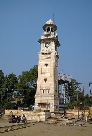
Balrampur district is one of the district of the Indian state of Uttar Pradesh and is a part of Devipatan division as well as the historic Awadh regions. It has been cut from the adjacent district Gonda in 1997. Located on the banks of the West Rapti River. Balrampur is known for the temple of Pateshwari Devi, a Shakti Pitha, and for the ruins of the nearby ancient city of Sravasti, now a pilgrimage site for Buddhists and Jains. The nearest airport is Shravasti airport 23.3 kilometres (14.5 mi) from the town but it is not an international and regular airport; the nearest international and regular airport is Chaudhary Charan Singh International Airport in Lucknow, 235 kilometres (146 mi) away. Lucknow is the capital city of Uttar Pradesh and is 220 kilometres (140 mi) from Balrampur district headquarters.

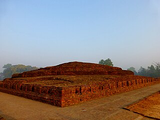
Tilaurakot is a neighborhood in Kapilvastu Municipality in Kapilvastu District, in the Lumbini Province of southern Nepal. Previously it was a Village development committee. At the time of the 1991 Nepal census it had a population of 5684 people living in 944 individual households. It is situated 25 kilometers (15.5 mi) northwest of the Maya Devi Temple in Lumbini, and 4.5 kilometers (2.8 mi) southeast of Nigali Sagar in Nigalihawa.
Jaitapur is a village in Gainsari Mandal, Balrampur district, Uttar Pradesh State. Jaitapur is 18 km distance from its town Gainsari. Jaitapur is 35 km distance from its district main city Balrampur. And 167 km distance from its state main city Lucknow.
National Highway 330 is a national highway in India that links Prayagraj, Uttar Pradesh to Balrampur in Uttar Pradesh. Previously this highway was named NH-96. NH 330 is a 4 Lane highway in UP.
Tulsipur is a constituency of the Uttar Pradesh Legislative Assembly covering the city of Tulsipur in the Balrampur district of Uttar Pradesh, India. It is one of five assembly constituencies in the Shravasti Lok Sabha constituency.
Gainsari is a constituency of the Uttar Pradesh Legislative Assembly covering the city of Gainsari in the Balrampur district of Uttar Pradesh, India.
Balrampur is an Assembly constituency of the Uttar Pradesh Legislative Assembly, covering the city of Balrampur in the Balrampur district of Uttar Pradesh, India. Balrampur is one of five assembly constituencies in the Shravasti Lok Sabha constituency. Since 2008, this assembly constituency is numbered 294 amongst 403 constituencies.
Bargadwa is a village in Pachperwa block, Balrampur district, Uttar Pradesh, India.
Sadullanagar SMT Village is a village in Uttar Pradesh, India. Utraula, Balrampur, Faizabad, Tulsipur are the nearby Cities to Sadullanagar. Sadullanagar Pin Code is 271307. Sadullanagar is a legislative assembly constituency in Uttar Pradesh. Since 2008, Sadullanagar Assembly constituency merged as Utraula Assembly Constituency. ISadullanagar comes under Gonda Lok Sabha constituency. Sadullanagar is saprated from Utraula by Kunwa River and by Bishui river from Mankapur. Sadullanagar people speak Hindi, Urdu as their main communication language. located 169 km from State capital Lucknow.
In October 2022, heavy rainfall caused floods in Balrampur, in the Indian state of Uttar Pradesh. Over 1300 villages were affected by this flood.