Gascoyne Land Division

Last updated

Location of Gascoyne division in Western Australia Gascoyne land division of Western Australia.png
Location of Gascoyne division in Western Australia

Gascoyne Land Division was a land division of Western Australia defined under the Land Regulations of 2 March 1887. It included almost all of the modern Gascoyne region of the State. In the Land Act 1898, it was renamed Western to avoid confusion with the Gascoyne Land District which had just been created by the Department of Lands and Surveys, [1] and on 1 February 1907, section 26 of the Land Act Amendment Act 1906 merged it into North-West Land Division.

The lands administrative divisions of Western Australia refer to subdivisions of the state of Western Australia for cadastral purposes, most of which have been in place since the 19th century. The state is divided up for this purpose into five land divisions, which in turn are subdivided into land districts, which correspond to counties in other Australian states. These districts are then subdivided further into numbered locations, as well as gazetted townsites. Together, they form part of the lands administrative divisions of Australia.

Western Australia State in Australia

Western Australia is a state occupying the entire western third of Australia. It is bounded by the Indian Ocean to the north and west, and the Southern Ocean to the south, the Northern Territory to the north-east, and South Australia to the south-east. Western Australia is Australia's largest state, with a total land area of 2,529,875 square kilometres, and the second-largest country subdivision in the world, surpassed only by Russia's Sakha Republic. The state has about 2.6 million inhabitants – around 11 percent of the national total – of whom the vast majority live in the south-west corner, 79 per cent of the population living in the Perth area, leaving the remainder of the state sparsely populated.

Gascoyne Land District Cadastral in Western Australia

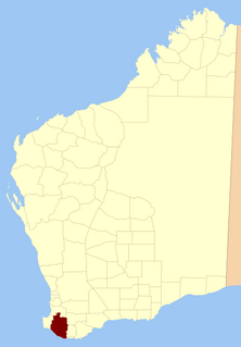
Gascoyne Land District is a land district of Western Australia, located within the North-West Land Division.

It was defined thus in the Land Regulations in 1887: [2]

Related Research Articles

Western Australia is divided into regions according to a number of systems.

Shire of Upper Gascoyne Local government area in Western Australia

The Shire of Upper Gascoyne is a local government area in the Gascoyne region of Western Australia, inland from Carnarvon and about 1,000 kilometres (621 mi) north of the state capital, Perth. The Shire has an area of 57,939 square kilometres (22,370 sq mi), much of which is uninhabited land or sparsely vegetated sheep station country, and its seat of government is the small town of Gascoyne Junction. It has a population of 285, 46% of whom identify as Aboriginal.

Shire of Nanango Local government area in Queensland, Australia

The Shire of Nanango was a local government area located in the South Burnett region of Queensland, Australia, about 100 kilometres (62 mi) northwest of the capital, Brisbane. The Shire covered an area of 1,738.4 square kilometres (671.2 sq mi), and existed as a local government entity from 1879 until 2008, when it amalgamated with several other councils in the South Burnett area to become the South Burnett Regional Council.

Kimberley Land Division

Kimberley Land Division is one of five land divisions of Western Australia recognised in the Land Administration Act 1997. It occupies roughly the same area as the Kimberley region of the state.

North West Australia region of Western Australia

The North West, North West Coast, North Western Australia and North West Australia, are usually informal names for the northern regions of the State of Western Australia. However, some conceptions of "North West Australia" have included adjoining parts of the Northern Territory (NT) – or even the entire NT.

Mining in Western Australia is administered in terms of the administrative divisions of the:-

Sussex Land District Cadastral in Western Australia

Sussex Land District is a land district of Western Australia, located within the South-West Land Division on the state's west coast. It covers the south-western corner of the state and includes the townsites of Busselton, Margaret River and Augusta as well as Cape Naturaliste and Cape Leeuwin.

Nelson Land District Cadastral in Western Australia

Nelson Land District is a land district of Western Australia, located within the South West Division on the state's south coast. It covers part of the state's Lower South West region and includes the townsites of Bridgetown, Manjimup, Pemberton, Northcliffe and Nannup as well as Point D'Entrecasteaux and, at its far southeastern corner, Walpole.

Wellington Land District, Western Australia Cadastral in Western Australia

Wellington Land District is a land district of Western Australia, located within the South-West Land Division on the state's west coast. It spans roughly 32°56'S - 33°40'S in latitude and 115°25'E - 116°50'E in longitude.

Balladonia Land District Cadastral in Western Australia

Balladonia Land District is a land district of Western Australia mostly within the Eucla Land Division. It spans roughly 31°50'S - 32°40'S in latitude and 123°10'E - 124°00'E in longitude.

Murray Land District Cadastral in Western Australia

Murray Land District is a land district of Western Australia, located within the South-West Land Division on the state's west coast. It spans roughly 32°25'S - 32°56'S in latitude and 115°25'E - 116°30'E in longitude, and is located on the Indian Ocean coast, taking in the Shires of Murray and Waroona, the eastern part of the Serpentine-Jarrahdale and the western suburbs of Mandurah.

Mundrabilla Land District Cadastral in Western Australia

Mundrabilla Land District is a land district of Western Australia, located within the Eucla Land Division on the Nullarbor Plain. It spans roughly 31°00'S - 32°00'S in latitude and 127°30'E - 129°00'E in longitude.

Esperance Land District Cadastral in Western Australia

Esperance Land District is a land district of Western Australia, located within the Eucla Land Division on the state's south coast. It spans roughly 33°15'S - 34°00'S in latitude and 121°00'E - 122°20'E in longitude.

Nuyts Land District Cadastral in Western Australia

Nuyts Land District is a land district of Western Australia, located within the Eastern and Eucla land divisions on the Nullarbor Plain. It spans roughly 31°00'S - 32°50'S in latitude and 124°00'E - 125°30'E in longitude.

Wells Land District Cadastral in Western Australia

Wells Land District is a land district of Western Australia, located within the Eastern Land Division of the state. It spans roughly 24°00'S - 26°20'S in latitude and 121°40'E - 123°20'E in longitude. Its name honours Lawrence Allen Wells, an explorer of the area in 1896–1897.

Tugaila Land District Cadastral in Western Australia

Tugaila Land District is a land district of Western Australia, located within the Eastern Land Division in the Gibson Desert. It spans roughly 24°00'S - 26°50'S in latitude and 123°20'E - 125°50'E in longitude.

Yamarna Land District Cadastral in Western Australia

Yamarna Land District is a land district of Western Australia, located within the Eastern Land Division in the Great Victoria Desert, north of the Nullarbor Plain. It spans roughly 26°50'S - 29°00'S in latitude and 123°30'E - 125°00'E in longitude.

Balwina Land District Cadastral in Western Australia

Balwina Land District is a land district of Western Australia, located within the Eastern Land Division in the Great Sandy Desert. It spans roughly 19°30'S - 21°00'S in latitude and 126°25'E - 129°00'E in longitude.

Byro Station

Byro Station is a pastoral lease and sheep station that also carries cattle located in the Mid West region of Western Australia.

References

  1. The Western Mail noted, "The division hitherto called Gascoyne has been renamed "Western," so as not to be confused with the Gascoyne District." "The New Consolidated Land Bill". Western Mail . Perth, WA: National Library of Australia. 7 January 1898. p. 12. Retrieved 2 December 2010.
  2. "Land Regulations. Part III — Division of the Colony". Western Australia Government Gazette. 2 March 1887. p. 1887:133.

Coordinates: 25°15′S116°35′E / 25.250°S 116.583°E / -25.250; 116.583

Geographic coordinate system Coordinate system

A geographic coordinate system is a coordinate system that enables every location on Earth to be specified by a set of numbers, letters or symbols. The coordinates are often chosen such that one of the numbers represents a vertical position and two or three of the numbers represent a horizontal position; alternatively, a geographic position may be expressed in a combined three-dimensional Cartesian vector. A common choice of coordinates is latitude, longitude and elevation. To specify a location on a plane requires a map projection.