Bharthana is a town and a municipal board in Etawah district in the state of Uttar Pradesh, India. Bharthana is located at 26.75°N 79.23°E. It has an average elevation of 135 metres (442 feet).
Bikihakola is a census town in Panchla CD Block of Howrah Sadar subdivision in Howrah district in the state of West Bengal, India.
Chandur Railway is a city and a municipal council in Amravati district in the state of Maharashtra, India. Chandur Railway is one of the three talukas of Chandur Railway subdivision in Amravati district.
Dhuilya is a census town in Sankrail CD Block of Howrah Sadar subdivision in Howrah district in the Indian state of West Bengal. It is a part of Kolkata Urban Agglomeration.
Handia is a town, near the city of Prayagraj and a nagar panchayat in the Prayagraj district of the Indian state of Uttar Pradesh.

Kakrala is a city and municipal board in Badaun district in the Indian state of Uttar Pradesh.
Kodigenahalli is a census town in Tumkur district in the Indian state of Karnataka.
Koratagere is a Panchayat Town in Tumkur district in the Indian state of Karnataka.
Mulanur is a panchayat town under in Dharapuram taluk in Tirupur District in the Indian state of Tamil Nadu.
Nachhratpur Katabari is a census town in Raiganj CD Block in Raiganj subdivision of Uttar Dinajpur district in the Indian state of West Bengal.
Sahapur is a census town in Panchla CD Block of Howrah Sadar subdivision in Howrah district in the Indian state of West Bengal.
Sarai Mir is a town and a nagar panchayat in Azamgarh district in the Indian state of Uttar Pradesh.
Talen is a town in Madhya Pradesh, India.

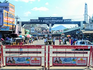
Usilampatti is a town and a second grade municipality of Madurai district in the Indian state of Tamil Nadu. It is also a designated taluk and revenue division.
Vijayapur is a town in Devanahalli taluk and Bangalore Rural district in the Indian state of Karnataka. Vijayapura's old name is Vadigenahalli. Local villagers still refer Vijayapura as Vadigenahalli.
Fatehabad is a town in Agra district in the state of Uttar Pradesh, India. It is nearly 35 km south-east of Agra in the direction of Etawah. The historical name of the town is Samugarh.
Shahpura or Shahpura Bhitoni is a town and a nagar panchayat in Jabalpur district in the Indian state of Madhya Pradesh.

Farah is a town and a nagar panchayat in Mathura district in the state of Uttar Pradesh, India.
Maheshpur is a village in West Champaran district in the Indian state of Bihar.
Harpur Kalan is a small village of 1269 families located in Majorganj, Sitamarhi, Bihar, India. The Harpur Kalan village has a population of 5510 of which 2990 are males while 2520 are females as per Population Census 2011. In Harpur Kalan village the population of children between the ages of 0-6 is 1027, which makes up 18.64% of the total population. The average sex ratio of Harpur Kalan village is 843, lower than the Bihar state average of 918. The child sex ratio for Harpur Kalan as per census is 824, lower than the Bihar average of 935.


