
Geikie
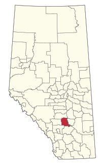
Location of Geikie, Alberta
Geikie is a locality in Alberta, Canada. [1]
The locality takes its name from Mount Geikie. [2]
Geikie is a locality in Alberta, Canada. [1]
The locality takes its name from Mount Geikie. [2]
The Victoria Cross Ranges are a set of mountain ranges in the Canadian Rockies, located to the northwest of Jasper. Of the 19 peaks contained within this range, five are named after Canadian recipients of the Victoria Cross. The area of the ranges is 678 square kilometers.

Bentley is a town in central, Alberta, Canada within Lacombe County. It is located on Highway 12, approximately 28 km (17 mi) northwest of Red Deer.

The County of Stettler No. 6 is a municipal district in central Alberta, Canada.

Athabasca Pass is a high mountain pass in the Canadian Rockies on the border between Alberta and British Columbia. In fur trade days it connected Jasper House on the Athabasca River with Boat Encampment on the Columbia River.
Kneehill County is a municipal district in central Alberta, Canada within Census Division No. 5.

The County of Paintearth No. 18 is a municipal district in east central Alberta, Canada. Located in Census Division No. 7, its municipal office is located southeast of the Town of Castor near the intersection of Highway 12 and Highway 36.
Aden is a locality in the County of Forty Mile No. 8, Alberta. It serves as a port of entry into the U.S. state of Montana for the nearby Canada – United States border crossing. The port of entry is located where Alberta Highway 880 continues as Secondary Highway 409 within Liberty County, Montana.
Tonquin Pass, 1948 m (6393 ft), is a mountain pass in the Canadian Rockies, linking Tonquin Valley in Jasper National Park, Alberta, to Mount Robson Provincial Park and adjoining areas of British Columbia. It is at the headwaters of Tonquin Creek, which flows into British Columbia. Located on the interprovincial boundary, it is on the Continental Divide.

Bistcho Lake 213 is an Indian reserve of the Dene Tha' First Nation in Alberta, located within Mackenzie County.
Bingley is a locality in Alberta, Canada.
Cline River is a locality in central Alberta, Canada within Clearwater County. It is located along Highway 11 approximately 134 km (83 mi) west of Rocky Mountain House.
Goodwin is a locality in Alberta, Canada.
Hawkins is a locality in Alberta, Canada.
Hope Valley is a locality in Alberta, Canada.
Cavell Creek is a stream in Alberta, Canada.
Mount Clitheroe is a summit in Alberta, Canada. It takes its name from Clitheroe, in England.
Decoigne is a locality in Alberta, Canada. It is located west of Jasper, near the border with British Columbia.
Emigrants Mountain is a summit in Jasper National Park in Alberta, Canada. accessible by walking track and with views over the Miette Valley, Mount Fitzwilliam and other peaks in the Great Divide. Emigrants Mountain was so named on account of gold prospectors in the area.
Mount Henry is a summit in Alberta, Canada.
Coordinates: 52°52′00″N118°16′09″W / 52.86671°N 118.26909°W
| | This Alberta's Rockies location article is a stub. You can help Wikipedia by expanding it. |