
A geographic information system (GIS) consists of integrated computer hardware and software that store, manage, analyze, edit, output, and visualize geographic data. Much of this often happens within a spatial database, however, this is not essential to meet the definition of a GIS. In a broader sense, one may consider such a system also to include human users and support staff, procedures and workflows, the body of knowledge of relevant concepts and methods, and institutional organizations.

A digital elevation model (DEM) or digital surface model (DSM) is a 3D computer graphics representation of elevation data to represent terrain or overlaying objects, commonly of a planet, moon, or asteroid. A "global DEM" refers to a discrete global grid. DEMs are used often in geographic information systems (GIS), and are the most common basis for digitally produced relief maps. A digital terrain model (DTM) represents specifically the ground surface while DEM and DSM may represent tree top canopy or building roofs.
A GIS software program is a computer program to support the use of a geographic information system, providing the ability to create, store, manage, query, analyze, and visualize geographic data, that is, data representing phenomena for which location is important. The GIS software industry encompasses a broad range of commercial and open-source products that provide some or all of these capabilities within various information technology architectures.

Analysis of Functional NeuroImages (AFNI) is an open-source environment for processing and displaying functional MRI data—a technique for mapping human brain activity.

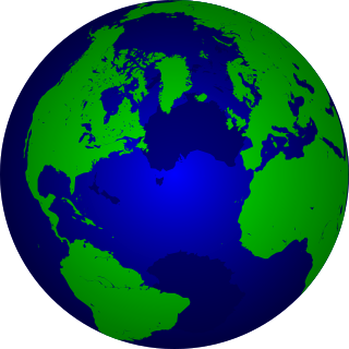
A virtual globe is a three-dimensional (3D) software model or representation of Earth or another world. A virtual globe provides the user with the ability to freely move around in the virtual environment by changing the viewing angle and position. Compared to a conventional globe, virtual globes have the additional capability of representing many different views of the surface of Earth. These views may be of geographical features, man-made features such as roads and buildings, or abstract representations of demographic quantities such as population.

Geoscience Australia is an agency of the Australian Government. It carries out geoscientific research. The agency is the government's technical adviser on all aspects of geoscience, and custodian of the geographic and geological data and knowledge of the nation.

ArcGIS is a family of client, server and online geographic information system (GIS) software developed and maintained by Esri.

OpenStreetMap (OSM) is a free, open geographic database updated and maintained by a community of volunteers via open collaboration. Contributors collect data from surveys, trace from aerial imagery and also import from other freely licensed geodata sources. OpenStreetMap is freely licensed under the Open Database License and as a result commonly used to make electronic maps, inform turn-by-turn navigation, assist in humanitarian aid and data visualisation. OpenStreetMap uses its own topology to store geographical features which can then be exported into other GIS file formats. The OpenStreetMap website itself is an online map, geodata search engine and editor.
In computing, data transformation is the process of converting data from one format or structure into another format or structure. It is a fundamental aspect of most data integration and data management tasks such as data wrangling, data warehousing, data integration and application integration.
Geospatial metadata is a type of metadata applicable to geographic data and information. Such objects may be stored in a geographic information system (GIS) or may simply be documents, data-sets, images or other objects, services, or related items that exist in some other native environment but whose features may be appropriate to describe in a (geographic) metadata catalog.
GSHHG is a high-resolution shoreline data set amalgamated from two data bases in the public domain. The data have undergone extensive processing and are free of internal inconsistencies such as erratic points and crossing segments. The shorelines are constructed entirely from hierarchically arranged closed polygons. The four-level hierarchy is as follows: seashore, lakes, islands within lakes, ponds within islands within lakes.

Web mapping or an online mapping is the process of using, creating, and distributing maps on the World Wide Web, usually through the use of Web geographic information systems. A web map or an online map is both served and consumed, thus, web mapping is more than just web cartography, it is a service where consumers may choose what the map will show.

MapWindow GIS is a lightweight open-source GIS (mapping) desktop application and set of programmable mapping components.
CitCom is a finite element code designed to solve thermal convection problems relevant to Earth's mantle released under the GNU General Public License. Written in C, the code's latest version, CitComS, runs on a variety of parallel processing computers, including shared and distributed memory platforms.
Pål Wessel, pronounced as, and also known as, Paul Wessel, is a professor of the Department of Geology and Geophysics at the School of Ocean and Earth Science and Technology (SOEST) at the University of Hawaiʻi at Mānoa. He has taught as a visiting professor at Sydney University in Australia and University of Oslo in Norway. Dr. Wessel is a Fellow of the Geological Society of America.

Google Fusion Tables was a web service provided by Google for data management. Fusion tables was used for gathering, visualising and sharing data tables. Data are stored in multiple tables that Internet users can view and download.

CARTO is a software as a service (SaaS) spatial analysis platform that provides GIS, web mapping, data visualization, spatial analytics, and spatial data science features. The company is positioned as a Location Intelligence platform due to its tools for geospatial data analysis and visualization that do not require advanced GIS or development experience. As a cloud-native platform, CARTO runs natively on cloud data warehouse platforms overcoming any previous limits on data scale for spatial workloads.

GPlates is open-source application software offering a novel combination of interactive plate-tectonic reconstructions, geographic information system (GIS) functionality and raster data visualisation.

Art of Illusion is a free software, and open source software package for making 3D graphics.
Walter H. F. Smith is a geophysicist, currently working in NOAA's Laboratory for Satellite Altimetry. He was formerly Chair of the scientific and technical sub-committee of GEBCO from 2003 to 2013.
