Chicago
| | This section is empty. You can help by adding to it. (July 2010) |
George H. Sisson | |
|---|---|
| Born | Michigan, United States |
George H. Sisson was a nineteenth-century American entrepreneur. He was born in Michigan, and was an early real estate developer in Chicago. He was a mining engineer in Arizona, and with his profits from that operation, purchased a large land concession in Baja California.
| | This section is empty. You can help by adding to it. (July 2010) |
| | This section is empty. You can help by adding to it. (July 2010) |
On July 24, 1884, he and Luis Huller obtained a concession from the Mexican government for a tract of land in Baja California, extending between 29° North and 32°42' North, including Cedros Island. [1] This was extended with additional purchases to 28° North, which later was to become the border between Baja California and Baja California Sur. Land was also purchased northward to the United States border. In 1885, they formed the International Company of Mexico [2] in Hartford, Connecticut, and George H. Sisson was named as general manager. Eventually, the Huller Estate covered over 13,325,650 acres of land, a representation of the vast neocolonial inequities in Mexican land distribution during the Porfiriato. [3] The company was sold to the British Mexican Land and Colonization Company in 1888. [4] Related lawsuits continued for years afterward. [5]
Alta California, also known as Nueva California among other names, was a province of New Spain formally established in 1804. Along with the Baja California peninsula, it had previously comprised the province of Las Californias, but was made a separate province in 1804. Following the Mexican War of Independence, it became a territory of Mexico in April 1822 and was renamed Alta California in 1824.

Tijuana is the largest city in the state of Baja California located on the northwestern Pacific Coast of Mexico. Tijuana is the municipal seat of the Tijuana Municipality and the hub of the Tijuana metropolitan area. It has a close proximity to the Mexico–United States border, which is part of the San Diego-Tijuana metro area.
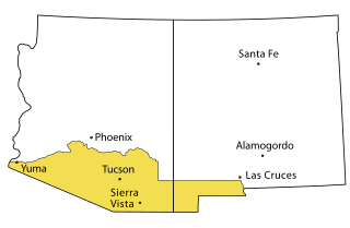
The Gadsden Purchase is a 29,640-square-mile (76,800 km2) region of present-day southern Arizona and southwestern New Mexico that the United States acquired from Mexico by the Treaty of Mesilla, which took effect on June 8, 1854. The purchase included lands south of the Gila River and west of the Rio Grande where the U.S. wanted to build a transcontinental railroad along a deep southern route, which the Southern Pacific Railroad later completed in 1881–1883. The purchase also aimed to resolve other border issues.
{{Short description|}

Mexicali is the capital city of the Mexican state of Baja California. The city, seat of the Mexicali Municipality, has a population of 689,775, according to the 2010 census, while the Calexico–Mexicali metropolitan area is home to 1,000,000 inhabitants on both sides of the Mexico–United States border. Mexicali is a regional economic and cultural hub for the border region of The Californias.
San Ysidro is a district of the City of San Diego, immediately north of the Mexico–United States border. It neighbors Otay Mesa West to the north, Otay Mesa to the east, and Nestor and the Tijuana River Valley to the west; together these communities form South San Diego, a practical exclave of the City of San Diego. Major thoroughfares include Beyer Boulevard and San Ysidro Boulevard.

Rosarito is a coastal city in Playas de Rosarito Municipality, Baja California, on the Pacific Coast of Mexico. As of 2010, the city had a population of 65,278. Located 10 miles (16 km) south of the US-Mexico border, Rosarito is a part of the greater San Diego–Tijuana region and one of the westernmost cities in Mexico. Rosarito is a major tourist destination, known for its beaches, resorts, and events like Baja Beach Fest.

The Kumeyaay, also known as 'Iipai-Tiipai or by the historical Spanish name Diegueño, is a tribe of Indigenous peoples of the Americas who live at the northern border of Baja California in Mexico and the southern border of California in the United States. They are an indigenous people of California.
Tecate is a city in Tecate Municipality, Baja California. It is across the Mexico–US border from Tecate, California. As of 2019, the city had a population of 108,860 inhabitants, while the metropolitan area has a population of 132,406 inhabitants. Tecate is part of the San Diego-Tijuana metropolitan area and the largest city between Tijuana and Mexicali. Tecate is a regional economic hub and popular tourist destination, known as home to the Tecate Port of Entry and to Tecate Beer.

San Quintín is a city in San Quintín Municipality, Baja California, located on the Pacific Coast of Mexico. The city had a population of 4777 in 2011. San Quintín is an important agricultural center for Baja California. The city is also an emerging tourist destination, known for its sand dunes and beaches.
XEPRS-AM is a commercial radio station licensed to Playas de Rosarito, a suburb of Tijuana in Baja California, Mexico. It broadcasts a sports/talk radio format, branded as "The Mightier 1090". The station can be heard across the San Diego-Tijuana, Los Angeles-Orange County, Riverside-San Bernardino and areas of Southern California.
Wirt G. Bowman was an American self-described capitalist. He was also an entrepreneur, speculator, casino owner, and one of the founders of the Agua Caliente Casino and Hotel in Tijuana, Baja California, Mexico.
San Diego–Tijuana is an international transborder agglomeration, straddling the border of the adjacent North American coastal cities of San Diego, California, United States, and Tijuana, Baja California, Mexico. The 2020 population of the region was 5,456,577, making it the largest bi-national conurbation shared between the United States and Mexico, and the second-largest shared between the US and another country. The conurbation consists of the San Diego metropolitan area, in the United States and the municipalities of Tijuana, Rosarito Beach (126,980), and Tecate (108,440) in Mexico. It is the third most populous region in the California–Baja California region, smaller only than the metropolitan areas of Greater Los Angeles and the San Francisco Bay Area.

The Spanish and Mexican governments made many concessions and land grants in Alta California and Baja California from 1775 to 1846. The Spanish Concessions of land were made to retired soldiers as an inducement for them to settle in the frontier. These Concessions reverted to the Spanish crown upon the death of the recipient.

Punta Colonet is a town located in Ensenada Municipality, Baja California, Mexico. Located 115 km (71 mi) south of the city of Ensenada, the community is located in an agriculturally productive region of Baja California spurred on by its location along Mexican Federal Highway 1 and proximity to agricultural markets in the United States.

Ornithostaphylos is a monotypic plant genus which contains the single species Ornithostaphylos oppositifolia, commonly known as the Baja California birdbush or Baja California manzanita. A large, evergreen shrub in the heather family, this species is near-endemic to northwestern Baja California, with a small population just north of the border in San Ysidro, California. It produces a much-branched inflorescence of white, urn-shaped flowers, and has leathery leaves that appear opposite or in whorls. These characteristics separate it from its close relatives in the region, which include manzanitas (Arctostaphylos), summer holly (Comarostaphylis) and mission manzanita (Xylococcus).

The Inaja Band of Diegueño Mission Indians of the Inaja and Cosmit Reservation is a federally recognized tribe of Kumeyaay Indians, who are sometimes known as Mission Indians.
Rancho San Antonio Abad, a land grant in what is now the western part of Tijuana in the Tijuana Municipality of Baja California, Mexico. The name of the rancho derives from Saint Anthony the Abbot.
Rancho San Isidro Ajajolojol, also known as Rancho Joljol or Toljol or Rancho Jesus Maria or San Ysidro Ajajolojol, was a land grant made to José López in 1836 by interim Governor Nicolas Gutierrez.