This article does not cite any sources . (March 2009) (Learn how and when to remove this template message) |
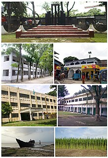
Ghagra Union is a place situated at the North-West side of Purbadhala Upazila in Bangladesh. It stands on the bank of the Kongsho river. The Dhobaura Upazila of Mymensingh District is situated at the North and West side of the Ghagra Union.
Purbadhala is an Upazila of Netrokona District in the Division of Mymensingh, Bangladesh.
Bangladesh, officially the People's Republic of Bangladesh, is a sovereign country in South Asia. It shares land borders with India and Myanmar (Burma). The country's maritime territory in the Bay of Bengal is roughly equal to the size of its land area. Bangladesh is the world's eighth most populous country as well as its most densely-populated, to the exclusion of small island nations and city-states. Dhaka is its capital and largest city, followed by Chittagong, which has the country's largest port. Bangladesh forms the largest and easternmost part of the Bengal region. Bangladeshis include people from a range of ethnic groups and religions. Bengalis, who speak the official Bengali language, make up 98% of the population. The politically dominant Bengali Muslims make the nation the world's third largest Muslim-majority country. Islam is the official religion of Bangladesh.
Dhobaura is an Upazila of Mymensingh District in the Division of Mymensingh, Bangladesh.
Coordinates: 24°43′07″N90°21′30″E / 24.7187°N 90.3582°E
A geographic coordinate system is a coordinate system that enables every location on Earth to be specified by a set of numbers, letters or symbols. The coordinates are often chosen such that one of the numbers represents a vertical position and two or three of the numbers represent a horizontal position; alternatively, a geographic position may be expressed in a combined three-dimensional Cartesian vector. A common choice of coordinates is latitude, longitude and elevation. To specify a location on a plane requires a map projection.
This Mymensingh Division location article is a stub. You can help Wikipedia by expanding it. |
The Monti Cimini, in English: Cimini Hills, are a range of densely wooded volcanic hills approximately 56 km (35 mi) north-west of Rome. They are part of the Antiapennine range, facing the Apennines main range towards the Tyrrhenian Sea. They are situated in the centre of Tuscia Viterbese, the highest point at Mount Cimino, 1,053 m (3,455 ft) above sea level. Lake Vico, a volcanic crater lake, is situated in the hills.
Banaripara is an Upazila of Barisal District in the Division of Barisal in southern-central Bangladesh.
Doshmina is an Upazila of Patuakhali District in the Division of Barisal, Bangladesh.
Galachipa is an Upazila of Patuakhali District in the Division of Barisal, Bangladesh. In March 2011, part of the upazila was separated to make the new Rangabali Upazila.
Kalapara is an Upazila of Patuakhali District in the Division of Barisal, Bangladesh.
Shahrasti is an upazila of Chandpur District in the Division of Chittagong, Bangladesh.
Balaganj is an upazila of Sylhet District in Sylhet Division, Bangladesh.
Dohar is an upazila of Dhaka District in the division of Dhaka, Bangladesh. The upazila is situated in the southernmost part of Dhaka District. The Padma River borders the southern part of the upazila.
Charbhadrasan or Char Bhadrasan is an Upazila of Faridpur District in the Division of Dhaka, Bangladesh.
Kaliakair is an Upazila of Gazipur District in the Division of Dhaka, Bangladesh.
Kapasia is an Upazila of Gazipur District in the Division of Dhaka, Bangladesh.
Kuliarchar is an Upazila of Kishoreganj District in the Division of Dhaka, Bangladesh.
Gafargaon is an Upazila of Mymensingh District in the Division of Mymensingh, Bangladesh.
Bhuyanpur is an Upazila of Tangail District in the Division of Dhaka, Bangladesh.
Kalihati is an Upazila of Tangail District, Dhaka Division, Bangladesh.
Daulatpur is an Upazila of Kushtia District in the Division of Khulna, Bangladesh.
Pirgachha is an upazila of Rangpur District in the division of Rangpur, Bangladesh.
Mirpur is a thana of Dhaka city, Bangladesh. It is bounded by Pallabi Thana to the north, Mohammadpur Thana to the south, Kafrul to the east, and Savar Upazila to the west.
Meghna is a newly formed Upazila. This upazila consists of 8 union. In the end of 1998, Meghna was declared as the upazila. This upazila has been formed with 5 union of Daudkandi upazila and 03 union of Homna upazila. As the Meghna river flows on one side of this upazila, Meghna Upazila is named after the proposal of the name of Meghna. Here is the list of Union: