Purbadhala Upazila

Last updated • 1 min readFrom Wikipedia, The Free Encyclopedia
Purbadhala
পূর্বধলা
Purbadhala in Mymensingh division (Bangladesh).svg
Coordinates: 24°56′N90°36.2′E / 24.933°N 90.6033°E / 24.933; 90.6033
Country Flag of Bangladesh.svg  Bangladesh
Division Mymensingh Division
District Netrokona District
Area
  Total308.03 km2 (118.93 sq mi)
Population
 (2022) [1]
  Total332,398
  Density1,100/km2 (2,800/sq mi)
Time zone UTC+6 (BST)
Postal code
2410 [2]
Website Official Map of Purbadhala

Purbadhala (Bengali : পূর্বধলা) is an upazila of Netrokona District [3] in the Division of Mymensingh, Bangladesh.

Contents

Geography

Purbadhala is located at 24°56′00″N90°36′10″E / 24.9333°N 90.6028°E / 24.9333; 90.6028 . It has 68083 households and total area 308.03 km2 (118.93 sq mi). [4] It is bounded by Durgapur and Kalmakanda upazilas on the north, Kendua and Gauripur upazilas on the south, Barhatta and Atpara upazilas on the east, Purbadhala upazila on the west. [3]

Demographics

Religions in Purbadhala Upazila (2022) [5]
ReligionPercent
Islam
95.08%
Hinduism
4.66%
Other or not stated
0.26%

According to the 2011 Census of Bangladesh, Purbadhala Upazila had 68,083 households and a population of 310,834. 87,051 (28.01%) were under 10 years of age. Purbadhala has a literacy rate (age 7 and over) of 42.78%, compared to the national average of 51.8%, and a sex ratio of 1029 females per 1000 males. 22,132 (7.12%) lived in urban areas. [6] [7]

As of the 1991 Bangladesh census, Purbadhala had a population of 235,675. Males constituted 50.79% of the population, and females 49.21%. This Upazila's eighteen up population was 114,878. Purbadhala had an average literacy rate of 23% (7+ years), and the national average of 32.4% literate. [8]

Administration

Netrokona Thana was formed in 1874 and it was turned into an upazila in 1983. [3]

Purbadhala Upazila is divided into 11 union parishads: Agia, Bairaty, Bishkakuni, Dhalamulgaon, Ghagra, Gohalakanda, Hogla, Jaria, Khalishaur, Narandia, and Purbadhala. The union parishads are subdivided into 224 mauzas and 336 villages. [9]

Chairman:Sujon, from Awame League Vice Chairman: Masum Mostofa, from Jamayet e Islam

See also

Related Research Articles

<span class="mw-page-title-main">Patuakhali Sadar Upazila</span> Upazila in Barisal, Bangladesh

Patuakhali Sadar is an upazila of Patuakhali District in the Division of Barisal, Bangladesh.

<span class="mw-page-title-main">Haimchar Upazila</span> Upazila in Chittagong, Bangladesh

Haimchar is an upazila of Chandpur District in the Division of Chittagong, Bangladesh.

<span class="mw-page-title-main">Nawabganj Upazila, Dhaka</span> Upazila in Dhaka, Bangladesh

Nawabganj is an upazila of Dhaka District in the Dhaka Division, Bangladesh.

<span class="mw-page-title-main">Charbhadrasan Upazila</span> Upazila in Dhaka, Bangladesh

Charbhadrasan or Char Bhadrasan is an upazila of Faridpur District in the Division of Dhaka, Bangladesh.

<span class="mw-page-title-main">Sreepur Upazila, Gazipur</span> Upazila in Dhaka, Bangladesh

Sreepur Upazila also spelled Shreepur Upazila is an upazila (sub-district) of Gazipur District in central Bangladesh, part of the Dhaka Division.

<span class="mw-page-title-main">Nikli Upazila</span> Upazila in Dhaka, Bangladesh

Nikli is an upazila of Kishoreganj District in the Division of Dhaka, Bangladesh.

<span class="mw-page-title-main">Tarail Upazila</span> Upazila in Dhaka, Bangladesh

Tarail is an upazila of Kishoreganj District in the Division of Dhaka, Bangladesh.

<span class="mw-page-title-main">Araihazar Upazila</span> Upazila in Dhaka, Bangladesh

Araihazar is an upazila (sub-district) of the Narayanganj District in Bangladesh, part of the Dhaka Division.

<span class="mw-page-title-main">Rupganj Upazila</span> Upazila in Dhaka, Bangladesh

Rupganj is an upazila of Narayanganj District in the Division of Dhaka, Bangladesh.

<span class="mw-page-title-main">Barhatta Upazila</span> Upazila in Mymensingh, Bangladesh

Barhatta is an upazila of Netrokona District, located in Bangladesh's Mymensingh Division.

<span class="mw-page-title-main">Durgapur Upazila, Netrokona</span> Upazila in Mymensingh, Bangladesh

Durgapur is an upazila of the Netrokona District in the Mymensingh Division of Bangladesh.

<span class="mw-page-title-main">Khaliajuri Upazila</span> Upazila in Mymensingh, Bangladesh

Khaliajuri is an upazila (sub-district) of the Netrokona District in Bangladesh, part of the Mymensingh Division.

<span class="mw-page-title-main">Kalmakanda Upazila</span> Upazila in Mymensingh, Bangladesh

Kalmakanda, originally Karamakhanda, is an upazila of Netrokona District in the Division of Mymensingh, Bangladesh.

<span class="mw-page-title-main">Kendua Upazila</span> Upazila in Mymensingh, Bangladesh

Kendua is an upazila of Netrokona District in the Division of Mymensingh, Bangladesh.

<span class="mw-page-title-main">Madan Upazila</span> Upazila in Netrakona district of Mymensingh Division, Bangladesh

Madan is an upazila of Netrokona District in the Division of Mymensingh, Bangladesh.

<span class="mw-page-title-main">Netrokona Sadar Upazila</span> Upazila in Mymensingh, Bangladesh

Netrokona Sadar is an upazila (sub-district) of Netrokona District under Mymensingh Division, Bangladesh.

<span class="mw-page-title-main">Rupsa Upazila</span> Upazila in Khulna, Bangladesh

Rupsa is an upazila of Khulna District in the Division of Khulna, Bangladesh.

<span class="mw-page-title-main">Mirpur Upazila</span> Upazila in Khulna, Bangladesh

Mirpur (Bengali: মিরপুর is an upazila of Kushtia District in the Division of Khulna, Bangladesh. Mirpur Thana was formed in 1885 and it was turned into an upazila in 1983.

<span class="mw-page-title-main">Shalikha Upazila</span> Upazila in Khulna, Bangladesh

Shalikha is an upazila of Magura District in the Division of Khulna, Bangladesh.

<span class="mw-page-title-main">Mohanganj Upazila</span> Upazila in Mymensingh, Bangladesh

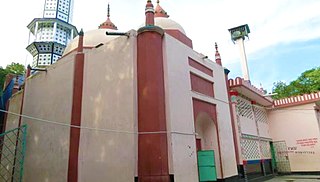
Mohanganj is an upazila of Netrokona District in the Mymensingh division of Bangladesh. It is one of the 10 upazilas of Netrakona district. Mohanganj is largely known as the capital of Lower Bangladesh as it is the economic heart of Lower Bangladesh generally known as Haor.

References

  1. National Report (PDF). Population and Housing Census 2022. Vol. 1. Dhaka: Bangladesh Bureau of Statistics. November 2023. p. 401. ISBN   978-9844752016.
  2. "Bangladesh Postal Code". Dhaka: Bangladesh Postal Department under the Department of Posts and Telecommunications of the Ministry of Posts, Telecommunications and Information Technology of the People's Republic of Bangladesh. 20 October 2024.
  3. 1 2 3 Syed Marufuzzaman (2012), "Purbadhala Upazila", in Sirajul Islam and Ahmed A. Jamal (ed.), Banglapedia: National Encyclopedia of Bangladesh (Second ed.), Asiatic Society of Bangladesh
  4. "পূর্বধলা উপজেলা". http. Retrieved 2021-07-30.
  5. Population and Housing Census 2022 - District Report: Netrokona (PDF). District Series. Dhaka: Bangladesh Bureau of Statistics. June 2024. ISBN   978-984-475-237-5.
  6. "Community Tables: Netrokona district" (PDF). bbs.gov.bd. 2011.
  7. "Bangladesh Population and Housing Census 2011 Zila Report – Netrokona" (PDF). bbs.gov.bd. Bangladesh Bureau of Statistics.
  8. "Population Census Wing, BBS". Archived from the original on 2005-03-27. Retrieved November 10, 2006.
  9. "District Statistics 2011: Netrokona" (PDF). Bangladesh Bureau of Statistics. Archived from the original (PDF) on 13 November 2014. Retrieved 14 July 2014.