Dhobaura Upazila

Last updated • 3 min readFrom Wikipedia, The Free Encyclopedia
Dhobaura
ধোবাউড়া
Dhobaura in Mymensingh division (Bangladesh).svg
Coordinates: 25°5.5′N90°32′E / 25.0917°N 90.533°E / 25.0917; 90.533
Country Flag of Bangladesh.svg  Bangladesh
Division Mymensingh
District Mymensingh
Government
  Upazila ChairmanDavid Rana Chisim
  Vice ChairmanMd. Abul Fazal
Area
  Total
252.23 km2 (97.39 sq mi)
Population
 (2022) [1]
  Total
217,467
  Density860/km2 (2,200/sq mi)
Time zone UTC+6 (BST)
Postal code
2416 [2]
Website dhobaura.mymensingh.gov.bd

Dhobaura (Bengali : ধোবাউড়া) is an upazila of the Mymensingh District in Bangladesh. [3]

Contents

History

Since ancient times, Dhobaura has been inhabited by the Garo people. During the Mughal period, a mosque was built in the village of Darsha which is now in ruins. [4]

Dhobaura was formerly known as Jikkowa Bazar. In the mid-18th century, the area was home to Babu Gauriballabh Sen, a prominent agriculturalist. At that time several dhobis led by a dhobi named Sita lived on the bank of a pond (today known as Sita Dighi) that was part of Sen's agricultural land. One day, Sita went missing and could not be found. Her body was found a few days later, floating in the pond. Thinking it was a ghostly incident, Sita's dhobis left the bank and migrated to an unknown place without informing anyone. The village then came to be known as Dhobaura, meaning floating dhoba in the Bengali language. A mouza centered in Dhobaura was later established and not long after it became a union parishad. In 1976, Dhobaura became a thana and in 1983 it was upgraded to an upazila. [4]

From 1937 to 1949, Moni Singh's tanka movement spread to Dhobaura. During the Bangladesh Liberation War of 1971, a confrontation took place between the freedom fighters and the Pakistan Army on 19 July 1971. 11 people were killed, including two freedom fighters. On 3 October at midnight, the Pakistani army's surprise attacke on the Mukti Bahini camp at Guatala Bazar, led to the death of four freedom fighters. A mass killing was conducted the next day in the same place as well as in Taraikandi Ferry Ghat leading to 120 deaths. 7 mass graves were discovered in Guatala, Taraikandi, Zigatala, Defulia Para, Digalbagh, Milagara, and Goborchena.

Geography

Dhobaura Upazila (Mymensingh district) with an area of 252.23  km2, is bounded by the Indian state of Meghalaya on the north, Phulpur and Purbadhala upazilas on the south, Durgapur upazila on the east and Haluaghat upazila on the west. The main rivers are Nitai and Kangsa. There are many hillocks in the northern region of the upazila.

Dhobaura is located at 25°05′30″N90°32′00″E / 25.0917°N 90.5333°E / 25.0917; 90.5333 . It has 44,007 households and a total area of 252.23  km2.

Demographics

Religions in Dhobaura Upazila (2022) [5]
ReligionPercent
Islam
92.13%
Christianity
4.68%
Hinduism
3.16%
Other or not stated
0.03%

According to the 2011 Census of Bangladesh, Dhobaura Upazila had 44,007 households and a population of 196,284. 59,105 (30.11%) people were under 10 years of age. Dhobaura has a literacy rate (age 7 and over) of 29.36%, compared to the national average of 51.8%, and a sex ratio of 1035 females per 1000 males. 6,927 (3.53%) lived in urban areas. [6] [7]

Bengali Muslims are the majority community in the upazila. 10,765 (5.48%) were members of ethnic population groups, mainly 9,803 Garo and 908 Hajong. Christianity is the second-largest religion, mainly present among the Garo people. Hinduism is the third-largest religion, practiced by the Hajong. Languages prevalent in the upazila include Bengali, Arabic, English, Garo and Hajong.

Economy and tourism

A porcelain mine was discovered in the village of Vedikura in Dakshin Maijpara union. [3] Several Dhobaura's residents are employed abroad in countries such as Malaysia, Saudi Arabia, Bahrain, Kuwait, Singapore and the United Arab Emirates.

There are a number of tourist attractions in Dhobaura Upazila. The historic village of Darsha has a very old 3.3-acre pond known as Patharkata as well as ruins of a mosque dating back to the Mughal era. The 7.4-acre Dharam Shah reservoir in Langaljora, Gamaritala is also quite popular. Dhobaura is also home to the practice of bullfighting. [4]

Administration

Dhobaura thana, now an upazila, was established in 1976.

Porakandulia. The union parishads are subdivided into 99 mouzas and 164 villages. [8]

The area of the town is 3.82  km2. The town has one dak bungalow.

Education

Average literacy is 65%; males 68% and females 62%. Educational institutions: college 3, high school 20, junior high school 3, madrasa 6, government primary school 43, non-government 44 and kindergarten school 6.

See also

Related Research Articles

<span class="mw-page-title-main">Netrokona District</span> District of Bangladesh in Mymensingh

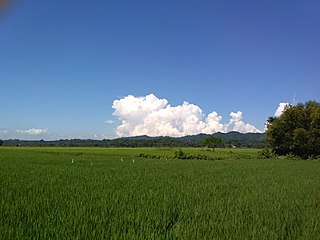
Netrokona District is a district of Mymensingh Division in north-east of Bangladesh.

<span class="mw-page-title-main">Akhaura Upazila</span> Upazila in Chittagong, Bangladesh

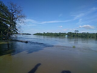
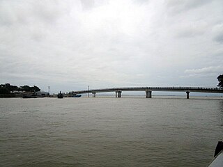
Akhaura is an upazila of Brahmanbaria District, a district under Chattogram, Bangladesh. Akhaura Upazila has an area of 99.28 km2. The main river that run through this upazila is the Titas River. Akhaura played an important historical role during both World War II and Liberation War of Bangladesh.

<span class="mw-page-title-main">Ramu Upazila</span> Upazila in Chittagong, Bangladesh

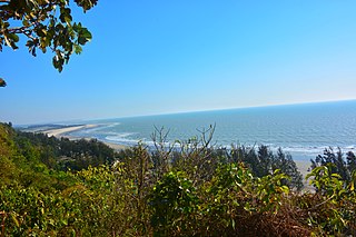
Ramu is an upazila of Cox's Bazar District in the Division of Chittagong, Bangladesh.

<span class="mw-page-title-main">Balaganj Upazila</span> Upazila in Sylhet, Bangladesh

Balaganj is an upazila of Sylhet District in Sylhet Division, Bangladesh.

<span class="mw-page-title-main">Baksiganj Upazila</span> Upazila in Mymensingh Division, Bangladesh

Bakshiganj is an upazila of Jamalpur District in the Division of Mymensingh, Bangladesh.

<span class="mw-page-title-main">Pakundia Upazila</span> Upazila in Kishoreganj District, Bangladesh

Pakundia is an upazila (subdistrict) in Kishoreganj District, Dhaka Division, Bangladesh. Its total land area is 180.52 square kilometres. It has a population of 237,218 residents. It was formed in 1922 as a thana. On 14 September 1983, it was turned into an upazila.

<span class="mw-page-title-main">Bhaluka Upazila</span> Upazila in Mymensingh Division, Bangladesh

Bhaluka is an upazila of the Mymensingh District located in Bangladesh. It is one of the oldest small business hubs in the area.

<span class="mw-page-title-main">Fulbaria Upazila</span> Upazila in Mymensingh, Bangladesh

Fulbaria is an upazila of the Mymensingh District in Bangladesh.

Gafargaon Upazila Upazila in Mymensingh Division, Bangladesh

Gafargaon is an upazila of Mymensingh District in the Division of Mymensingh, Bangladesh.

<span class="mw-page-title-main">Haluaghat Upazila</span> Upazila in Mymensingh Division, Bangladesh

Haluaghat is an upazila of Mymensingh District in the Division of Mymensingh, Bangladesh.

<span class="mw-page-title-main">Trishal Upazila</span> Upazila in Mymensingh, Bangladesh

Trishal is an upazila of Mymensingh District in the Division of Mymensingh, Bangladesh. The famous Bengali poet Kazi Nazrul Islam attended a school here.

<span class="mw-page-title-main">Belabo Upazila</span> Upazila in Dhaka, Bangladesh

Belabo is an upazila of the Narsingdi District of Bangladesh, located in the Dhaka Division. Here the 2,500-year-old civilisation of Wari-Bateshwar has been discovered. It is believed that it was a port city with foreign trade with Ancient Rome, Southeast Asia and other regions. It is the oldest city so far discovered after Indus Valley civilisation. Though part of Narsingdi, the Bengali dialect spoken by the people of Belabo is similar to that of Greater Mymensingh.

<span class="mw-page-title-main">Atpara Upazila</span> Upazila in Mymensingh, Bangladesh

Atpara is the smallest upazila of Netrokona District, in the Division of Mymensingh, Bangladesh.

<span class="mw-page-title-main">Barhatta Upazila</span> Upazila in Mymensingh, Bangladesh

Barhatta is an upazila of Netrokona District, located in Bangladesh's Mymensingh Division.

<span class="mw-page-title-main">Durgapur Upazila, Netrokona</span> Upazila in Mymensingh, Bangladesh

Durgapur is an upazila of the Netrokona District in the Mymensingh Division of Bangladesh.

<span class="mw-page-title-main">Khaliajuri Upazila</span> Upazila in Mymensingh, Bangladesh

Khaliajuri is an upazila (sub-district) of the Netrokona District in Bangladesh, part of the Mymensingh Division.

<span class="mw-page-title-main">Kalmakanda Upazila</span> Upazila in Mymensingh, Bangladesh

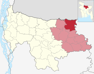
Kalmakanda, originally Karamakhanda, is an upazila of Netrokona District in the Division of Mymensingh, Bangladesh.

<span class="mw-page-title-main">Netrokona Sadar Upazila</span> Upazila in Mymensingh, Bangladesh

Netrokona Sadar is an upazila (sub-district) of Netrokona District under Mymensingh Division, Bangladesh.

<span class="mw-page-title-main">Nalitabari Upazila</span> Upazila in Mymensingh Division, Bangladesh

Nalitabari is an upazila of Sherpur District in the Division of Mymensingh, Bangladesh.

<span class="mw-page-title-main">Sreebardi Upazila</span> Upazila in Mymensingh Division, Bangladesh

Sreebardi is an upazila of Sherpur District in the Division of Mymensingh, Bangladesh.

References

  1. National Report (PDF). Population and Housing Census 2022. Vol. 1. Dhaka: Bangladesh Bureau of Statistics. November 2023. p. 401. ISBN   978-9844752016.
  2. "Bangladesh Postal Code". Dhaka: Bangladesh Postal Department under the Department of Posts and Telecommunications of the Ministry of Posts, Telecommunications and Information Technology of the People's Republic of Bangladesh. 20 October 2024.
  3. 1 2 Abdul Motaleb Talukder (2012). "Dhobaura Upazila". In Sirajul Islam; Miah, Sajahan; Khanam, Mahfuza; Ahmed, Sabbir (eds.). Banglapedia: the National Encyclopedia of Bangladesh (Online ed.). Dhaka, Bangladesh: Banglapedia Trust, Asiatic Society of Bangladesh. ISBN   984-32-0576-6. OCLC   52727562. OL   30677644M . Retrieved 25 January 2025.
  4. 1 2 3 উপজেলার ঐতিহ্য [Tradition of the Upazila]. Dhobaura Upazila (in Bengali).
  5. Population and Housing Census 2022 - District Report: Mymensingh (PDF). District Series. Dhaka: Bangladesh Bureau of Statistics. June 2024. ISBN   978-984-475-226-9.
  6. "Community Tables: Mymensingh district" (PDF). bbs.gov.bd. 2011.
  7. "Bangladesh Population and Housing Census 2011 Zila Report – Mymensingh" (PDF). bbs.gov.bd. Bangladesh Bureau of Statistics.
  8. "District Statistics 2011: Mymensingh" (PDF). Bangladesh Bureau of Statistics. Archived from the original (PDF) on 13 November 2014. Retrieved 14 July 2014.