Related Research Articles
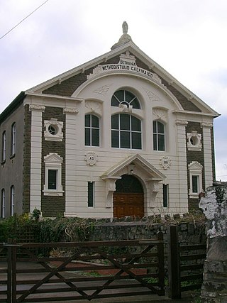
Glanamman is a Welsh mining village in the valley of the River Amman in Carmarthenshire. Glanamman has long been a stronghold of the Welsh language; village life is largely conducted in Welsh. Like the neighbouring village of Garnant it experienced a coal-mining boom in the 19th and early 20th centuries, but the last big colliery closed in 1947 and coal has been extracted fitfully since then.

Carmarthen East and Dinefwr is a constituency of the House of Commons of the Parliament of the United Kingdom represented since 2010 by Jonathan Edwards of Plaid Cymru. It elects one Member of Parliament (MP) by the first past the post system of election. It was created in 1997, mostly from the former seat of Carmarthen.

Llanelli is a constituency of the House of Commons of the Parliament of the United Kingdom. From 1918 to 1970 the official spelling of the constituency name was Llanelly. It elects one Member of Parliament (MP) by the first past the post system of election. Since 2005, it is currently represented by Nia Griffith of the Labour Party.
Cwmamman is a community in Carmarthenshire, about 12 miles north of Swansea in southwest Wales. Literally meaning "Amman valley", it takes its name from the River Amman which runs through the area.

Carmarthenshire County Council is the local authority for the county of Carmarthenshire, Wales. It provides a range of services including education, planning, transport, social services and public safety. The council is one of twenty-two unitary authorities that came into existence on 1 April 1996 under the provisions of the Local Government (Wales) Act 1994. It took over local government functions previously provided by the three district councils of Carmarthen, Dinefwr, and Llanelli, as well as the county-level services in the area from Dyfed County Council, all of which councils were abolished at the same time.
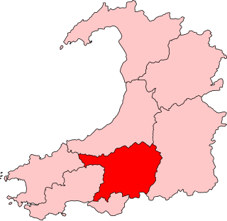
Carmarthen East and Dinefwr is a constituency of the Senedd. It elects one Member of the Senedd by the first past the post method of election. Also, however, it is one of eight constituencies in the Mid and West Wales electoral region, which elects four additional members, in addition to eight constituency members, to produce a degree of proportional representation for the region as a whole.

Llanelli is a constituency of the Senedd. It elects one Member of the Senedd by the first past the post method of election. Also, however, it is one of eight constituencies in the Mid and West Wales electoral region, which elects four additional members, in addition to eight constituency members, to produce a degree of proportional representation for the region as a whole.
The first election to Dyfed County Council was held in April 1973. It was followed by the 1977 election. The vast majority of the councillors elected had been members of one of the three previous county authorities which were merged to create Dyfed, namely Cardiganshire, Carmarthenshire, and Pembrokeshire.
Carmarthen Town North was an electoral ward, representing part of the community of Carmarthen, Carmarthenshire, Wales.
Carmarthen Town South was an electoral ward, representing part of the community of Carmarthen, Carmarthenshire, Wales. Much of its southern border was defined by the River Towy, with the Carmarthen Town North and Carmarthen Town West wards to the north.
Ammanford is the name of an electoral ward to Carmarthenshire County Council, representing the community of Ammanford, Carmarthenshire, Wales.
Betws is an electoral ward, representing part of the community of Betws, near Ammanford, Carmarthenshire, Wales.
Bigyn is an electoral ward, representing part of the community of Llanelli, Carmarthenshire, Wales. It is a three-member ward for the purposes of elections to Carmarthenshire County Council, with the number of councillors being increased from two to three for the elections held in May 2022.
Dafen is an electoral ward, representing the immediate area around the village of Dafen in the community of Llanelli Rural, Carmarthenshire, Wales.

The 2022 Welsh local elections took place on 5 May 2022 to elect members of all twenty-two local authorities in Wales. They were held alongside other local elections in the United Kingdom. The previous elections were held in 2017.
The 2022 Carmarthenshire County Council election took place on Thursday 5 May 2022 to elect 75 members to Carmarthenshire Council. On the same day, elections were held to the other 21 local authorities and to community councils in Wales as part of the 2022 Welsh local elections.
Hengoed is an electoral ward for Carmarthenshire County Council and Llanelli Rural Council in Llanelli Rural, Carmarthenshire, Wales.
Trelech is the name of an electoral ward for Carmarthenshire County Council in Carmarthenshire, Wales. It is represented by one county councillor.
Llandeilo is the name of an electoral ward for Carmarthenshire County Council, which includes the communities of Llandeilo and Dyffryn Cennen, in Carmarthenshire, Wales. It is represented by one county councillor.
Pontamman was the name of an electoral ward for Carmarthenshire County Council, which included parts of the town and community of Ammanford, Carmarthenshire, Wales. It was represented by one county councillor.
References
- ↑ "The County of Carmarthenshire (Electoral Arrangements) Order 2021". Legislation.gov.uk. 22 September 2021. Retrieved 24 July 2022.
- ↑ "Election maps". Ordnance Survey . Retrieved 24 July 2022.
- ↑ UK Census (2011). "Local Area Report – Glanamman Ward (as of 2011) (W05000474)". Nomis. Office for National Statistics . Retrieved 24 July 2022.
- ↑ "Review of the Electoral Arrangements of the County of Carmarthenshire – Final Recommendations Report" (PDF). Local Democracy and Boundary Commission for Wales. October 2019. pp. 9, 11. Retrieved 24 July 2022.
- ↑ "Local Elections 2022: County Council election results - Laugharne Township". Carmarthenshire County Council. Retrieved 24 July 2022.
- 1 2 Robert Dalling (6 May 2022). "The full election result for Carmarthenshire as Plaid remains the largest party despite leader losing seat". Wales Online . Retrieved 24 July 2022.
- ↑ "Dinefwr Welsh District Council Election Results 1973-1993" (PDF). The Elections Centre (Plymouth University). Retrieved 24 July 2022.
- ↑ "Dyfed County Council Election Results 1973-1993" (PDF). The Elections Centre (Plymouth University). Retrieved 24 July 2022.
- ↑ "Carmarthenshire County Council Election Results 1995-2012" (PDF). The Elections Centre (Plymouth University). Retrieved 23 July 2022.
- ↑ "The top 23 most interesting wards to watch in Wales at the 2022 local elections - Glanamman, Carmarthenshire". Nation.Cymru. 2 May 2022. Retrieved 24 July 2022.
- ↑ Rebecca Wilks (7 May 2022). "Carmarthenshire local elections result: Plaid Cymru secures majority". South Wales Guardian . Retrieved 24 July 2022.
- ↑ "Carmarthenshire County Council election results". The Carmarthenshire Herald. 5 May 2017. Retrieved 24 July 2022.