
The Main is the longest tributary of the Rhine. It rises as the White Main in the Fichtel Mountains of northeastern Bavaria and flows west through central Germany for 525 kilometres (326 mi) to meet the Rhine below Rüsselsheim, Hesse. The cities of Mainz and Wiesbaden are close to the confluence.

The Meuse or Maas is a major European river, rising in France and flowing through Belgium and the Netherlands before draining into the North Sea from the Rhine–Meuse–Scheldt delta. It has a total length of 925 km.

The Rhine is one of the major European rivers. The river begins in the Swiss canton of Graubünden in the southeastern Swiss Alps. It forms the Swiss-Liechtenstein border and partly the Swiss-Austrian and Swiss-German borders. After that the Rhine defines much of the Franco-German border, after which it flows in a mostly northerly direction through the German Rhineland. Finally in Germany, the Rhine turns into a predominantly westerly direction and flows into the Netherlands where it eventually empties into the North Sea. It drains an area of 9,973 km2.

North Rhine-Westphalia or North-Rhine/Westphalia, commonly shortened to NRW, is a state (Land) in Western Germany. With more than 18 million inhabitants, it is the most populous state in Germany. Apart from the city-states, it is also the most densely populated state in Germany. Covering an area of 34,084 km2 (13,160 sq mi), it is the fourth-largest German state by size.
The Westerwald is a low mountain range on the right bank of the river Rhine in the German federal states of Rhineland-Palatinate, Hesse and North Rhine-Westphalia. It is a part of the Rhenish Massif. Its highest elevation, at 657 m above sea level, is the Fuchskaute in the High Westerwald.

The Ruhr, also referred to as the Ruhr area, sometimes Ruhr district, Ruhr region, or Ruhr valley, is a polycentric urban area in North Rhine-Westphalia, Germany. With a population density of 2,800/km2 and a population of over 5 million (2017), it is the largest urban area in Germany and the third of the European Union. It consists of several large cities bordered by the rivers Ruhr to the south, Rhine to the west, and Lippe to the north. In the southwest it borders the Bergisches Land. It is considered part of the larger Rhine-Ruhr metropolitan region of more than 10 million people, which is the third largest in Western Europe, behind only London and Paris.

The Alpine Rhine Valley is a glacial alpine valley, formed by the Alpine Rhine, the part of the Rhine between the confluence of the Anterior Rhine and Posterior Rhine at Reichenau and Lake Constance. It covers three countries, with sections of the river demarcating the borders between Austria and Switzerland and between Liechtenstein and Switzerland. The full length of the Alpine Rhine is 93.5 km.

The Lahn is a 245.6-kilometre-long (152.6 mi), right tributary of the Rhine in Germany. Its course passes through the federal states of North Rhine-Westphalia (23.0 km), Hesse (165.6 km), and Rhineland-Palatinate (57.0 km).

The Roer or Rur is a major river that flows through portions of Belgium, Germany and the Netherlands. It is a right (eastern) tributary to the Meuse. About 90 percent of the river's course is in Germany.

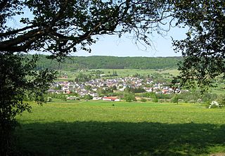
The Oude IJssel or Issel is a river in Germany and the Netherlands approximately 82 km (51 mi) long. It is a right tributary of the river IJssel. Oude IJssel is Dutch for "Old IJssel"; the Oude IJssel was the upper course of the IJssel until the connection with the Rhine was dug, possibly in the Roman era.

The main European watershed is the drainage divide ("watershed") which separates the basins of the rivers that empty into the Atlantic Ocean, the North Sea and the Baltic Sea from those that feed the Mediterranean Sea, the Adriatic Sea and the Black Sea. It stretches from the tip of the Iberian Peninsula at Gibraltar in the southwest to the endorheic basin of the Caspian Sea in Russia in the northeast.
A water board is a regional or national organisation that has very different functions from one country to another. The functions range from flood control and water resources management at the regional or local level, water charging and financing at the river basin level (France), bulk water supply, regulation of pricing and service quality of drinking water supply at the national level (Kenya) or the coordination of water resources policies between various Ministries and agencies at the national level together with the regulation of drinking water supply.

High Rhine is the name of the part of the Rhine between Lake Constance and the city of Basel, flowing in a general east-to-west direction and forming mostly the Germany–Switzerland border. It is the first of four named sections of the Rhine between Lake Constance and the river delta at the North Sea.

The Sorpe Dam is a dam on the Sorpe river, near the small town of Sundern in the district of Hochsauerland in North Rhine-Westphalia, Germany.

The Danube is the second-longest river in Europe, after the Volga in Russia. It flows through Central and Southeastern Europe, from the Black Forest south into the Black Sea. A large and historically important river, it was once a frontier of the Roman Empire. In the 21st century, it connects ten European countries, running through their territories or marking a border. Originating in Germany, the Danube flows southeast for 2,850 km (1,770 mi), passing through or bordering Austria, Slovakia, Hungary, Croatia, Serbia, Romania, Bulgaria, Moldova, and Ukraine. Among the many cities on the river are four national capitals: Vienna, Bratislava, Budapest, and Belgrade. Its drainage basin amounts to 817,000 km2 (315,000 sq mi) and extends into nine more countries.
Germany is a country in Central and Western Europe that stretches from the Alps, across the North European Plain to the North Sea and the Baltic Sea. It is the second-most populous country in Europe after Russia, and is seventh-largest country by area in the continent. The area of Germany ranked 63rd and covers 357,600 km2 (138,070 sq mi), consisting of 349,250 km2 (134,846 sq mi) of land and 8,350 km2 (3,224 sq mi) of waters, smaller than Japan but larger than Republic of the Congo.

Karl-Josef Laumann is a German politician of the Christian Democratic Union (CDU). Since 2017, he has been the State Minister of Labor, Health and Social Affairs of North Rhine-Westphalia, an office he previously held between 2005 and 2010.
Kleine Aa is a river of North Rhine-Westphalia, Germany, a tributary of the Aabach. Thus it is part of the Rhine River Basin.
Martin Renner is a German politician of Alternative for Germany (AfD), previously of CDU. Martin Renner has served as a member of the Bundestag from the state of North Rhine-Westphalia since 2017.
The Deltarhine region is a river basin district of the Rhine basin, consisting of the Dinkel, the Berkel, and the Oude IJssel regional river basins. It covers 11,000 square kilometres and straddles the German-Dutch border, with 65% in the Netherlands and 35% in Germany.

