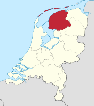
Friesland, historically and traditionally known as Frisia, named after the Frisians, is a province of the Netherlands located in the country's northern part. It is situated west of Groningen, northwest of Drenthe and Overijssel, north of Flevoland, northeast of North Holland, and south of the Wadden Sea. As of January 2023, the province had a population of about 660,000, and a total area of 5,753 km2 (2,221 sq mi).
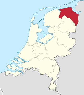
Groningen is the northeasternmost province of the Netherlands. It borders on Friesland to the west, Drenthe to the south, the German state of Lower Saxony to the east, and the Wadden Sea to the north. As of January 2023, Groningen had a population of about 596,000, and a total area of 2,955 km2 (1,141 sq mi).

The Kingdom of Holland was the successor state of the Batavian Republic. It was created by Napoleon Bonaparte in March 1806 in order to strengthen control over the Netherlands by replacing the republican government with a monarchy. Since becoming emperor in 1804, Napoleon sought to extirpate republican tendencies in territories France controlled, and placed his third brother, Louis Bonaparte, on the throne of the puppet kingdom. The name of the leading province, Holland, now designated the whole country. In 1807, East Frisia and Jever were added to the kingdom.

North Brabant, also unofficially called Brabant, is a province in the south of the Netherlands. It borders the provinces of South Holland and Gelderland to the north, Limburg to the east, Zeeland to the west, and the Flemish provinces of Antwerp and Limburg to the south. The northern border follows the Meuse westward to its mouth in the Hollands Diep strait, part of the Rhine–Meuse–Scheldt delta. North Brabant had a population of about 2,626,000 as of January 2023. Major cities in North Brabant are Eindhoven, Tilburg, Breda, its provincial capital 's-Hertogenbosch, and Helmond

Drenthe is a province of the Netherlands located in the northeastern part of the country. It is bordered by Overijssel to the south, Friesland to the west, Groningen to the north, and the German state of Lower Saxony to the east. As of January 2023, Drenthe had a population of about 502,000, and a total area of 2,680 km2 (1,030 sq mi).

Gelderland, also known as Guelders in English, is a province of the Netherlands, located in the centre-east of the country. With a total area of 5,136 km2 (1,983 sq mi) of which 176 km2 (68 sq mi) is water, it is the largest province of the Netherlands by land area, and second by total area. Gelderland shares borders with six other provinces and the German state of North Rhine-Westphalia.
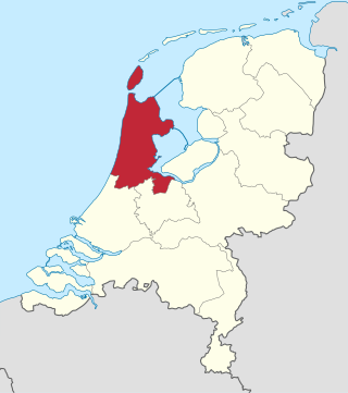
North Holland is a province of the Netherlands in the northwestern part of the country. It is located on the North Sea, north of South Holland and Utrecht, and west of Friesland and Flevoland. As of January 2023, it had a population of about 2,952,000 and a total area of 4,092 km2 (1,580 sq mi), of which 1,429 km2 (552 sq mi) is water.
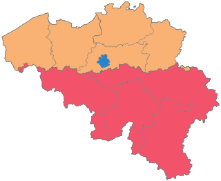
The Kingdom of Belgium is divided into three regions. Two of these regions, Flanders and Wallonia, are each subdivided into five provinces. The third region, Brussels, does not belong to any province, nor is it subdivided into provinces. Instead, it has amalgamated both regional and provincial functions into a single "Capital Region" administration.

The States General of the Netherlands is the supreme bicameral legislature of the Netherlands consisting of the Senate and the House of Representatives. Both chambers meet at the Binnenhof in The Hague.
The Generality Lands, Lands of the Generality or Common Lands were about one-fifth of the territories of the United Provinces of the Netherlands, that were directly governed by the States-General. Unlike the seven provinces of Holland, Zeeland, Utrecht, Guelders, Overijssel, Friesland and Groningen, these territories had no States-Provincial and were not represented in the central government. At the time of the Union of Utrecht, these territories were under Spanish control, and would only be conquered by the Dutch Republic later in the war. From an economic point of view, they were exploited with heavy taxes and levies.

The National Reserve Corps is a part of the Royal Netherlands Army. NATRES is a corps in the sense that it has a specialized task. The reservist is part of the military, just like all Dutch military personnel, but mostly working parttime or sometimes full time as a replacement for regulars.
The Estates, also known as the States, was the assembly of the representatives of the estates of the realm, the divisions of society in feudal times, called together for purposes of deliberation, legislation or taxation. A meeting of the estates that covered an entire kingdom was called an estates general.
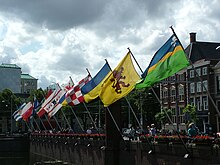
This list contains all twelve official flags of the provinces of the Netherlands, including the pennons.
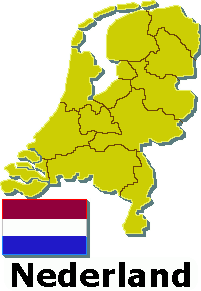
The Netherlands has several levels of administrative subdivisions. The first level of subdivision consists of 12 provinces. The second level of subdivision consists of 342 municipalities.
The Historic composition of the House of Representatives of the Netherlands gives an overview of the composition of the House of Representatives of the Dutch parliament. It shows the composition after elections, splits from parties are not included.

Provincial elections were held in the Netherlands on 20 March 2019. Eligible voters elected the members of the Provincial States in the twelve provinces of the Netherlands. The elections were held on the same day as the 2019 Dutch water boards elections and, in the Caribbean Netherlands, island council elections.

Land van Cuijk is a municipality in the province of North Brabant, Netherlands, formed from the merger of Boxmeer, Cuijk, Sint Anthonis, Mill en Sint Hubert and Grave on 1 January 2022. It belongs to the region of De Peel.

Provincial elections were held in the Netherlands on 15 March 2023, on the same day as the water board elections, as well as island council elections in the Caribbean Netherlands.
In the run-up to the 2023 Dutch provincial elections, various organisations are carrying out opinion polling to gauge voting intentions in the Netherlands. In addition to national pollsters such as I&O Research and Ipsos, some local and smaller polling organizations have polled for voting intentions in specific provinces or even cities. The first opinion polls for these elections were conducted in January 2023, with final polls often being released close to the election. The elections were held on 15 March 2023.