List of extreme points of the Netherlands

Last updated

Extreme points of the European part of the Netherlands Extreme points Netherlands.png
Extreme points of the European part of the Netherlands

This is a list of the extreme points of the Netherlands , the points that are farther up, down, north, south, east or west than any other location.

Contents

European part of the Netherlands

Netherlands

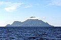
When in the list above the special municipalities in the Caribbean are included, the western- and southernmost points change to locations on the island Bonaire, whereas the highest point is on the island Saba. The approximate locations are:

Kingdom of the Netherlands

When all countries of the Kingdom of the Netherlands are taken into account, the southernmost point moves to Curaçao and the westernmost point moves to Aruba.

See also

Related Research Articles

Aruba Caribbean island constituent country of the Netherlands

Aruba is a constituent country of the Kingdom of the Netherlands physically located in the mid-south of the Caribbean Sea, about 29 kilometres (18 mi) north of the Venezuelan peninsula of Paraguaná and 80 kilometres (50 mi) northwest of Curaçao. It measures 32 kilometres (20 mi) long from its northwestern to its southeastern end and 10 kilometres (6 mi) across at its widest point. Together with Bonaire and Curaçao, Aruba forms a group referred to as the ABC islands. Collectively, these and the other three Dutch substantial islands in the Caribbean are often called the Dutch Caribbean, of which Aruba has about one-third of the population. In 1986, it became a constituent country within the Kingdom of the Netherlands, and acquired the formal name the Country of Aruba.

Geography of the Netherlands Antilles

The Netherlands Antilles was a constituent country in the Caribbean Sea. It consisted of two island groups, the ABC islands Curaçao, Bonaire and Aruba just north of Venezuela, and the SSS islands east of the Virgin Islands.

Geography of the European Netherlands Overview of the geography of the European Netherlands

The geography of the European Netherlands is unusual in that much of its land has been reclaimed from the sea and is below sea level, protected by dikes. It is a small country with a total area of 41,545 km2 (16,041 sq mi) and ranked 131st. With a population of 17.4 million and density of 521/km2 (1,350/sq mi) makes it the second most densely populated member of the European Union after Malta, and the 12th most densely populated country in the world, behind only three countries with a population over 16 million. Consequently, the Netherlands is highly urbanized.

Bonaire Caribbean island and special municipality of the Netherlands

Bonaire is an island in the Leeward Antilles in the Caribbean Sea. Its capital is Kralendijk, near the ocean on the lee side of the island. Aruba, Bonaire and Curaçao form the ABC islands, 80 km off the coast of Venezuela. Unlike much of the Caribbean region, the ABC islands lie outside Hurricane Alley. The islands have an arid climate that attracts visitors seeking warm, sunny weather all year round. Bonaire is a popular snorkeling and scuba diving destination because of its multiple shore diving sites and easy access to the island's fringing reefs.

Eemsmond Former municipality in Groningen, Netherlands

Eemsmond is a former municipality with a population of 15,864 in the north of the province of Groningen in the northeast of the Netherlands. On 1 January 2019 it merged with the municipalities of Bedum, De Marne and Winsum to form the new municipality Het Hogeland.

ABC islands (Leeward Antilles) Aruba, Bonaire and Curaçao

The ABC islands is the physical group of Aruba, Bonaire, and Curaçao, the three westernmost islands of the Leeward Antilles in the Caribbean Sea. These have a shared political history and a status of Dutch underlying ownership, since the Anglo-Dutch Treaty of 1814 ceded them back to the Netherlands, as Curaçao and Dependencies from 1815. They are a short distance north of the Falcón State, Venezuela. Aruba and Curaçao are autonomous, self-governing constituent countries of the Kingdom of the Netherlands, while Bonaire is a special municipality of the Netherlands. Territories of the Kingdom of the Netherlands, the countries, and its special municipalities, are outside the European Union; citizens have Dutch nationality and the former colonial power benefits from preferential trade, mineral and natural resource rights, particularly offshore.

ALM Antillean Airlines Netherlands Antillean airline

ALM Antillean Airlines was the main airline of the Netherlands Antilles between its foundation in 1964 and its shut-down in 2001, operating out of Aruba, Bonaire, and Curaçao.

The extreme points of South America are the points that are farther north, south, east or west than any other location on the continent. The continent's southernmost point is often said to be Cape Horn, but Águila Islet of the Diego Ramírez Islands lies further south.

Postage stamps and postal history of the Netherlands Antilles

This is a survey of the postage stamps and postal history of the postal areas Netherlands Antilles as well as its predecessor Curaçao. The area consisted of the islands Bonaire, Saba and Sint Eustatius as well as Sint Maarten, Curaçao and Aruba.

Leeward Antilles Island group in the Caribbean

The Leeward Antilles are a chain of islands in the Caribbean – specifically, the southerly islands of the Lesser Antilles along the southeastern fringe of the Caribbean Sea, just north of the Venezuelan coast of the South American mainland. The Leeward Antilles, while among the Lesser Antilles, are not to be confused with the Leeward Islands to the northeast.

Roman Catholic Diocese of Willemstad Latin Catholic ecclesiastical jurisdiction in the Caribbean

The Roman Catholic Diocese of Willemstad is a diocese of the Latin Rite of the Roman Catholic Church in the Caribbean. The diocese encompasses the territory of the Kingdom of the Netherlands in the Caribbean: the countries Aruba, Curaçao, Sint Maarten and the islands Bonaire, St. Eustatius, Saba. The cathedra is in the city of Curaçao. The diocese is a suffragan of the Archdiocese of Port of Spain, and a member of the Antilles Episcopal Conference.

Dissolution of the Netherlands Antilles 2010 dissolution of the autonomous Caribbean country of the Netherlands

The Netherlands Antilles was an autonomous Caribbean country within the Kingdom of the Netherlands. It was dissolved on 10 October 2010.

Kingdom of the Netherlands Sovereign state and constitutional monarchy

The Kingdom of the Netherlands, commonly known as simply the Netherlands, is a sovereign state and constitutional monarchy with 98% of its territory and population in Western Europe and with several small West Indian island territories in the Caribbean.

Index of Netherlands Antilles–related articles Wikipedia index

The following is an alphabetical list of topics related to the former nation of the Netherlands Antilles.

Curaçao national football team Mens national association football team representing Curaçao

The Curaçao national football team represents Curaçao in International football and is controlled by the Curaçao Football Federation.

Caribbean Netherlands Overseas region of the Netherlands

The Caribbean Netherlands are the three special municipalities of the Netherlands that are located in the Caribbean Sea. They consist of the islands of Bonaire, Sint Eustatius and Saba, although the term "Caribbean Netherlands" is sometimes used to refer to all of the islands in the Dutch Caribbean. In legislation, the three islands are also known as Bonaire, Sint Eustatius and Saba or the BES islands. The islands are currently classified as public bodies in the Netherlands and as overseas countries and territories of the European Union; thus, EU law does not automatically apply.