Extreme points of Slovakia

Last updated

This is a list of the extreme points of Slovakia : the points that are farther north, south, east or west than any other location, as well as the highest and lowest points.

Contents

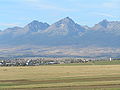
Latitude and longitude

The distance between Záhorská Ves (the westernmost point) and Nová Sedlica (the easternmost point) is 428 km.

Altitude

Other features

See also

Related Research Articles

<span class="mw-page-title-main">Geography of Hungary</span>

Hungary is a landlocked country in the southeastern region of Central Europe, bordering the Balkans. Situated in the Pannonian Basin, it has a land area of 93,030 square km, measuring about 250 km from north to south and 524 km from east to west. It has 2,106 km of boundaries, shared with Slovakia to the north, Ukraine to the northeast, Romania to the east and southeast, Serbia to the south, Croatia to the south and southwest, Slovenia to the west and southwest, and Austria to the west.

<span class="mw-page-title-main">Geography of Slovakia</span>

Slovakia is a landlocked Central European country with mountainous regions in the north and flat terrain in the south. During much of the Holocene, Slovakia was much more forested than today. Decline of the forest occurred in as consequence of the Valachian colonization and the development of mining in the territory.

<span class="mw-page-title-main">Tatra Mountains</span> Mountain range on the Polish–Slovak border

The Tatra Mountains, Tatras, are a series of mountains within the Western Carpathians that form a natural border between Slovakia and Poland. They are the highest mountains in the Carpathians. The Tatras are distinct from the Low Tatras, a separate Slovak mountain range further south.

<span class="mw-page-title-main">Low Tatras</span> Mountain range in Slovakia

The Low Tatras or Low Tatra is a mountain range of the Inner Western Carpathians in central Slovakia.

<span class="mw-page-title-main">Spiš</span> Historical region in Slovakia and Poland

Spiš is a region in north-eastern Slovakia, with a very small area in south-eastern Poland. Spiš is an informal designation of the territory, but it is also the name of one of the 21 official tourism regions of Slovakia. The region is not an administrative division in its own right, but between the late 11th century and 1920 it was an administrative county of the Kingdom of Hungary.

<span class="mw-page-title-main">Rysy</span> Mountain in the High Tatras

Rysy is a mountain in the crest of the High Tatras, eastern part of the Tatra Mountains, lying on the border between Poland and Slovakia. Rysy has three summits: the middle at 2,501 m (8,205 ft); the north-western at 2,500 m (8,202 ft); and the south-eastern at 2,473 m (8,114 ft). The north-western summit is the highest point of Poland and belongs to the Crown of Polish Mountains; the other two summits are on the Slovak side of the border.

This is a list of the extreme points of Europe: the geographical points that are higher or farther north, south, east or west than any other location in Europe. Some of these positions are open to debate, as the definition of Europe is diverse.

<span class="mw-page-title-main">Western Tatras</span> Mountain range in Europe

The Western Tatras are mountains in the Tatras, part of the Carpathian Mountains, located on the Polish-Slovak borders. The mountains border the High Tatras in the east, Podtatranská kotlina in the south, Choč Mountains in the west and Rów Podtatrzański in the north. The main ridge is 37 kilometers long and the mountain range contains 31 two-thousanders.

<span class="mw-page-title-main">High Tatras</span> Mountain range along the border of Slovakia and Poland

The High Tatras or High Tatra Mountains, are a mountain range along the border of northern Slovakia in the Prešov Region, and southern Poland in the Lesser Poland Voivodeship. They are a range of the Tatra Mountains chain.

<span class="mw-page-title-main">Geography of North Dakota</span>

The Geography of North Dakota consists of three major geographic regions: in the east is the Red River Valley, west of this, the Missouri Plateau. The southwestern part of North Dakota is covered by the Great Plains, accentuated by the Badlands. There is also much in the way of geology and hydrology.

This is a list of the extreme points of Central America, the points that are farther north, south, east, or west than any other location on the region. The list also included highest and lowest points and identifies the most extensive lake.

<span class="mw-page-title-main">Stará Lesná</span> Village in Slovakia

Stará Lesná or "Old Forest" is a village and municipality in Kežmarok District in the Prešov Region in north-central Slovakia. Stará Lesná is located in an area traditionally known as Spiš and it is situated within the Slovak Tourism Region of the Tatras.

<span class="mw-page-title-main">Tatra National Park, Slovakia</span>

Tatra(s) National Park is one of the nine national parks in Slovakia. It is situated in North Central Slovakia in the Tatra Mountains. The park is important for protecting a diverse variety of flora and fauna, with many endemic species, including the Tatra chamois.

<span class="mw-page-title-main">Podtatranská kotlina</span>

The Podtatranská kotlina is a basin in northern Slovakia, part of the Fatra-Tatra Area, which belongs to the Inner Western Carpathians.

<span class="mw-page-title-main">Geography of Poland</span>

Poland is a country that extends across the North European Plain from the Sudetes and Carpathian Mountains in the south to the sandy beaches of the Baltic Sea in the north. Poland is the fifth-most populous country of the European Union and the ninth-largest country in Europe by area. The territory of Poland covers approximately 312,696 km2 (120,733 sq mi), of which 98.52% is land and 1.48% is water. The Polish coastline was estimated at 770 km (478 mi) in length. Poland's highest point is Rysy, at 2,500 m (8,202 ft).

<span class="mw-page-title-main">Extreme points of Bhutan</span>

This is a list of the extreme points of Bhutan.

<span class="mw-page-title-main">Popradské pleso</span>

Popradské pleso is a mountain lake of glacial origin located in the High Tatras, Slovakia. It is situated right on the Tatranská magistrála hiking path, at an altitude of 1,494 metres (4,902 ft).

<span class="mw-page-title-main">Skalnaté Pleso (lake)</span>

Skalnaté pleso (1751m) is a lake located in the High Tatras mountains in the north of Slovakia.

References