Extreme points of Luxembourg

Last updated

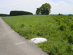
This is a list of the extreme points of Luxembourg , the points that are farther north, south, east or west, higher or lower than any other location in the territory of the state.

Contents

The northernmost point of Luxembourg MostNpointInLux.jpg
The northernmost point of Luxembourg

Latitude and longitude

Kneiff, the highest point in the country Kneiff.jpg
Kneiff, the highest point in the country

Elevation

See also


Related Research Articles

Geography of Luxembourg

Luxembourg is a small country located in the Low Countries, part of North-West Europe It borders Belgium for 148 kilometres to the west and north, France (23 km [14 mi]) to the south, and Germany (138 km [86 mi]) to the east. Luxembourg is landlocked, separated from the North Sea by Belgium.

Geography of France Overview of the geography of France

The geography of France consists of a terrain that is mostly flat plains or gently rolling hills in the north and west and mountainous in the south and the east. Metropolitan France has a total size of 551,695 km2 (213,011 sq mi). It is the third largest country in Europe after Russia and Ukraine.

Luxembourg District

The District of Luxembourg was one of three districts of the Grand Duchy of Luxembourg. It contained four cantons, divided into 44 communes:

  1. Capellen
  2. Esch-sur-Alzette
  3. Luxembourg
  4. Mersch
Diekirch District

The District of Diekirch was one of three districts of the Grand Duchy of Luxembourg. Immediately prior to its abolition on 3 October 2015, it contained five cantons divided into 43 communes:

  1. Clervaux
  2. Diekirch
  3. Redange
  4. Vianden
  5. Wiltz
Grevenmacher District

The District of Grevenmacher was one of three districts of Luxembourg. It contained three cantons divided into 25 communes:

  1. Echternach
  2. Grevenmacher
  3. Remich
Buurgplaatz

Buurgplaatz is a hill in the commune of Troisvierges, in northern Luxembourg. The 559-metre-high (1,834 ft) summit lies within the Oesling region at 50.1615°N 6.0281°E.

Born, Luxembourg

Born is a village on the River Sauer in the commune of Mompach, in eastern Luxembourg. It lies on the N10, 14 km (9 mi) south of Echternach and 8 km (5 mi) north of Wasserbillig. Only 5 minutes drive from the E44 motorway from Luxembourg City to Trier, it is popular with tourists and day-trippers who walk, cycle or fish along the banks of the river.

Steinheim, Luxembourg

Steinheim is a town in the commune of Rosport, in eastern Luxembourg. As of 2005, the town has a population of 532.

Niederkorn

Niederkorn is a town in the commune of Differdange, in south-western Luxembourg, on the Chiers river, from which it takes its name. As of March 31, 2020, the town has a population of 7,272.

Troisvierges railway station is a railway station serving Troisvierges, in northern Luxembourg. It is operated by Chemins de Fer Luxembourgeois, the state-owned railway company.

Sörenberg

Sörenberg is a village in the Swiss Alps, located in the southern part of the canton of Lucerne. The village lies in the municipality of Flühli in the Entlebuch region, near the upper end of the Waldemme valley.

This is a list of the extreme points and extreme elevations in Scotland.

Geography of Germany Geographical features of Germany

Germany is a country in west-central Europe, that stretches from the Alps, across the North European Plain to the North Sea and the Baltic Sea. Germany has the second largest population in Europe and is seventh largest in area. The territory of Germany covers 357,021 km2 (137,847 sq mi), consisting of 349,223 km2 (134,836 sq mi) of land and 7,798 km2 (3,011 sq mi) of waters.

Borders of the oceans The limits of Earths oceanic waters

The borders of the oceans are the limits of Earth's oceanic waters. The definition and number of oceans can vary depending on the adopted criteria.

Extreme points of Bhutan

This is a list of the extreme points of Bhutan.

History of rail transport in Luxembourg

The history of rail transport in Luxembourg began in 1846 and continues to the present day.