Glaubenbielen Pass

Last updated
Glaubenbielen Pass

Glaubenbuhl.jpg

Glaubenbielen Pass
Elevation 1,611 m (5,285 ft)
Traversed by Road
Location Obwalden, Switzerland
Range Emmental Alps
Coordinates 46°49′09″N08°05′36″E / 46.81917°N 8.09333°E / 46.81917; 8.09333 Coordinates: 46°49′09″N08°05′36″E / 46.81917°N 8.09333°E / 46.81917; 8.09333
Switzerland relief location map.jpg
Red pog.svg
Location in Switzerland

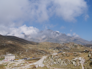
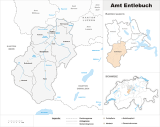
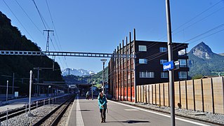
Glaubenbielen Pass (or Glaubenbühl ) (el. 1611 m.) is a mountain pass in the Emmental Alps between the Entlebuch region of the canton of Lucerne and the canton of Obwalden. The pass itself is located within Obwalden, and connects Giswil in Obwalden and Sörenberg in the Entlebuch region. It divides the basins of the Kleine Emme and the Sarner Aa, both within the Reuss basin. [1]

Mountain pass Route through a mountain range or over a ridge

A mountain pass is a navigable route through a mountain range or over a ridge. Since many of the world's mountain ranges have presented formidable barriers to travel, passes have played a key role in trade, war, and both human and animal migration throughout Earth's history. At lower elevations it may be called a hill pass. The highest vehicle-accessible pass in the world appears to be Mana Pass, located in the Himalayas on the border between India and Tibet, China.

Emmental Alps mountain range

The Emmental Alps are a mountain range in the western part of the Alps, in Switzerland. They are located north-west of the Brünig Pass, mainly in the cantons of Lucerne, Bern, and Obwalden, with a small portion in the canton of Nidwalden. The highest summit of the range is the Brienzer Rothorn, which is also the highest point in the canton of Lucerne. The range is named after the Emme valley. In the north-west corner one finds the relatively low, but widespread, and very furrowed Napf.

Canton of Lucerne Canton of Switzerland

The canton of Lucerne is a canton of Switzerland. It is located in the centre of Switzerland. The population of the canton is 406,506. As of 2007, the population included 57,268 foreigners, or about 15.8% of the total population. The cantonal capital is Lucerne.

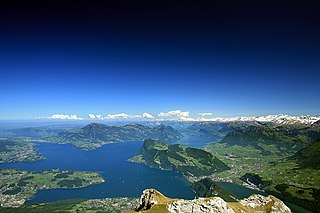
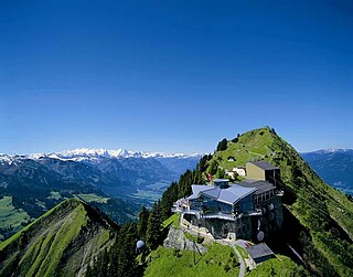
The pass road has a maximum grade of 12 percent, running along the northern slope of the Giswilerstock (2011 m). It is known as Panoramastrasse, providing a splendid view of Pilatus and the Stanserhorn when travelling towards Giswil, and of the Brienzer Rothorn massif when travelling towards Flühli.

Pilatus (mountain) mountain in Switzerland

Pilatus, also often referred to Mount Pilatus, is a mountain massif overlooking Lucerne in Central Switzerland. It is composed of several peaks, of which the highest is named Tomlishorn.

Stanserhorn mountain in Switzerland

The Stanserhorn is a mountain in Switzerland, located in the canton of Nidwalden near to the border with Obwalden, with the peak at 1,898 metres (6,227 ft) above sea level.

Brienzer Rothorn mountain in the Swiss Alps

The Brienzer Rothorn is a mountain of the Emmental Alps, in Switzerland. With an elevation of 2,350 metres above sea level, the Brienzer Rothorn is the highest summit of the range. To its west lies the Tannhorn, whilst to its east are Arnihaaggen, Höch Gumme and the Brünig Pass. On its south side it overlooks Lake Brienz, whilst to the north it looks out over the Waldemme valley.

See also

Related Research Articles

Swiss Alps portion of the Alps mountain range that lies within Switzerland

The Alpine region of Switzerland, conventionally referred to as the Swiss Alps, represents a major natural feature of the country and is, along with the Swiss Plateau and the Swiss portion of the Jura Mountains, one of its three main physiographic regions. The Swiss Alps extend over both the Western Alps and the Eastern Alps, encompassing an area sometimes called Central Alps. While the northern ranges from the Bernese Alps to the Appenzell Alps are entirely in Switzerland, the southern ranges from the Mont Blanc massif to the Bernina massif are shared with other countries such as France, Italy, Austria and Liechtenstein.

Lake Lucerne lake at Lucerne, Switzerland

Lake Lucerne is a lake in central Switzerland and the fourth largest in the country.

Canton of Obwalden Canton of Switzerland

The canton of Obwalden, also canton of Obwald is a canton of Switzerland. It is located in the centre of Switzerland. Its capital is Sarnen. The canton contains the geographical centre of Switzerland.

Giswil Place in Obwalden, Switzerland

Giswil is a municipality in the canton of Obwalden in Switzerland.

San Bernardino Pass mountain pass

San Bernardino Pass is a high mountain pass in the Swiss Alps connecting the Hinterrhein and the Mesolcina (Misox) valleys between Thusis and Bellinzona. Located in the far eastern side of the Western Alps it is not to be confused with the Great St Bernard Pass and the Little St Bernard Pass. The top of the pass represents both the Italo-German language frontier and the watershed between the Po basin and the Rhine basin.

Titlis Swiss mountain of the Urner Alps

Titlis is a mountain of the Uri Alps, located on the border between the cantons of Obwalden and Bern. At 3,238 metres (10,623 ft) above sea level, it is the highest summit of the range north of the Susten Pass, between the Bernese Oberland and Central Switzerland. It is mainly accessed from Engelberg (OW) on the north side and is famous as the site of the world's first rotating cable car. The cable car system connects Engelberg to the summit of Klein Titlis through the three stages of Gerschnialp, Trübsee and Stand.

Entlebuch District District in Switzerland

Entlebuch District is one of six disctricts of the canton of Lucerne, Switzerland. Its administrative center is the village of Schüpfheim. Entlebuch District roughly corresponds to the basin of the river Kleine Emme. The district receives its name from the village of Entlebuch, which is in turn named for the rivers Grosse and Kleine Entle, a right tributary of Kleine Emme.

The Sarner Aa is a 28 km (17 mi) long river in the Swiss canton of Obwalden. It drains the area to the eastern side of the Brünig Pass, flowing through the Lake Lungern, Lake Sarnen and the Wichelsee, before entering Lake Lucerne near Alpnach. It goes by several names over its length, being known as the Lauibach upstream of the Lungerersee, and the Aa or Aawasser between the Lungerersee and Lake Sarnen.

Brünig Pass

The Brünig Pass, at an altitude of 1,008 m (3,307 ft), connects the Bernese Oberland and central Switzerland, linking Meiringen in the canton of Bern and Lungern in the canton of Obwalden. It is on the watershed between the upper reaches of the Aare, which flows through Lake Brienz and Lake Thun, and the Sarner Aa, which flows into Lake Lucerne.

Ächerli Pass mountain pass

Ächerli Pass is a high mountain pass between the cantons of Obwalden and Nidwalden.

Glaubenberg Pass mountain pass

Glaubenberg Pass is a high mountain pass in the Emmental Alps between the cantons of Lucerne and Obwalden in Switzerland.

Rengg mountain pass

Rengg is a locality and a mountain pass in the canton of Lucerne in Switzerland.

Sörenberg

Sörenberg is a village in the Swiss Alps, located in the southern part of the canton of Lucerne. The village lies in the municipality of Flühli in the Entlebuch region, near the upper end of the Waldemme valley.

Kleine Emme river in Switzerland

The Kleine Emme is a river of the canton of Lucerne, Switzerland, a left tributary of the Reuss extending for 58 km, draining a basin of 477 km². It is not to be confused with the Emme of the canton of Berne. The Kleine Emme rises as the Waldemme in the southwestern corner of the canton of Obwalden, n the Brienzer Rothorn massif at the Emmensprung, flowing north-west along the Mariental, past Sörenberg. Turning north, it enters the Entlebuch region, where it is joined by the Weissemme near Schüpfheim and by the Entlen at Entlebuch. After receiving the Fontannen, it turns to the east at Wolhusen where it is joined by the Wigger and later by the Rümlig. From here, it flows parallel to the Pilatus chain, past Malters, joining the Reuss at Emmen, 2 km downstream of Lake Lucerne.

Höch Gumme mountain in Switzerland

The Höch Gumme is a mountain of the Emmental Alps in Switzerland. It lies to the east of the Brienzer Rothorn and Arnihaaggen, and the west of the Wilerhorn and Brünig Pass. The Schönbüel cable car station is on its eastern flank.

A8 motorway (Switzerland) motorway in Switzerland

The A8 motorway, an Autobahn in central Switzerland, is a divided highway connecting the Bernese Oberland and the Innerschweiz. It is part of the National Road N8. For the Canton of Obwalden, it is the lifeline that has allowed the settling of industrial firms in this historically predominantly agricultural region. Via the A8, speedy connections to the major economic centers in the Mittelland and the north–south transit axis A2 are now possible. For tourists, A8 opens up in the opposite direction: the large ski resorts in the Bernese Oberland and the tourism regions around the Brünig Pass and Interlaken.

Giswil railway station

Giswil is a Swiss railway station on the Brünig line, owned by the Zentralbahn, that links Lucerne and Interlaken. The station is in the municipality of Giswil in the canton of Obwalden.

Arnihaaggen mountain in Switzerland

The Arnihaaggen is a mountain of the Emmental Alps in Switzerland. It lies to the east of the Brienzer Rothorn and to the west of the Höch Gumme. The small mountain lake of Eisee lies immediately to the north.

Rosenberg Castle (Obwalden)

Rosenberg Castle is a ruined castle in the municipality of Giswil in the canton of Obwalden in Switzerland.

References

  1. map.geo.admin.ch (Map). Swiss Confederation. Retrieved 2014-10-27.