Giswil

Last updated
Giswil
Giswil - Sarnersee - Brunigstrasse 2016-08-11 10-54-02.JPG
Giswil and Sarnersee as seen from Brünigstrasse in August 2016
CHE Giswil COA.svg
Location of Giswil
Giswil
Switzerland adm location map.svg
Red pog.svg
Giswil
Reliefkarte Obwalden blank.png
Red pog.svg
Giswil
Coordinates: 46°50′N8°11′E / 46.833°N 8.183°E / 46.833; 8.183
Country Switzerland
Canton Obwalden
District n.a.
Area
[1]
  Total85.96 km2 (33.19 sq mi)
Elevation
485 m (1,591 ft)
Population
 (31 December 2018) [2]
  Total3,657
  Density43/km2 (110/sq mi)
Time zone UTC+01:00 (Central European Time)
  Summer (DST) UTC+02:00 (Central European Summer Time)
Postal code(s)
6074
SFOS number 1403
Surrounded by Flühli (LU), Hofstetten bei Brienz (BE), Lungern, Sachseln, Sarnen, Schwanden bei Brienz (BE)
Website www.giswil.ch
SFSO statistics

Giswil is a municipality in the canton of Obwalden in Switzerland.

Contents

History

Giswil is first mentioned in the 11th century, as Kisevilare. [3]

Geography

Aerial view from 1600 m by Walter Mittelholzer (1919) ETH-BIB-Giswil, Diechtersmatt, Grossteil, Rudenz v. S. W. aus 1600 m-Inlandfluge-LBS MH01-004929.tif
Aerial view from 1600 m by Walter Mittelholzer (1919)

The municipality is located on the southern end of Lake Sarnen. It consists of the village sections of Grossteil, Kleinteil, Rudenz and Diechtersmatt, as well as scattered farm houses and hamlets. To the south-west, the municipality rises up to the summits of the Giswilerstock, Brienzer Rothorn, Arnihaaggen and Höch Gumme. The Glaubenbielen Pass crosses to Sörenberg in the Entlebuch region of the canton of Lucerne. [4]

View of Giswil from neighboring mountains Giswil09.jpg
View of Giswil from neighboring mountains

Giswil has an area, as of 2006, of 85.9 square kilometers (33.2 sq mi). Of this area, 35.9% is used for agricultural purposes, while 53.3% is forested. Of the rest of the land, 2.2% is settled (buildings or roads) and the remainder (8.7%) is non-productive (rivers, glaciers , or mountains). [5]

Demographics

Roman Catholic church of Giswil Giswil07.JPG
Roman Catholic church of Giswil

Giswil has a population (as of 31 December 2020) of 3,676. [6] As of 2007, 8.9% of the population was made up of foreign nationals. [7] After a period of poverty and emigration in the late 19th century, where the population stagnated at about 1600 persons, the population increased quite continuously in the 20th century. Over the past 40 years the population has increased by 38%, mainly because economic conditions in the region and public transport to Luzern have improved so that the migration balance definitely changed its sense towards immigration. Most of the population (as of 2000) speaks German (95.5%), with Serbo-Croatian being second most common ( 1.0%) and Portuguese being third ( 0.8%). [5] As of 2000 the gender distribution of the population was 50.9% male and 49.1% female. As of 2000 there are 1,250 households in Giswil. [7]

In the 2007 federal election the most popular party was the SVP which received 35.9% of the vote. The next three most popular parties were the CVP (26.2%), the SPS (19.4%) and the rest of the votes went to other parties (18.6%). [5]

In Giswil about 68.2% of the population (between age 25–64) have completed either non-mandatory upper secondary education or additional higher education (either university or a Fachhochschule ). [5]

Giswil has an unemployment rate of 1.24%. As of 2005, there were 329 people employed in the primary economic sector and about 125 businesses involved in this sector. 335 people are employed in the secondary sector and there are 53 businesses in this sector. 467 people are employed in the tertiary sector, with 84 businesses in this sector. [5]

The historical population is given in the following table: [3]

yearpopulation
17441,040
18501,610
19001,711
19502,642
19903,085
20003,435

Transport

Giswil is served by Giswil station on the Brünig line, an inter-regional narrow-gauge railway from Interlaken to Lucerne. The hourly InterRegio train between Interlaken and Lucerne stops at the station, which is also the terminus of the half-hourly Lucerne S-Bahn S5 service from Lucerne.

The A8 motorway passes to the south of the town, through the Giswil Tunnel.

Sights

The main sights of Giswil are two ruins ( Rosenberg and Rudenz ), as well as traditional farmhouses in the scattered settlement Grossteil. [ citation needed ]

Weather

Giswil has an average of 144.1 days of rain per year and on average receives 1,311 mm (51.6 in) of precipitation. The wettest month is August during which time Giswil receives an average of 168 mm (6.6 in) of precipitation. During this month there is precipitation for an average of 14.4 days. The month with the most days of precipitation is June, with an average of 14.4, but with only 146 mm (5.7 in) of precipitation. The driest month of the year is January with an average of 79 mm (3.1 in) of precipitation over 14.4 days. [8]

Related Research Articles

<span class="mw-page-title-main">Sarnen</span> Municipality in Obwalden, Switzerland

Sarnen is a small historic town, a municipality, and the capital of the canton of Obwalden situated on the northern shores of Lake Sarnen in Switzerland. It has a population of just over 10,000 and is surrounded by countryside and mountains. Sarnen is located 20 km south of Lucerne.

<span class="mw-page-title-main">Alpnach</span> Municipality in Obwalden, Switzerland

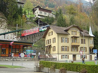
Alpnach is a village in the canton of Obwalden in Switzerland. It comprises the villages of Alpnach Dorf, Alpnachstad and Schoried.

<span class="mw-page-title-main">Lungern</span> Municipality in Obwalden, Switzerland

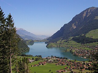
Lungern is a municipality in the canton of Obwalden in Switzerland. It encompasses Lake Lungern and, besides the village of Lungern, the settlements of Bürglen, Kaiserstuhl and Obsee.

<span class="mw-page-title-main">Engelberg</span> Municipality in Obwalden, Switzerland

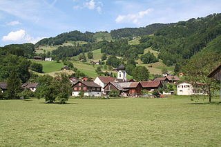
Engelberg is a village resort and a municipality in the canton of Obwalden in Switzerland. Alongside the central village of Engelberg, the municipality encompasses additional settlements, including Grafenort, Oberberg and Schwand.

<span class="mw-page-title-main">Hergiswil</span> Municipality in Nidwalden, Switzerland

Hergiswil is a municipality in the canton of Nidwalden in Switzerland.

<span class="mw-page-title-main">Lachen, Switzerland</span> Municipality in Schwyz, Switzerland

Lachen is a municipality in March District in the canton of Schwyz in Switzerland.

<span class="mw-page-title-main">Brienz</span> Place in Bern, Switzerland

Brienz is a village and municipality on the northern shore of Lake Brienz, at the foot of the Brienzer Rothorn mountain, and in the Bernese Oberland region of Switzerland. Besides the village of Brienz, the municipality includes the settlements of Kienholz and Axalp.

<span class="mw-page-title-main">Oberiberg</span> Municipality in Schwyz, Switzerland

Oberiberg is a village and municipality in Schwyz District in the canton of Schwyz in Switzerland. The municipality comprises the village of Oberiberg and the hamlet and ski area of Hoch-Ybrig.

<span class="mw-page-title-main">Entlebuch</span> Municipality in Lucerne, Switzerland

Entlebuch is a municipality in the canton of Lucerne in Switzerland. It is the seat of the district of Entlebuch. The area has been designated a Biosphere Reserve by UNESCO in 2001.

<span class="mw-page-title-main">Valeyres-sous-Rances</span> Municipality in Vaud, Switzerland

Valeyres-sous-Rances is a municipality in the district of Jura-Nord Vaudois in the canton of Vaud in Switzerland.

<span class="mw-page-title-main">Muotathal</span> Municipality in Schwyz, Switzerland

Muotathal is a village and a municipality in Schwyz District in the canton of Schwyz in Switzerland. The eponymous valley, the Muotatal, is formed by the Muota, which joins Lake Lucerne at Brunnen.

<span class="mw-page-title-main">Innerthal</span> Municipality in Schwyz, Switzerland

Innerthal is a municipality in March District in the canton of Schwyz in Switzerland.

<span class="mw-page-title-main">Flüelen</span> Municipality in Uri, Switzerland

Flüelen is a municipality in the canton of Uri in Switzerland.

<span class="mw-page-title-main">Aesch, Lucerne</span> Municipality in Lucerne, Switzerland

Aesch is a municipality in the district of Hochdorf in the canton of Lucerne in Switzerland.

<span class="mw-page-title-main">Luthern</span> Municipality in Lucerne, Switzerland

Luthern is a municipality in the district of Willisau in the canton of Lucerne in Switzerland.

<span class="mw-page-title-main">Wauwil</span> Municipality in Lucerne, Switzerland

Wauwil is a municipality in the district of Willisau in the canton of Lucerne in Switzerland.

<span class="mw-page-title-main">Schänis</span> Municipality in St. Gallen, Switzerland

Schänis is a municipality in the Wahlkreis (constituency) of See-Gaster in the canton of St. Gallen in Switzerland.

Hérémence is a municipality in the district of Hérens in the canton of Valais in Switzerland.

<span class="mw-page-title-main">Fieschertal</span> Municipality in Valais, Switzerland

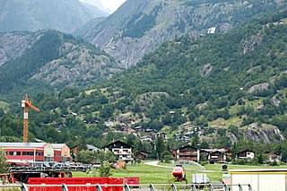
Fieschertal is a village and municipality in the district of Goms in the canton of Valais in Switzerland. Besides the village of Fieschertal, the municipality includes the nearby hamlets of Wichul, Zer Flie and Wirbul.

<span class="mw-page-title-main">Escholzmatt-Marbach</span> Municipality in Lucerne, Switzerland

Escholzmatt-Marbach is a municipality in the district of Entlebuch in the canton of Lucerne in Switzerland. On 1 January 2013 the former municipalities of Escholzmatt and Marbach merged to form the new municipality of Escholzmatt-Marbach.

References

  1. "Arealstatistik Standard - Gemeinden nach 4 Hauptbereichen". Federal Statistical Office. Retrieved 13 January 2019.
  2. "Ständige Wohnbevölkerung nach Staatsangehörigkeitskategorie Geschlecht und Gemeinde; Provisorische Jahresergebnisse; 2018". Federal Statistical Office. 9 April 2019. Retrieved 11 April 2019.
  3. 1 2 Giswil in German , French and Italian in the online Historical Dictionary of Switzerland .
  4. map.geo.admin.ch (Map). Swiss Confederation. Retrieved 2014-10-27.
  5. 1 2 3 4 5 Swiss Federal Statistical Office Archived January 5, 2016, at the Wayback Machine accessed 03-Sep-2009
  6. "Ständige und nichtständige Wohnbevölkerung nach institutionellen Gliederungen, Geburtsort und Staatsangehörigkeit". bfs.admin.ch (in German). Swiss Federal Statistical Office - STAT-TAB. 31 December 2020. Retrieved 21 September 2021.
  7. 1 2 Canton Obwalden Statistics Archived July 7, 2011, at the Wayback Machine accessed 2 September 2009 (in German)
  8. "Temperature and Precipitation Average Values-Table, 1961–1990" (in German, French, and Italian). Federal Office of Meteorology and Climatology – MeteoSwiss. Archived from the original on 27 June 2009. Retrieved 8 May 2009., the weather station elevation is 489 meters above sea level.