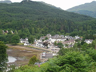
Lochgoilhead is a village on the Cowal Peninsula, in Argyll and Bute, Scottish Highlands. It is located within the Loch Lomond and The Trossachs National Park and is widely considered to be one of the most beautiful areas in Argyll and in Scotland as a whole.
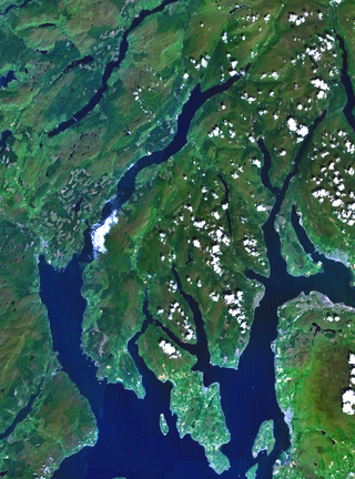
Cowal is a rugged peninsula in Argyll and Bute, on the west coast of Scotland. It is connected to the mainland to the north, and is bounded by Loch Fyne to the west, by Loch Long and the Firth of Clyde to the east, and by the Kyles of Bute to the south.

Arrochar is a village located near the head of Loch Long, on the Cowal Peninsula, in Argyll and Bute, Scottish Highlands. The Arrochar Alps are named after the village. The village is within the Loch Lomond and The Trossachs National Park.
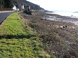
Kilmun is a linear settlement on the north shore of the Holy Loch, on the Cowal Peninsula in Argyll and Bute, Scottish Highlands. It takes its name from the 7th-century monastic community founded by an Irish monk, St Munn. The ruin of a 12th-century church still stands beside the Kilmun Parish Church and Argyll Mausoleum.
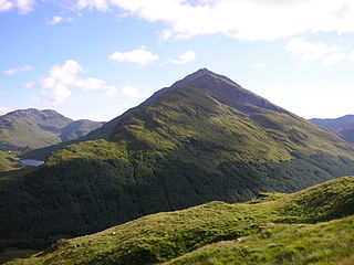
Beinn an Lochain is a mountain in the Arrochar Alps in western Scotland. A Corbett, reaching 901.7 metres (2,958 ft), Beinn an Lochain is situated within the Argyll Forest Park, which is itself within the Loch Lomond and the Trossachs National Park.

Loch Goil; is a small sea loch forming part of the coast of the Cowal peninsula in Argyll and Bute, Scotland. The sea loch is entirely within the Loch Lomond and The Trossachs National Park.

Strone is a village on the Cowal Peninsula, in Argyll and Bute in the Scottish Highlands at the point where the north shore of the Holy Loch becomes the west shore of the Firth of Clyde. The village lies within the Loch Lomond and The Trossachs National Park.

Ardentinny is a small village on the western shore of Loch Long, 14 miles (23 km) north of Dunoon on the Cowal Peninsula, in Argyll and Bute, Scottish Highlands.

Glen Croe is a glen in the heart of the Arrochar Alps on the Cowal Peninsula, in Argyll and Bute, west of Scotland. The glen is surrounded by large and rugged mountains characterised by huge boulders. The Croe Water flows through the glen and into Loch Long.

Balnain is a small village in Glenurquhart, Scotland, about 5 miles west of Drumnadrochit. It is mostly dependent on tourism, forestry, agriculture and farming. The first buildings were created in the 1870s and 1880s and minor expansions occurred in the 1900s, 1960s and 1970. Its height above sea level is 123.6m.

Loch Eck is a freshwater loch located on the Cowal Peninsula, north of Dunoon, in Argyll and Bute, west of Scotland. It is seven miles long. It is oriented in a north-south direction. Its main inflow, at the northern end, is the River Cur, and its main outflow, at the southern end, is the River Eachaig, which meanders somewhat within the confines of the broad strath before flowing into the head of Holy Loch, about 5 km further south.

Beinn Mhòr is the highest mountain on the Cowal Peninsula, west of Loch Eck in Argyll and Bute, west of Scotland. It has a high topographic prominence to height ratio and consequently commands a good all round view.

River Shira is the river that runs for about 7 miles through Glen Shira, in Argyll and Bute, west of Scotland. Originating to the north-east at 350 metres (1,150 ft) altitude, near the start of the River Fyne.

Hell's Glen is a glen on the Cowal Peninsula, in Argyll and Bute, west of Scotland, within the Arrochar Alps. The B839 single track road passes through the glen. To the west, the glen leads to Loch Fyne and to the east Lochgoilhead. Glen Mhor (B828) joins the glen about half way along and leeds to Glen Croe at the Rest & be Thankful viewpoint.
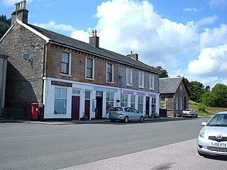
Blairmore is a village located on the Cowal Peninsula, in Argyll and Bute, west of Scotland. Blairmore lies within the Loch Lomond and The Trossachs National Park. It is situated on the western shore of Loch Long and around 1 mile (1.6 km) north of Strone. The village was largely built during the Victorian era and has a small wooden pier which dates to 1855.

Argyll Forest Park is a forest park located on the Cowal Peninsula in Argyll and Bute, Scottish Highlands. Established in 1935, it was the first forest park to be created in the United Kingdom. The park is managed by Forestry and Land Scotland, and covers 211 km2 in total.

Carrick Castle is a village on the western shore of Loch Goil, 7 km (4.3 mi) south of Lochgoilhead by a minor road along the loch shore, on the Cowal Peninsula, in Argyll and Bute, west of Scotland. It is within the Argyll Forest Park, and also within the Loch Lomond and The Trossachs National Park.
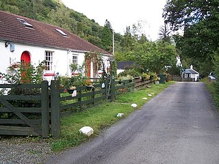
Glenbranter is a hamlet and former estate, once owned by Sir Harry Lauder, on the northwest shore of Loch Eck in the Argyll Forest Park, on the Cowal Peninsula, in Argyll and Bute, West of Scotland.

Loch Restil is a freshwater loch that lies in the pass between Glen Croe and Glen Kinglas on the Cowal Peninsula, in Argyll and Bute, West of Scotland. One of the main roads to the west of Scotland coast, the A83, passes Loch Restil. The burn that flows from Loch Restil is one of the feeds of Kinglas Water, in Glen Kinglas, which flows under the Butter Bridge.
Rashfield is a hamlet on the Cowal peninsula, situated between Loch Eck and the head of Holy Loch, in Argyll and Bute, Scotland. The hamlet is on the A815 road and the River Eachaig flows past from Loch Eck to the Holy Loch. Rashfield is within the Argyll Forest Park, which is itself within the Loch Lomond and The Trossachs National Park.


