
Annandale is a strath in Dumfries and Galloway, Scotland, named after the dale of the River Annan. It runs north–south through the Southern Uplands from Annanhead to Annan on the Solway Firth, and in its higher reaches it separates the Moffat hills on the east from the Lowther hills to the west. A 53-mile (85 km) long-distance walking route called Annandale Way running through Annandale was opened in September 2009.

The Merrick, or simply Merrick, is a mountain in the Range of the Awful Hand, a sub-range of the Galloway Hills range, part of the Southern Uplands of Scotland. The summit elevation is 843 metres, making it the highest mountain in the Southern Uplands and southern Scotland.

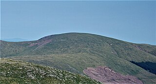
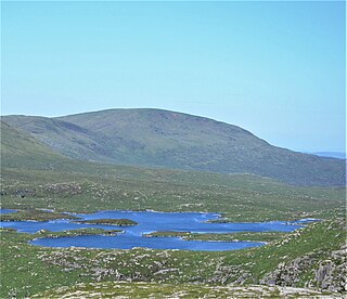
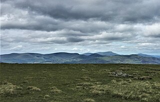
The Southern Uplands are the southernmost and least populous of mainland Scotland's three major geographic areas. The term is used both to describe the geographical region and to collectively denote the various ranges of hills and mountains within this region. An overwhelmingly rural and agricultural region, the Southern Uplands are partly forested and contain many areas of open moorland - the hill names in the area are congruent with these characteristics.

Scaur Water is a river which rises near Polskeoch in the Scaur hills in the region of Dumfries and Galloway, Scotland.

The Southern Upland Way is a 344-kilometre (214 mi) coast-to-coast long-distance footpath in southern Scotland. The route links Portpatrick in the west and Cockburnspath in the east via the hills of the Southern Uplands. The Way is designated as one of Scotland's Great Trails by NatureScot and is the longest of the 29 Great Trails. The Southern Upland Way meets with seven of the other Great Trails: the Annandale Way, the Berwickshire Coastal Path, the Borders Abbeys Way, the Cross Borders Drove Road, the Mull of Galloway Trail, the Romans and Reivers Route and St Cuthbert's Way.
The Battle of Glen Trool was a minor engagement in the First War of Scottish Independence, fought in April 1307. Glen Trool is a narrow glen in the Southern Uplands of Galloway, Scotland. Loch Trool is aligned on an east–west axis and is flanked on both sides by steep rising hills, making it ideal for an ambush. The battlefield is currently under research to be inventoried and protected by Historic Scotland under the Scottish Historical Environment Policy of 2009.

The Galloway Hills are part of the Southern Uplands of Scotland, and form the northern boundary of western Galloway. They lie within the bounds of the Galloway Forest Park, an area of some 300 square miles (800 km2) of largely uninhabited wild land, managed by Forestry and Land Scotland. The unusual place names reflect a mixture of the Old Norse and Scottish Gaelic languages and hint at the range of influences which have acted on society within the area over the centuries.

The Central Lowlands, sometimes called the Midland Valley or Central Valley, is a geologically defined area of relatively low-lying land in southern Scotland. It consists of a rift valley between the Highland Boundary Fault to the north and the Southern Uplands Fault to the south. The Central Lowlands are one of the three main geographical sub-divisions of Scotland, the other two being the Highlands and Islands which lie to the north, northwest and the Southern Uplands, which lie south of the associated second fault line. It is the most populated of Scotland’s three geographical regions.

Galloway Forest Park is a forest park operated by Forestry and Land Scotland, principally covering woodland in the historic counties of Kirkcudbrightshire and Wigtownshire in the administrative area of Dumfries and Galloway. It is claimed to be the largest forest in the UK. The park was granted Dark Sky Park status in November 2009, being the first area in the UK to be so designated.
Glentrool is a collection of mountain biking routes through the heart of Galloway in southwest Scotland. The mountain bike routes are part of the 7Stanes project by Forestry and Land Scotland throughout the Scottish Borders and Dumfries and Galloway.
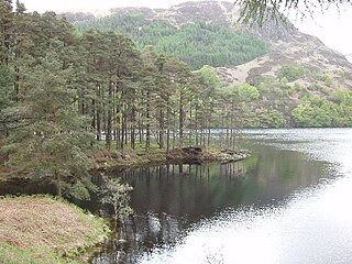
Loch Trool is a narrow, freshwater loch in Galloway, in the Southern Uplands in south-west Scotland. It lies in an elevated position in Glen Trool in the Galloway Forest Park and is approximately 8 miles (13 km) north of the town of Newton Stewart. The loch is the source of the Water of Trool which flows to the Water of Minnoch and the River Cree. There is a walking trail and footpath around the loch's perimeter.
Corserine is a hill in the Rhinns of Kells, a sub-range of the Galloway Hills range, part of the Southern Uplands of Scotland. The highest point of the range and the second highest point in Galloway, the usual route of ascent is from the car park at Forrest Lodge to the east of the hill via Loch Harrow and North Gairy Top. Forest Lodge is a short drive from the village of St. John's Town of Dalry.

Loch Neldricken is a loch in Galloway to the south-east of Merrick, south of Craig Neldricken and west of Craignaw. The loch is almost bisected by a long promontory. It drains via the short Mid Burn into Loch Valley and then via Gairland Burn down to Loch Trool.

Kirriereoch Hill is a hill in the Range of the Awful Hand, a sub-range of the Galloway Hills range, part of the Southern Uplands of Scotland. It lies on the border of the old counties of Ayrshire and Kirkcudbrightshire, or the modern regions of Dumfries and Galloway and South Ayrshire. A boundary wall near the summit is the highest point in South Ayrshire and Ayrshire as a whole. Kirriereoch Hill was classified as a Corbett and Marilyn but then deleted from these lists in 1984 due to not being thought to achieve the respective prominence criteria. In August 2015 the hill was relisted as a Marilyn after having been surveyed to have a 150.2 m prominence. However, since this is less than the 152.4 m required, the hill will not be re-listed as a Corbett.

Lamachan Hill is a hill in the Minnigaff Hills, a sub-range of the Galloway Hills range, part of the Southern Uplands of Scotland. It is the highest hill of the range, lying 11 kilometres (7 mi) north of Newton Stewart in Dumfries and Galloway.
Shalloch on Minnoch is a hill in the Range of the Awful Hand, a sub-range of the Galloway Hills range, part of the Southern Uplands of Scotland. It is frequently climbed from Stinchar bridge to the north, or as part of a full traverse of the range.

The Moffat Hills are a range of hills in the Southern Uplands of Scotland. They form a roughly triangular shape with a west facing side, a north facing side, and a south-east facing side. It is 17 kilometres from east to west across this triangle and some 16 kilometres north to south. The highest point is White Coomb at 821 m (2694 ft). The town of Moffat lies just south of the Moffat hills and along with Tweedsmuir, at the northern extremity, is the only centre of population around these hills. In some older maps, the northern part of the Moffat Hills is called the Tweedsmuir Hills, but can also be known by the title Manor Hills.
The Sir Walter Scott Way is a 92-mile (148 km) long-distance footpath in the Scottish Borders. The route broadly follows the waymarked Southern Upland Way, except for in a few sections. It commemorates Sir Walter Scott, one of Scotland's most renowned writers, who had many connections with the area.

Bargrennan is a village in Dumfries and Galloway, in the south west of Scotland. It is located 9 miles northwest of Newton Stewart by the River Cree and on the A714 road to Girvan. The Southern Upland Way runs through the village and the Glentrool Forest, managed by the Forestry Commission, is to the north-east of the village.
The Minnigaff Hills are a range of hills in the Galloway Hills range, part of the Southern Uplands of Scotland. A southerly range, they are perpendicular to the Range of the Awful Hand, Dungeon Hills and Rhinns of Kells to the north. In total, these four ranges are part of the Galloway Forest Park.
